


Panoramas around Gap
(vero;2018-August-31)
Panoramas taken during our treks in the region. Click on the panoramas to open a larger version in a separate tab. Click again to activate scrolling in the full picture and view it in detail.
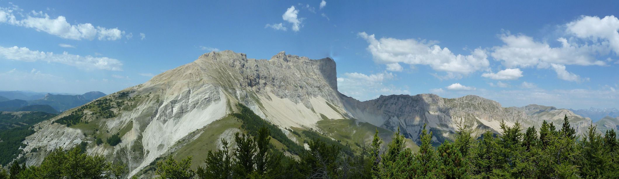
- Pic de Bure. A photogenic moutain difficult to avoid. At 2709m altitude it is the third highest peak of the Dévoluy mountains, northwest of Gap and can be seen from many view points around Gap.
- The Champsaur seen from Pic de Gleize or Pic de l'Aiguille. This range of mountains is located north/northeast of Gap.
- Some summits of Champsaur
- The rocky spur of Céüse southwest of Gap with amazing views
Pic de Bure
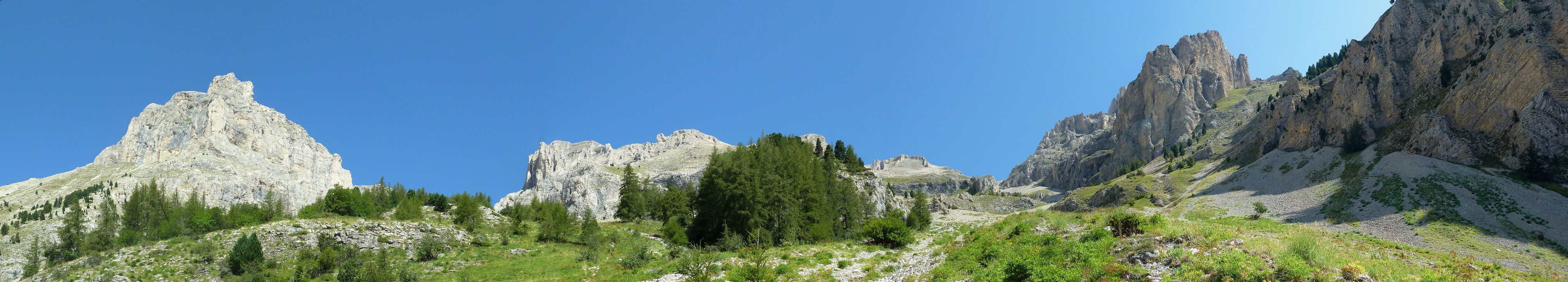
| On the way to Pic de Bure on a warm and sunny August day. The summit is very mineral and the rocks are limestone. Click on the panorama to open a larger version in a separate tab. Click again to activate scrolling in the full picture. |
 |
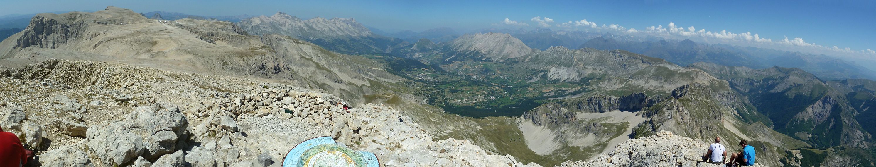
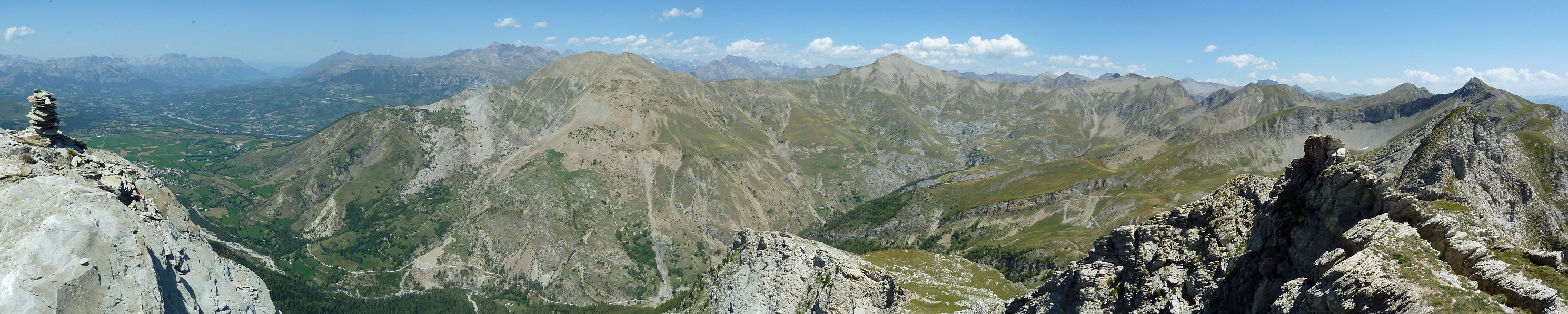
| View from the summit of Pic de Bure (2709m). On the left is the so-called Plateau de Bure (2550m) with its astronomy observation centre and six parabolic antennas. In its prolongation you can see the mountains of Champsaur. The valley of Gap is in the middle with the mountains of Queyras and Ubaye to the right. Click on the panorama to open a larger version in a separate tab. Click again to activate scrolling in the full picture. |
 |
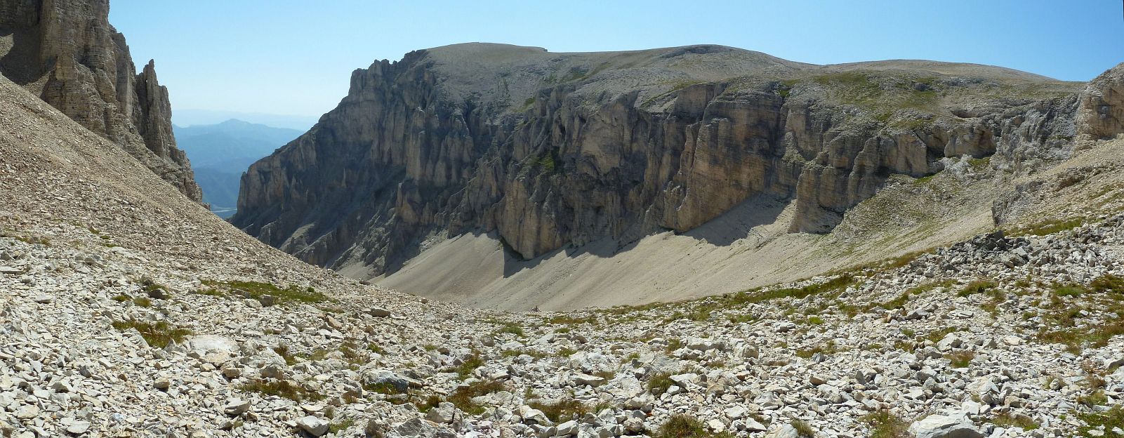
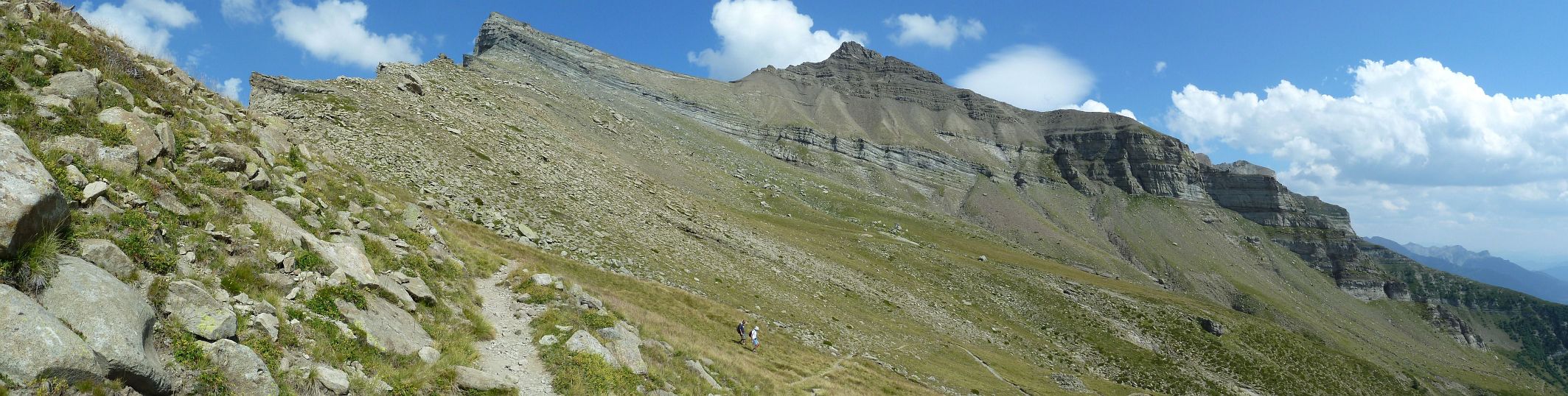
| Before you reach the Plateau de Bure you have to go through a steep scree, the Combe de Mai. It is hard going on the way up, more easy to negotiate on the way down. This picture shows the start of the descent. Click on the panorama to open a larger version in a separate tab. Click again to activate scrolling in the full picture. |
 |
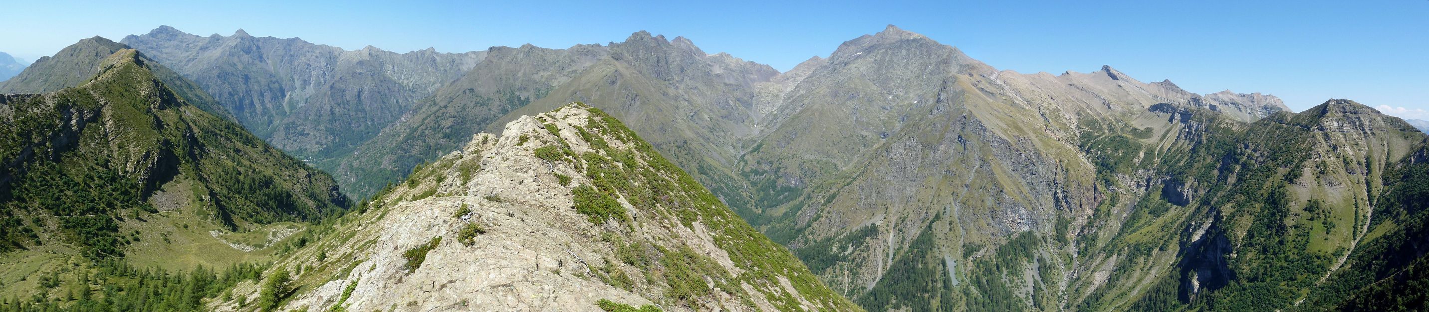
| The eastern wall of Pic de Bure seen from the summit of the Tête de Clappe (2019m). Click on the panorama to open a larger version in a separate tab. Click again to activate scrolling in the full picture. |
 |
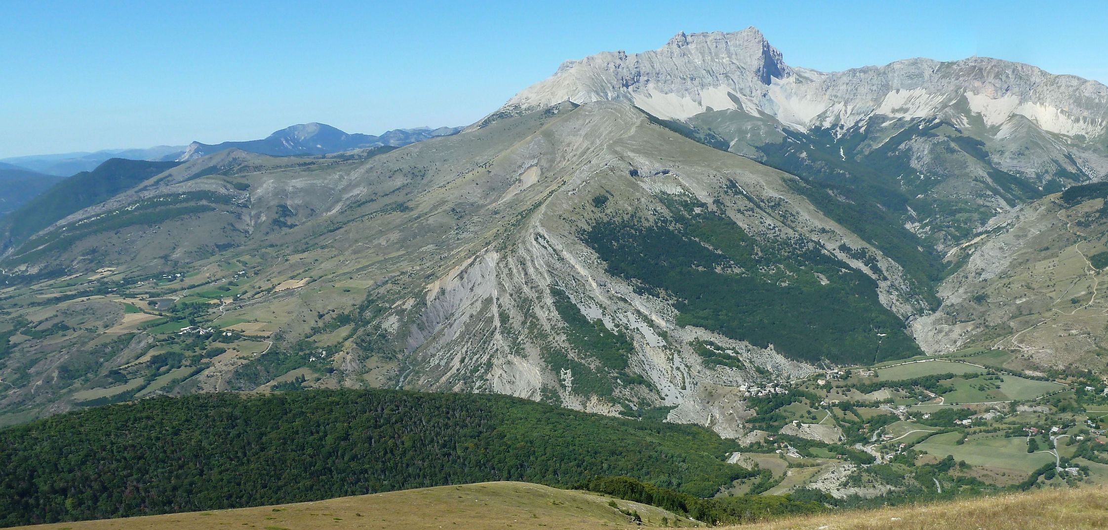
| The eastern wall of Pic de Bure seen from Cuchon (1930m), the highest point of the Montagne de Charance. The smaller moutain just in front of Pic de Bure is the Tête de la Clappe with its ridge La Barre (see previous panorama). On the bottom right, you can spot the quaint village of Rabou on its plateau. Click on the panorama to open a larger version in a separate tab. Click again to activate scrolling in the full picture. |
 |
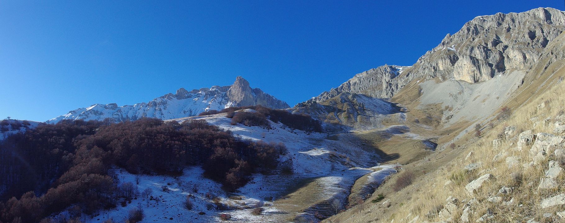
| Pic de Bure in winter, seen from our turning point on the way to Col de Rabou. It does not look like it but there was too much snow on the path for us to continue safely. Click on the panorama to open a larger version in a separate tab. Click again to activate scrolling in the full picture. |
 |
The Champsaur seen from Pic de Gleize or Pic de l'Aiguille
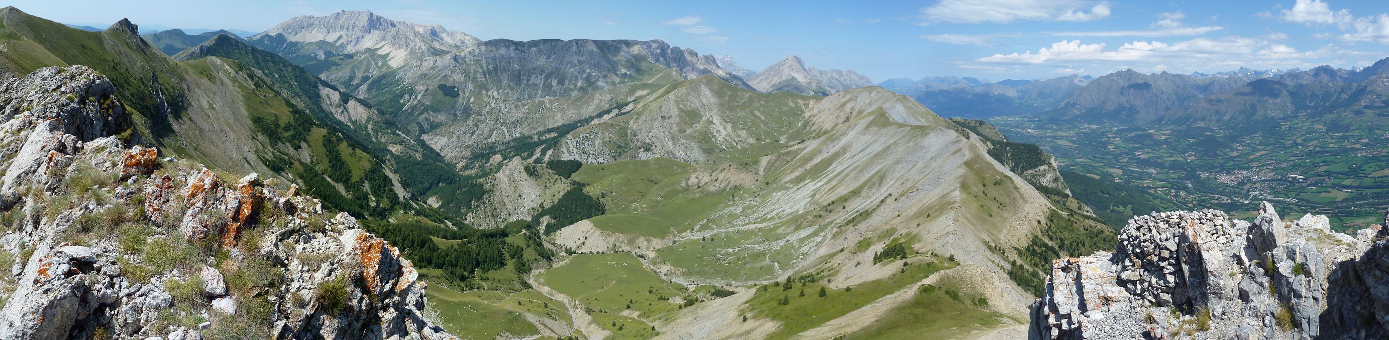
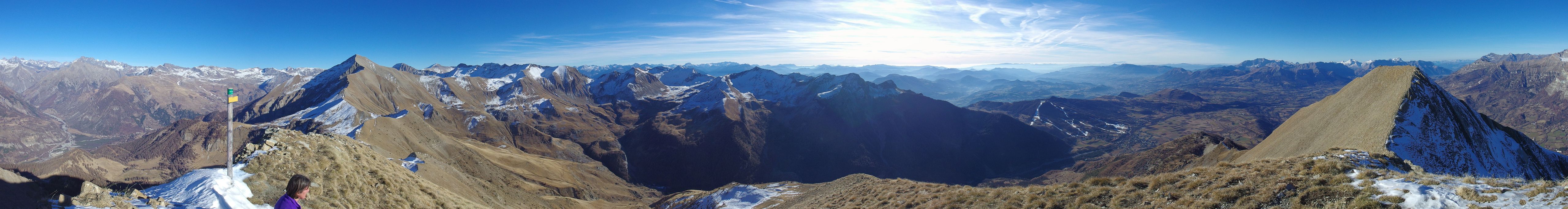
| View from the Pic de l'Aiguille (2143m). The ridge in front is Coste Folle overlooking the valley of Champsaur and the village of St Bonnet to the right. In the background, the summit on the left is Pic de Bure (2019m) and the one in the middle is the Obiou (2789m), the highest point of the Dévoluy mountains. Click on the panorama to open a larger version in a separate tab. Click again to activate scrolling in the full picture. |
 |
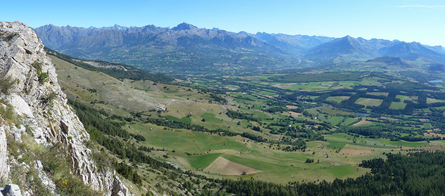
| View of the Champsaur Valley from Pic de Gleize. Pointy Vieux Chaillot a bit left of the middle and the Massif des Écrins in the background to the right. Click on the panorama to open a larger version in a separate tab. Click again to activate scrolling in the full picture. |
 |
| More or less the same view of the Champsaur valley but taken in winter. Click on the panorama to open a larger version in a separate tab. Click again to activate scrolling in the full picture. |
 |
Some summits of Champsaur
| View to the north from the summit of Piolit (2464m). On the left, the valley of Champsaur. The pointy summit below the clouds in the middle is Vieux Chaillol (3163m). Click on the panorama to open a larger version in a separate tab. Click again to activate scrolling in the full picture. |
 |
| A great ridge walk leading to the Col de la Pisse (2356m) north of the village of St Michel de Chaillol. Click on the panorama to open a larger version in a separate tab. Click again to activate scrolling in the full picture. |
 |
| A beautiful walk linking the Col de Cendrié and the Col de l'Escalier via the summit of Barry (2272m). Panorama taken from the Barry with views of pointy Vieux Chaillol (3163m) and the green summit of Cuchon de Molines (2375m) to the left. Click on the panorama to open a larger version in a separate tab. Click again to activate scrolling in the full picture. |
 |
| Winter day hike to the Col de Chorges (2249m) west of the Piolit summit. View to the north from the pass. Click on the panorama to open a larger version in a separate tab. Click again to activate scrolling in the full picture. |
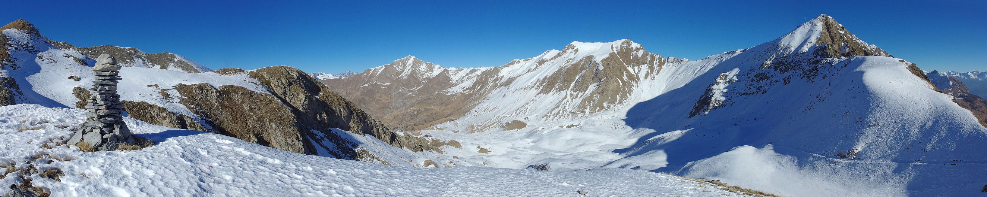 |
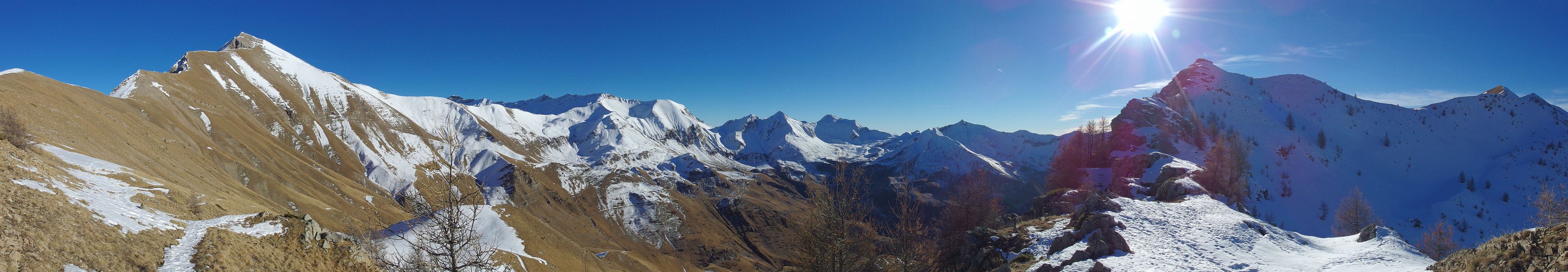
| Winter panorama taken from the summit of the Petite Autane (2519m). Click on the panorama to open a larger version in a separate tab. Click again to activate scrolling in the full picture. |
 |
| Winter panorama taken on the same day as the previous one from the Col de Combeau (2303m), eastern approach to the Petite Autane. Click on the panorama to open a larger version in a separate tab. Click again to activate scrolling in the full picture. |
 |
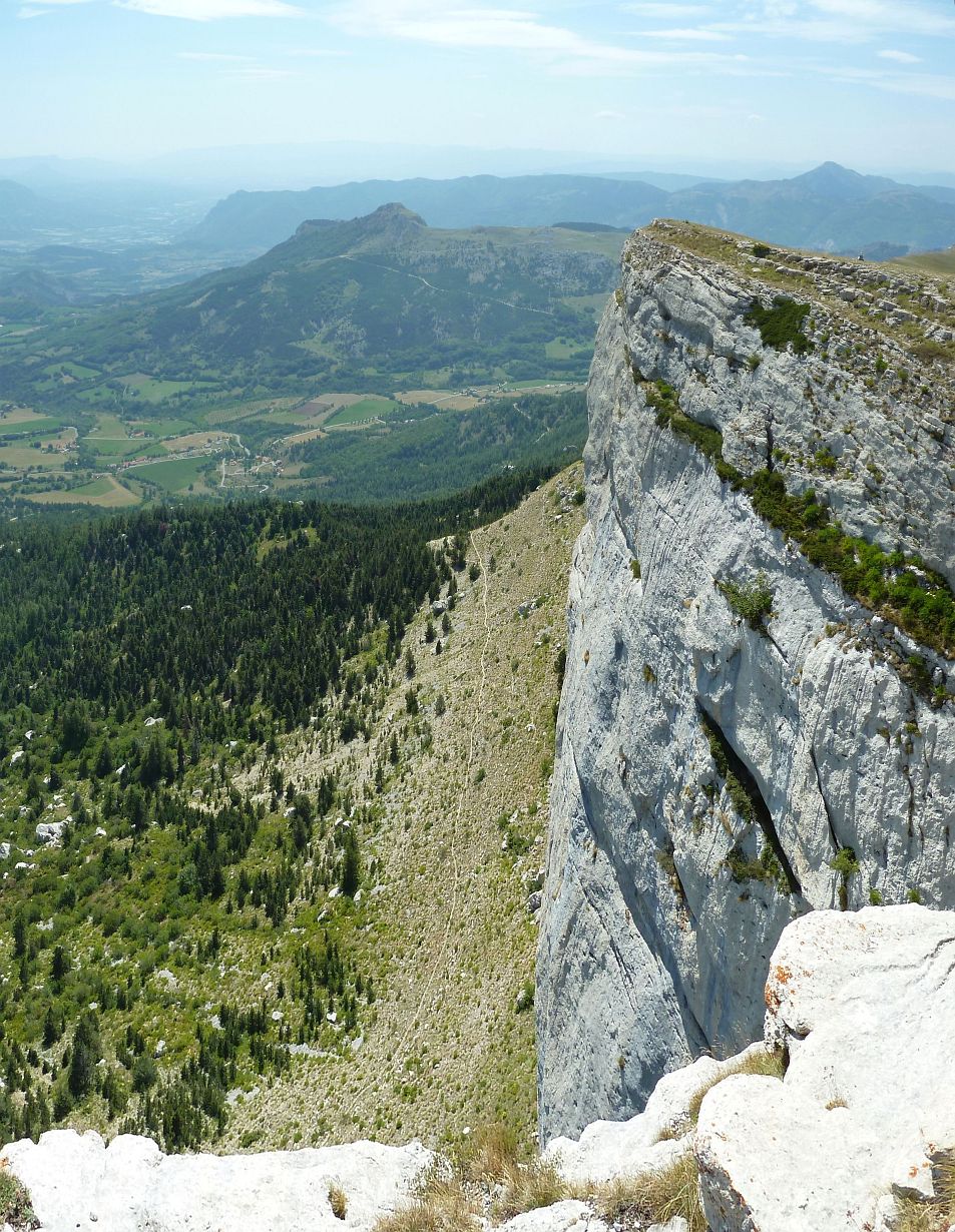
The rocky spur of Céüse
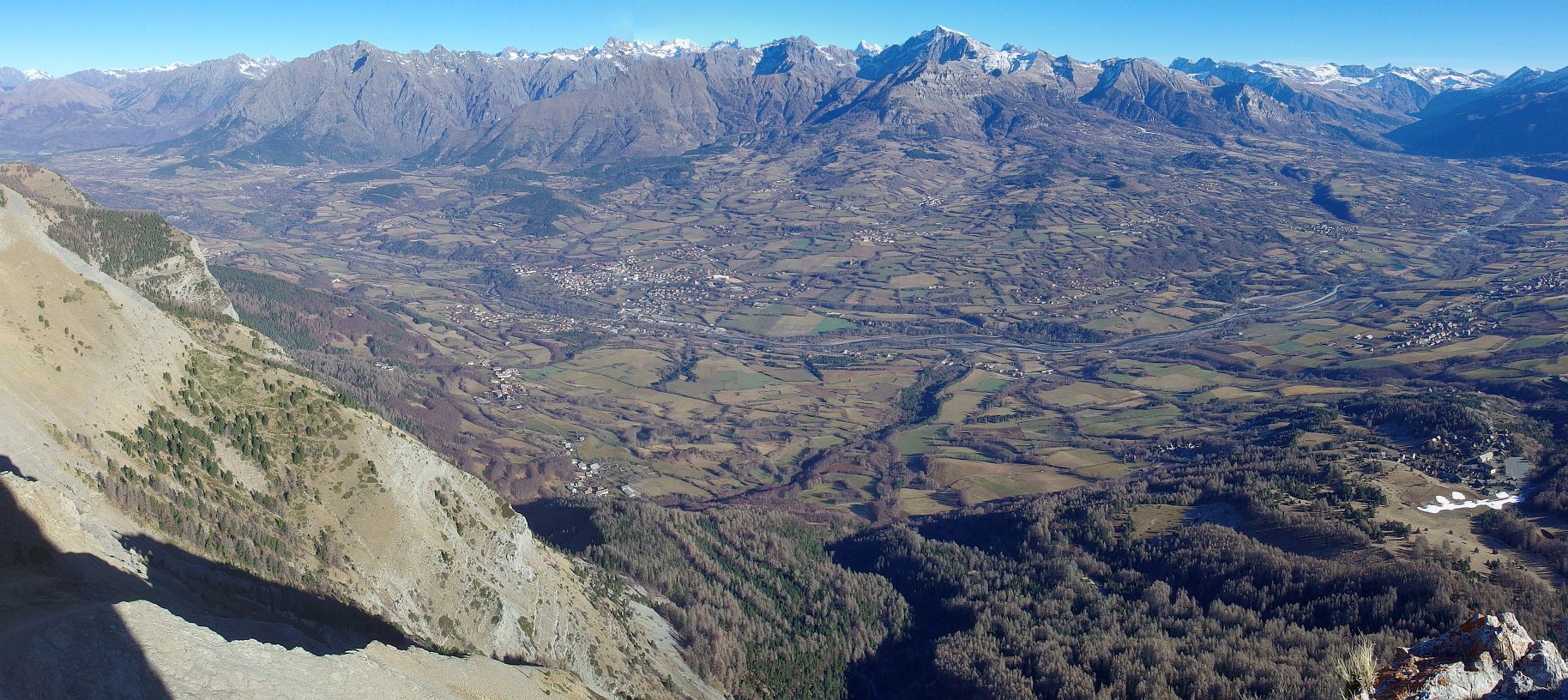
| Panorama of the Bassin de Gap and the Champsaur mountains taken from the corniche de Céüse. Click on the panorama to open a larger version in a separate tab. Click again to activate scrolling in the full picture. |
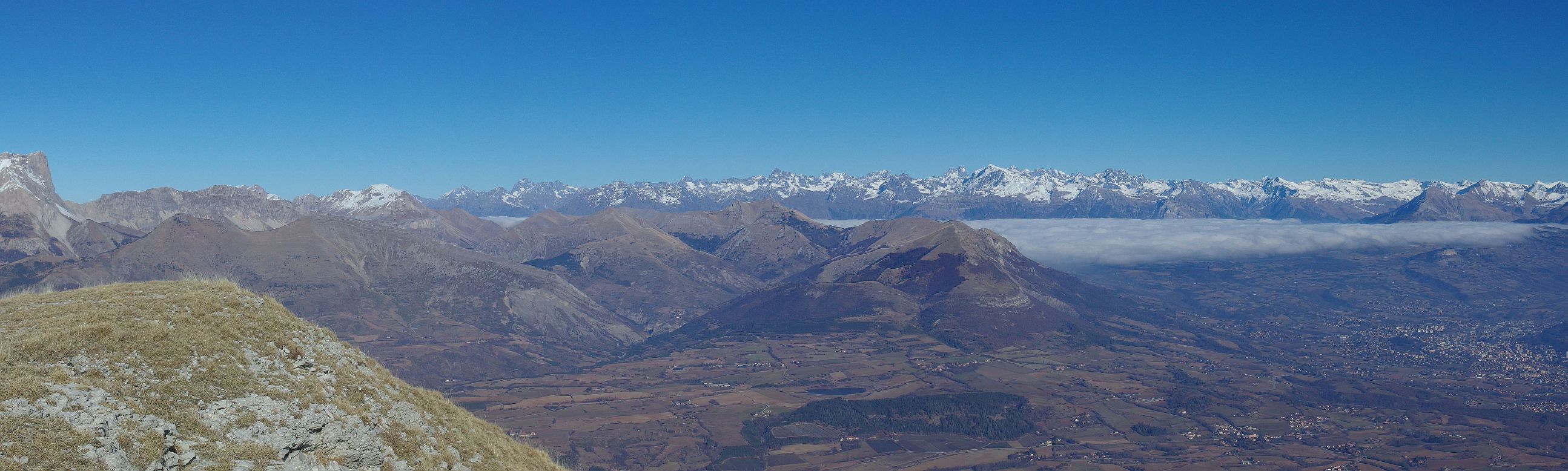 |
| Steep drop of the corniche de Céüse. Click on the panorama to open a larger version in a separate tab. Click again to activate scrolling in the full picture. |
 |
Go back to Gap and Around or go on to Summer in Gap or go up to Landscapes
$ updated from: Gap and Around.htxt Sun 24 May 2026 15:57:35 trvl2 — Copyright © 2026 Vero and Thomas Lauer unless otherwise stated | All rights reserved $