


Panoramas 2016 Solukhumbu Panoramas
(vero;2017-May-07)
Solukhumbu Panoramas
- Views from Labchane
- Lamjura La from Junbesi
- Views from the Everest View Lodge in Phurtyang
- Numbur and Khatang from Phaplu
Views from Labchane
Read our blog entry about the walk from Jiri to Labchane.
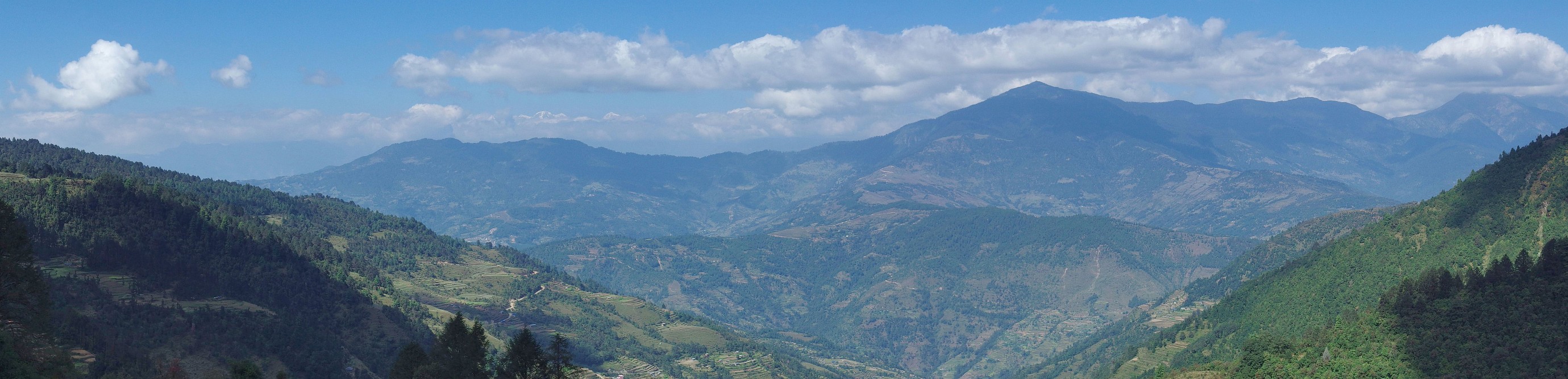
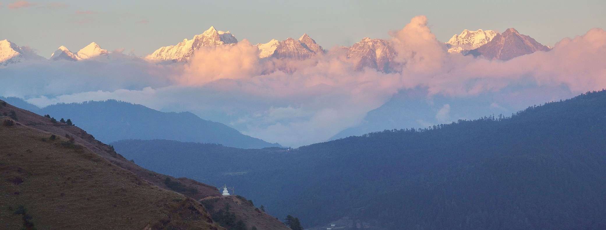
| Labchane. View to the northeast from the ridge over the village. Note the terraced fields and the dirt roads. There are glimpses of snow summits behind the clouds. Click on the panorama to open a larger version in a separate tab, click again to activate scrolling in the full picture. |
 |
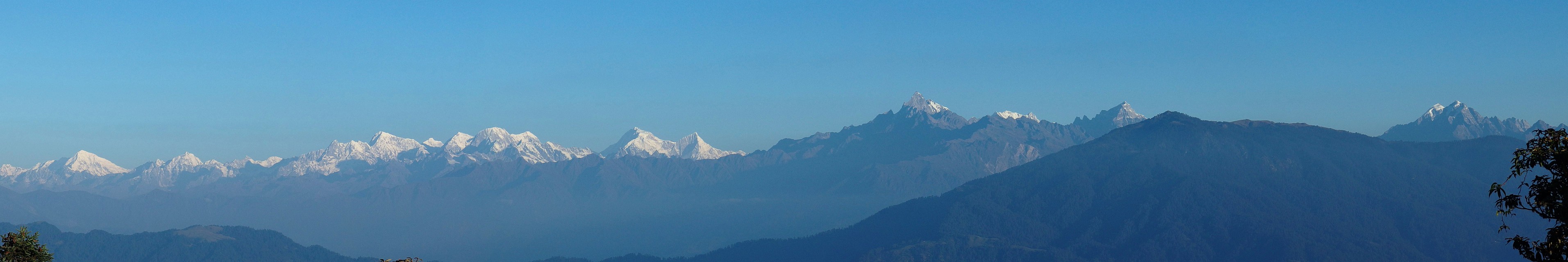
| Labchane. Sunrise view of the Rolwaling Himal on the left and Dudh Kunda (below the red dot) from the ridge over the village. Click on the panorama to open a larger version in a separate tab, click again to activate scrolling in the full picture. |
 |
Lamjura La from Junbesi
| View back on Lamjura La (below the red dot - 3530 m ) and the path skirting the hill to Junbesi on the right. Click on the panorama to open a larger version in a separate tab, click again to activate scrolling in the full picture. |
 |
Views from the Everest View Lodge in Phurtyang
Read our blog entry about our days in Phurtyang.
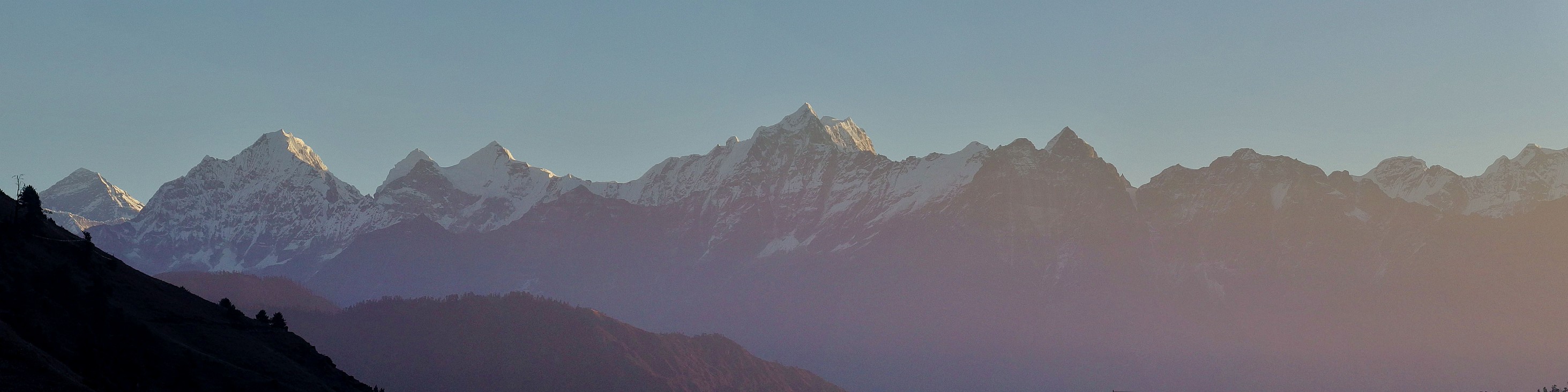
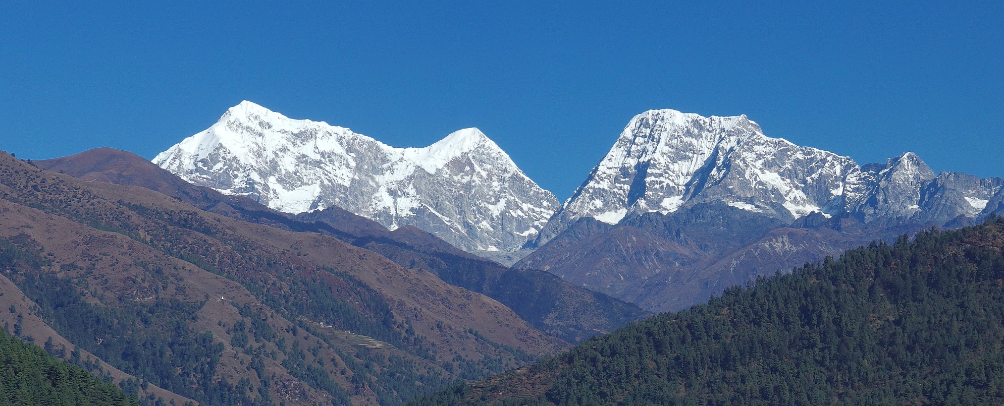
| Phurtyang. Sunset view from the terrace of the Everest View Lodge. From left to right: Everest (red - 8848 m), Thamserku (green - 6608 m), Kantega (yellow - 6685 m) and Kusum Kanguru (pink - 6367 m). The peaks further to the right include the black triangle of Kyashar (blue - 6770 m) and the Mera chain (6476 m). Click on the panorama to open a larger version in a separate tab, click again to activate scrolling in the full picture. |
 |
| Phurtyang. Sunrise view from the terrace of the Everest View Lodge. From left to right: Everest with clouds already approaching its summit, Thamserku (6608 m), Kantega (6685 m) and Kusum Kanguru (6367 m). Click on the panorama to open a larger version in a separate tab, click again to activate scrolling in the full picture. |
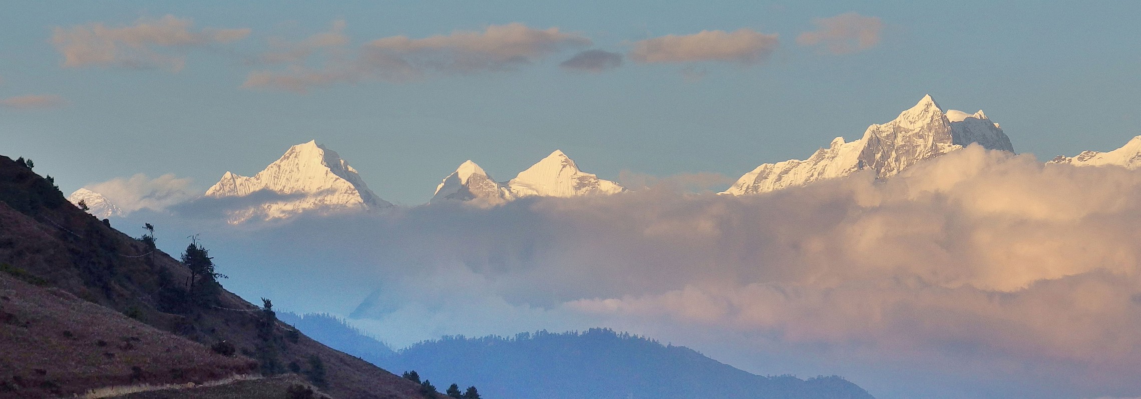 |
| Phurtyang. A bit later, another sunrise view from the terrace of the Everest View Lodge. Trakshindo La (3071m), the second high pass on the way to Lukla is below the red dot. From left to right: a bit of Thamserku (6608 m), Kantega (6685 m) and Kusum Kanguru (6367 m). The peaks further to the right include the black triangle of Kyashar (6770 m) and the Mera chain (6476 m). Click on the panorama to open a larger version in a separate tab, click again to activate scrolling in the full picture. |
 |
Numbur and Khatang from Phaplu
| View to the North from Phaplu with Numbur (6958m) on the left followed by Khatang (6852 m) at the end of the summit shoulder and Karyolung (6511 m) on the right of the picture. Click on the panorama to open a larger version in a separate tab, click again to activate scrolling in the full picture. |
 |
Go to Upper Pisang to Manang or up to Panoramas 2016.
$ updated from: Panoramas 2016.htxt Sun 24 May 2026 15:57:27 trvl2 — Copyright © 2026 Vero and Thomas Lauer unless otherwise stated | All rights reserved $