


Kyrenian Mountains
(Thomas;2006)
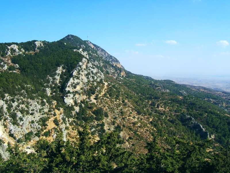
This mountain chain forms the backdrop of the northern coast line of Cyprus, east and west of Girne (or Kyrenia, in Greek). Its highest point is 1024 metres (around 3400 feet) above sea level. The British, when Cyprus was still a colony, built a dirt track that ran almost the entire length of the ridge. Our guide book enthuses about the views from up there, down to the coast as well as to the South, but also warns that a 4x4 would be necessary to actually drive it. The picture shows the ridge line as well as the summit (with a big radio mast) and the southern flanks.
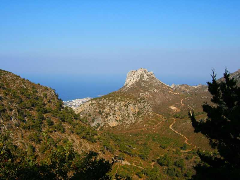
We were pleasantly surprised when we tried (one can always try) and saw that the whole track (along some 20 miles) was freshly covered with tarmac and is, though still narrow, now smooth as silk. The views are indeed good… so good that we drove the road twice. The photo gives an impression of the northern slopes, towards Girne. The structure on the hillock in the middle is the famous crusader castle of St Hilarion.
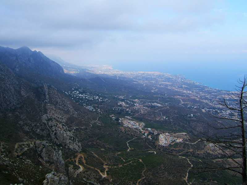
Again the northern slopes and the coast, towards Lapta. We also did a nice long hike in the vicinity, up from Lapta almost to the summit.
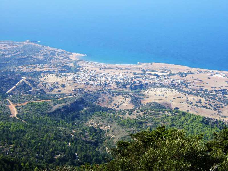
And still more of the northern coast line. It looks not at all bad from that high up but once down on the ground we found the strange mixture of ex-war-zone and construction boom rather unsettling.
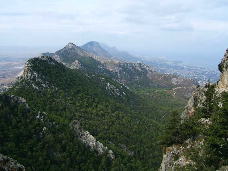
The next picture shows almost all of the chain, from its eastern extremity.
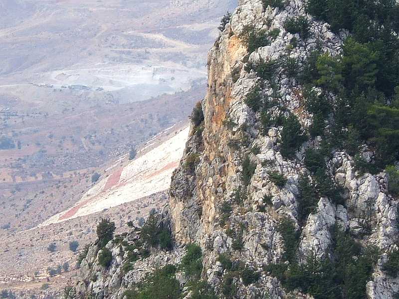
This is a zoomed-in part of the previous scene (in the extreme left): what you see here is a huge white/red Turkish-Cypriot flag which the Turkish army labouriously jcb'ed into the hillside. It must be hundreds of metres across and once again it's a sophisticated exercise in propaganda: these mountains (and with them this flag) are clearly visible from southern Cyprus, especially from the Greek-Cypriot part of Nicosia. So each and every day the Greek-Cypriots have the pleasure of being reminded by their courteous Turk-Cypriot neighbours that Cyprus is still a divided island. How stupid can politics get?
Want to see more? Go back to Selimiye Mosque or go on to St Hilarion or go up to Northern Cyprus.
$ updated from: Northern Cyprus.htxt Sun 24 May 2026 15:57:23 trvl2 — Copyright © 2026 Vero and Thomas Lauer unless otherwise stated | All rights reserved $