From Ghap to Dharapani
(vero;2017-Jan-31)
From Ghap to Dharapani (9 days, 11 Sept 2016 to 19 Sept 2016)
- 11 Sept: Ghap (2165m) to Namrung (2630)
- 12 Sept: Namrung (2630m) to Loh (3180m)
- 13-14 Sept: Loh (3180m) to Samagaon (3520m); rest day
- 15 Sept: Samagaon (3520m) to Samdo (3875m)
- 16 Sept: Samdo (3875m) to Dharamsala (4460m)
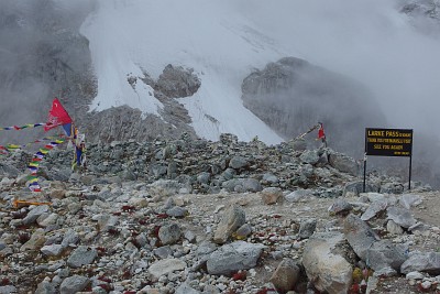
- 17 Sept: Dharamsala (4460m) to Bhimtang (3740m) via Larkya La (5160m)
- 18 Sept: Bhimtang (3740m) to Tilje (2300m)
- 19 Sept: Tilje (2300m) to Dharapani (1963m)
11 Sept: Ghap (2165m) to Namrung (2630)
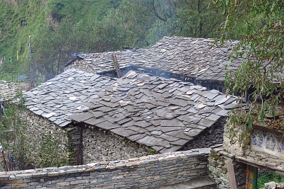 Big disappointment as we wake up: there are clouds everywhere and it is raining. There is no point staying here. We have a lazy morning and wait for the rain to stop before we set off to our next destination. Our host has problems with his mobile, Santosh helps him out and let him make a few calls with his phone, this is very much appreciated and ensures he gets a very good price for food and lodging. (We in turn are amazed that there is any phone coverage at all at this isolated spot with just a handful of houses.) The path today climbs steadily through forested slopes and we even see some monkeys: langurs. We arrive quickly in Namrung and have a surprise as we turn around the corner: we can hear hammering everywhere and we realise there's a huge building site in front of us. We make our way to an imposing tourist lodge and settle there before setting off to investigate what's going on. As we stroll through the village, we are quickly met by a young man: he welcomes us and explains that he is the project manager of this building site. He is happy to show us around and we follow him.
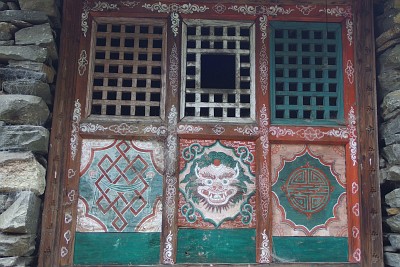
He starts with a bit of background which we cannot verify and assume to be correct: there was once a powerful local king who lived higher in the valley, maybe Samagaon. Unhappy about the harshness of the climate up there, he built a summer residence in the village of Namrung where he ended up spending more and more time. Namrung developed into an important stronghold with a palace, quarters for soldiers, a prison, a monastery and much more. The king died eventually and his kingdom has long since disappeared, but a few buildings, some of them 700 years old, have more or less survived until today, mostly in ruins but sometimes still used by the local population living in houses around the old compound.
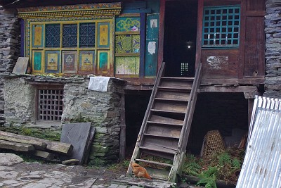 Having set the scene, he then begins to explain what is now happening. A wealthy local businessman has spotted the potential of those ruins and has succeeded in leasing Old Namrung from the government for 30 years. The old ruins are to be restored as far as possible and converted into an open-air museum for which he will obviously charge entry fees. Lodges and an impressive tourist resort are to be built around the “historic area” to accommodate the visitors. Indeed, he shows us several new buildings, all in different stages of construction: there will be tree-houses, bars, a sauna (!), a dedicated museum for local artifacts and crafts, shops, and all rooms will have attached bathrooms with flush toilets. Incredible.
We find it hard to believe that such a venture in this remote and extremely poor location has any chance of success. But he is quite confident: we should not forget that we are still in the monsoon time, in three weeks time, trekkers will start coming in bigger numbers, and the weather will be such that they will be able to enjoy the mountain views which we are sorely missing at the moment. Furthermore, they are building a helipad so that wealthy Nepalis and foreign tourists will be able to visit in style without having to trek all the way. They are planning a park with pleasant walks leading to view points: down valley to Ganesh Himal, up valley to Manaslu.
The resort will support the local economy; actually, this is already happening: about 100 Nepalis are working here. When possible, everything is crafted and built on the spot, the rest is flown in by helicopter, which explains the helicopter traffic we have noticed since starting our trek: wood is taken from surrounding forests, stones are brought to the site and a team of carpenters and masons is busy building the future resort. We see wooden furniture taking shape before our eyes, they have their own hydro-power station and get their own water from a glacier above the site. We are flabbergasted at this hive of completely unexpected activity.
Still, we cannot help but feel dubious about the whole thing. But who knows? Opening is planned for the autumn season of 2017, definitely something to follow.
12 Sept: Namrung (2630m) to Loh (3180m)
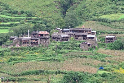 It is foggy and cloudy when we leave Namrung. We stop at the police check post at the end of the village to register our Manaslu trekking permits and are shocked at the conditions in which the men are living: there are 9 of them, posted here for 6 months and all living/working in one big tent. They tell us that they used to have their quarters in one of the still standing royal buildings of Old Namrung but have been evicted by the new master of the place. We hope that the rich man has made plans to build a police post for them…
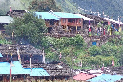
The valley is now wider and in spite of the clouds we have good views on the fields and hamlets on the other side of the river. The houses are rustic, made of grey stones with dark wooden balconies and black wooden roofs. The first settlement, Lihi, is quite bleak, a few houses but we see people repairing the gompa. Then comes Shyo, a bit bigger but as bleak, and this even more as it begins to rain. Many houses are empty and in a bad state of repair: they have been damaged during the 2015 earthquake and their inhabitants have abandoned their home, leaving the valley for Kathmandu or other cities. We would love to stay in Skrip: there is a lodge situated on a slope with nice views down valley, but the Didi is not prepared to have guests: she quotes us even higher prices than printed in her already expensive menu, because she has to get some extra water (?). We are probably not worth the effort. So we continue to Loh under the rain.
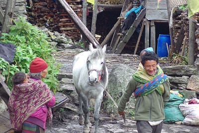
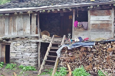
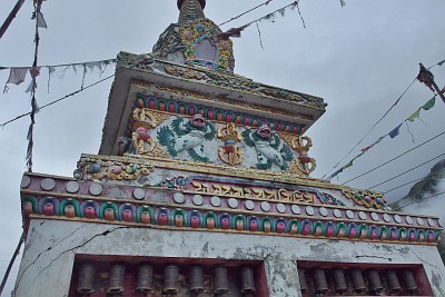 We take quarters in the middle of the village, in a nice lodge with small cottages around a garden and more traditional rooms in the main building. At last, we are in a substantial place with much to explore and we escape quickly to have a look. There are many people around, going about their business, and most of them have Tibetan features. The village lanes are muddy and slippery, and the many houses are all built in the same fashion, like English terraced houses. People watch us from their windows or balconies: they live on the first floor and keep their cattle and stock downstairs. There are many prayer flags flapping around in the wind and unusual “rococo-styled” stupas. For the first time, we see yak trains coming down, heavily loaded with Chinese goods: the border is very near.
As we go up in direction of the monastery along an endless mani wall, we pass many fields and gardens: at this time of the year the main crop is corn, and the trees are laden with apples and walnuts (and Santosh is busy collecting more fruits).
13-14 Sept: Loh (3180m) to Samagaon (3520m); rest day
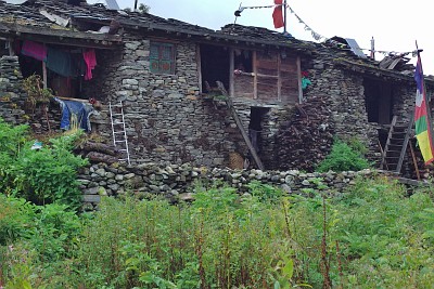 The walk up to Samagaon is not pleasant: it is foggy all the way and it starts to rain as we leave the village of Shyala where we had our lunch break. Shyala is not welcoming, it seems that the place is in a building frenzy: houses are being built everywhere and to our astonishment, those are not “normal houses” but tourist lodges. We are again puzzled by the huge expectations the locals seem to have as far as tourism is concerned. According to the NTNC 2015 annual report (National Trust for Nature Conservation), the last pre-earthquake number of visitors to the Manaslu area was 5658 for the 2014/2015 tourist year. They must be counting on a significant increase if they want all those new lodges to be viable… We wonder whether the government has plans, still unofficial, to open the area to “free trekking”, i.e. without permit and guide? Maybe. But we remain sceptical…
The path climbs a bit before reaching a high plateau with pastures and cattle grazing around. Although it is now flat, we are happy to arrive in Samagaon (or Sama) as the whole area is saturated with water, muddy, slippery and full of mule and yak shit.
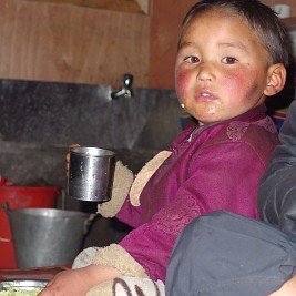 Sama is a substantial village. One strolls first through the old village before reaching the new part, where there are many lodges, a few shops and further on a big monastery. On the first day, we go to the gompa and explore the old village. We meet a Canadian girl who works as a volunteer in Sama for the NGO Mountain Child. They are quite active in the village and among other things run a pre-school for kids under 5 years. She shows us around and we can see the benefits of their work at first hand, since Sonam, the son of our lodge owners is going there. He is a bundle of energy and loves singing nursery rhymes or showing off with his few English words. In the morning, we can see the little kids, a small rucksack on their back and most of them accompanied by their parents, going happily to school and it is obvious that they are proud and enjoying it.
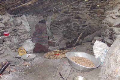
Old Sama is also very dirty and muddy, cattle is roaming around freely. Men galloping at wild speed through the main street give an impression of adventure in an exotic and exciting way. The houses are made of stone, all “glued” to each other and they remind us of those rows of small attached houses in English suburbs.
For once, we are not alone in the village. There are a few trekkers, all in fancier lodges and the place is busy with climbers who are gathering here before making their way up to Manaslu Base Camp to climb that summit. We have an Italian companion in our lodge, not very talkative, but he tells us that he just arrived and is acclimatising before going further up and meeting his fellow climbers at base camp. He is part of a commercial expedition, comprising 6 to 8 western climbers from Southern Europe: the team leader is from Romania, other climbers from Portugal, Spain and Italy. One Sherpa guide is also here, organising the logistics, sending porters with food and equipment back and forth on the way to the base camp. He leaves with our Italian companion the next day early in the morning. They are worried about the unusual late monsoon and the bad weather; we learn later that 9 members of the expedition have summited on October 1st.
There are many new arrivals today and we wonder where all these people come from, as we hardly saw any soul during the walk-in. We get the explanation as we wander along endless mani walls on the plateau and explore the shores of the Birendra lake. Many mule trains arrive from the other side of the Larkya La: this is quicker and safer than the route via the narrow, landslide-prone Buri Gandaki valley, the way we took. The dirt road on the Annapurna Circuit is going all the way to Dharapani (and even further), where the drivers load equipment, food (and even living chickens) on their beasts (further up, yaks are also used). It takes a mule train just 3 to 4 days to reach Sama and they avoid the dangerous landslides we have come across.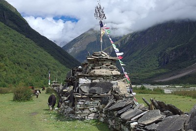
For a change, the weather is better, we can see the summit of the Samdo mountain in the morning, and there are bits of blue skies above us.
We meet an interesting party of three Nepalis who are trekking the length of the Great Himalaya Trail. They started in Humla (Western Nepal) and are heading to Taplejung in the Kanchenjunga area. They tell us that they are on their 62nd day and reckon that they will need 110 days in total. Although they have seen nothing of Thorong La or Larkya La because of clouds and fog, they are in a positive mood and confident to complete their trek. We are quite impressed and marvel at their small and light packs.
As we arrive back in our lodge on the second day, there are tables set in the courtyard and banners planted along the walls: some men “from the bank” have been here and are now waiting for their helicopter to fly them back down valley to Sirdibas. We learn that this is their 4th visit in Sama and that they are here to distribute money from foreign aid donors received after the earthquake to the 280 households of the village.They are due to come back for a last distribution in 10 days.
There is great excitement when their helicopter finally arrives as it is also bringing stuff to the village: among other things, a card box with new T-shirts for FC Samagaon, the football players are all wild about them!
15 Sept: Samagaon (3520m) to Samdo (3875m)
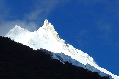 At last, we can see Manaslu this morning. Great rejoicing! But the joy is short: 15 minutes later, all clouds are back, obstructing the view. The walk today is short and pleasant on the high plateau with a short steep climb to reach the village of Samdo at the end.
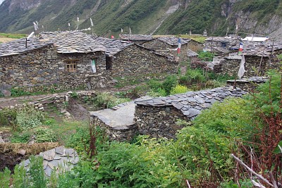
We have a long afternoon in front of us but time flies as there is a lot to explore in this nice village comprising 40 households. We see people working, idling or praying on their doorstep. We are staying in a “non-touristy” lodge and spend a great evening observing the goings on around us. Our host, a man of about 50, is an old-school lodge owner: welcoming, very chatty and not at all a “business man” intent on making money only. His wife is a formidable and imposing woman and her husband appears very tiny against her bulky frame: we call her Brunhilde. She is quite bossy and does not do a lot in the house, lying mostly on her bed in an adjoining room from where she does not miss a single thing.
And most importantly, there are two kitchen girls, young and rather pretty who are essential in running the lodge and attracting customers: the lodge is filled with mule and yak drivers and they seem to appreciate the young ladies very much. We even notice there's a romance in the making between one of the girls and a mule driver.
They talk a great deal and alcohol is flowing freely: first beer, then Ruslan vodka and whisky. The village drunk is also here. All this activity compensates for the dhal bhat: we get plenty of rice, but the dhal and the curry are very meagre indeed.
16 Sept: Samdo (3875m) to Dharamsala (4460m)
It rains as we wake up and we are worried that the weather will deteriorate tomorrow, the big day for us, when we will cross the Larkya La. Since the route today is so short, we take it easy and decide to wait until the rain stops.
Our host is also leaving: he confirms what we have observed the previous days, namely that nowadays the supply route for Sama and the high plateau comes in from Dharapani over the Larkya La and Samdo. He explains that a one kilo transported by mule from Arughat to Samdo along the Buri Gandaki costs 110 Rs, against 70 Rs for the route Dharapani - Samdo, not to mention the time savings. He prepares his 5 mules and plans to cross the pass today and be in Bhimtang in eight hours. Tomorrow, he will make his way to Dharapani, load his mules the following day and make the trip back to Samdo in two days: if all goes well, he will be gone for four days in total.
The trek to Dharamsala is short, we want to stay there for the night in order to acclimatise for the Larkya La. It is cold, clouds are hanging low and we have a very bleak day. The lodge in Dharamsala is appallingly bad and the host utterly unfriendly. He does not want us in his kitchen, so we have to stay in a huge freezing-cold dining room. Later he serves ice-cold dal bhat, the worst (and most expensive) dhal bhat we ever had in all our years in Nepal. We spend a miserable and very long afternoon in our sleeping bags in the depressing and silent lodge.
We strongly advise everybody to avoid the Dharamsala lodge at any cost: starting the Larkya La day from Samdo is quite possible and if one starts early, reaching Bhimtang on the other side by 3pm or so shouldn't be a problem.
17 Sept: Dharamsala (4460m) to Bhimtang (3740m) via Larkya La (5160m)
It has rained heavily during the night but as we listened in the dark, we knew that whatever happened, we would not stay a further day in Dharamsala. Needless to say that we leave early, despite the now weaker rain, happy to put this horrible lodge behind us. Luckily, shortly after leaving the rain stops.
The climb to the pass, skirting a moraine, is quite gentle at first. We are overtaken by a huge yak caravan, they are not really faster than we are, but we prefer having them in front of us: there are in total 41 yaks, 4 horses and 6 men. The yaks have bells around their necks and it is nice to follow them and walk to the sound of their jingling music.
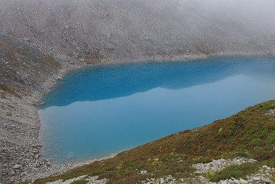
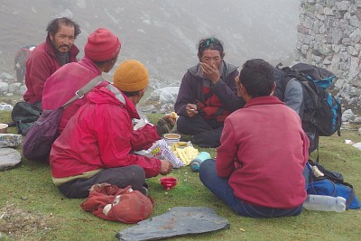
We pass a small turquoise lake, then climb to a ridge where we rejoin the Tibetans: they are having a tea break with some appetising fried bread and they offer us a bite as we pass them. We prefer to continue as there is still a good way to go (and anyway, Thomas can't walk with his stomach full).
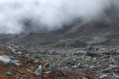
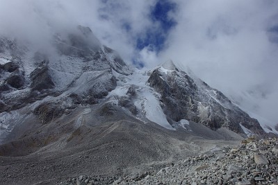
After the ridge, the trail descends a bit onto the moraine and to a bigger lake where the going gets tiring through stones and boulders. We can guess some glaciers and snow peaks around us. The lake looks quite desolate with the clouds hanging low, and there are whitened yak bones scattered all around the place.
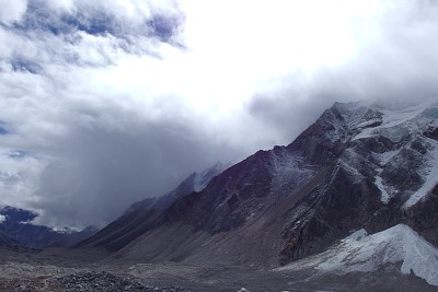
We continue up the moraine and see at last some praying flags flapping in the wind: but our hopes are dashed as we realise that we still have some way to go. It takes us some more 100 to 150 vertical meters before reaching at last the real pass and this last part is particularly frustrating and demanding.
We are quite shocked at the amount of garbage we see along the trail, the pass itself is strewn with empty packs of biscuits or noodle soup and tobacco, there are also many empty soda bottles and cans.
Once at the pass, we have a small break, eat some dried fruits and take pictures; we see the caravan arrive and how the Tibetan hang prayer flags on top of the pass. As it starts to snow, we decide to go down without losing too much time. The descent is not as bad as expected and the snowfall stops quite quickly. It is steep at the beginning, but since there is no snow or ice, we can take advantage of the sand on the ground which is relatively easy to negotiate. Some parts are rocky but not overly difficult. We meet three mule trains and a farmer with some cows coming from the other side.
There is a teashop in a makeshift tent one hour and a half after the pass and we have some biscuits. The caravan arrives as well and they make a longer break. We prefer to stay outside while the men disappear into the tent: it is too smoky and too cramped in there. The yaks are left to grass and roam freely around the flat expanse: they will have to be gathered before the caravan can leave again. 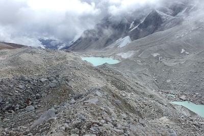
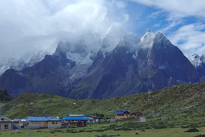
We continue and arrive well before them in Bhimtang. This is the first settlement after the pass: we can see the houses from far, down on a big green plateau criss-crossed by many small brooks, a very welcome sight after the bleak mountain scenery. We know now that we are nearly there and we take it easy, savouring every step down in anticipation. There are many lodges around, some quite fancy, others under construction. As usual, we try to find the lodge most likely to be used by locals and are lucky: the evening will bring a steady flow of visitors coming for a drink, a snack or to gossip.
There is a regular trade between Tibet and the area; based on what we see, Chinese cement seems to be the product of choice in this region. Samdo is the first port of call for the caravans from Tibet. Once there, they either continue to Sama or cross over the pass to Bhimtang, where their loads are transferred to mule trains which will bring everything down to Dharapani and the road. Naturally, this traffic also goes the other direction: on their way back, the yaks are loaded with goods brought by mules from Dharapani and transported to Samdo, Sama or back to Tibet. It's like a shuttle service.
We have a wash and a snack and are most happy to see that our Tibetan friends have also chosen to stay in our lodge. This will guarantee a pleasant, if noisy evening.
Their caravan is not heavily loaded, and we see soon each Tibetan making the round of all houses trying to sell their wares: potatoes from Samdo, milk, cheese and other stuff. They are more interested to collect goods in Bhimtang and transport them further up than bringing stuff down. When they arrived, they let the yaks roam freely, but as the night descends, they gather the animals and attach them to each other at a leg with a strong string fastened to a heavy-duty peg tucked deep into the ground. Thus they are sure that the animals will not go astray during the night.
18 Sept: Bhimtang (3740m) to Tilje (2300m)
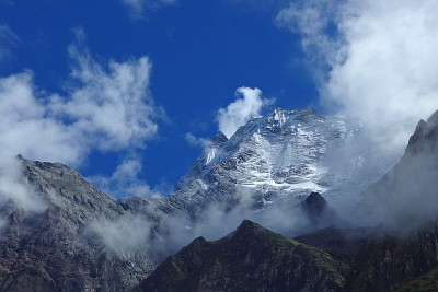
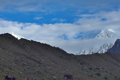
Compared to previous mornings, the weather is nice as we leave Bhimtang. We see blue sky and white snow summits piercing through the drifting clouds and yes, even the south peak of Manaslu!
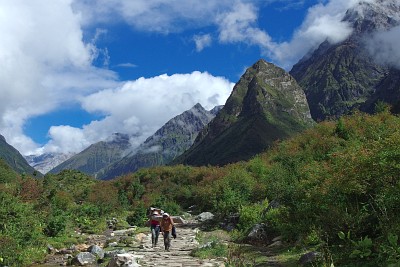
The trail goes through forest and all this greenery is a welcome change after the bleak and rocky landscape of the last two days.
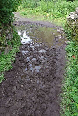 But this also has a drawback: the path is muddy, damaged by the many mule trains which are using it and the going is very slippery and slow. There are no villages on the way, except a few isolated lodges. We are happy to arrive in Tilje, our stop for the night and the last big place on the Manaslu Circuit.
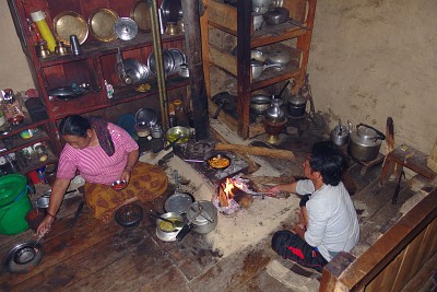
It is a substantial village with many fancy looking lodges but we look for a particular one: located in an apple garden, the place where we spent our last camping night back in 2001. We find it at the exit of the village and it is obvious that the lodge has seen better days. Actually, our host, an elderly lady, is surprised to see us: she is obviously not expecting guests and the sleeping quarters are a bit run-down, all trekkers are now stopping in the fancier lodges further up in Tilje. But she is very welcoming and after a thorough wash (bodies and clothes!), we spend a pleasant evening in her kitchen. It is a women's household and her teenage daughter is watching a Bollywood film on the TV while doing her homework.
19 Sept: Tilje (2300m) to Dharapani (1963m)
 The following morning there is blue sky again, for the second day running. Could it be that crossing the Larkya La has brought us to the area located in the famous “rain shadow” of the Himalayas? Could it be that the frustrating days of low-hanging clouds are at last over?
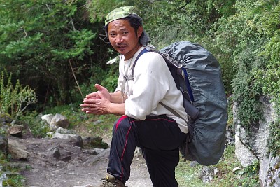 We leave Tilje early and Santosh is in a hurry. This is our last day with him, and the road is only 90 minutes away in Dharapani. There our ways will part: we will follow the Annapurna Circuit up, to the pass of Thorong La, and he will take a jeep to reach the main road further south where he has to catch a bus to Kathmandu. The sooner he is in Dharapani, the greater his chances to catch a bus all the way to Kathmandu before nightfall.
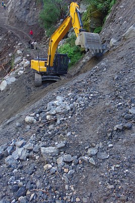
We have a last little scare shortly after leaving Tilje. The path is now a dirt road and a big landslide has gone straight through it; a JCB has already started some repairs, but this means another precarious crossing or a time-consuming detour to avoid the spot. Damned! It is obvious what Santosh's preference is. We opt for crossing the landslide, which is quite exposed, but luckily we are in the “climbing” direction, always easier than going down and not so scary. As before, Santosh makes the crossing twice in order to carry my pack, so that I feel safer going without. Thomas goes first (with his pack) and a man throws him a rope to hold tight while scrambling up the slope. When it is my turn, the JCB has already padded a small step, which makes it much easier for me.
There is nothing barring our way until Dharapani, we say our good-byes to Santosh and are ready to start on the Annapurna Circuit.
Go back to From Soti Khola to Ghap or go on to Around Annapurna
$ updated from: Around Manaslu.htxt Mon 28 Apr 2025 14:55:28 trvl2 — Copyright © 2025 Vero and Thomas Lauer unless otherwise stated | All rights reserved $


