Welcome FAQs
Links News
And it's Nepal again!
We trekked the Manaslu and Annapurna circuits and paid a short visit to the Everest foothills to top it all...
Post 2015 earthquake, our first time during the monsoon season, we have a lot to share and reflect upon.
Full map of all Nepal 2016 pages
Panoramas 2016 Annapurna Panoramas
(vero;2017-Feb-28)
Annapurna Panoramas
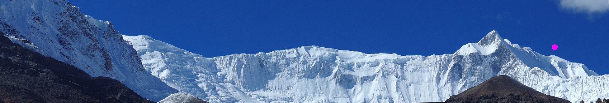
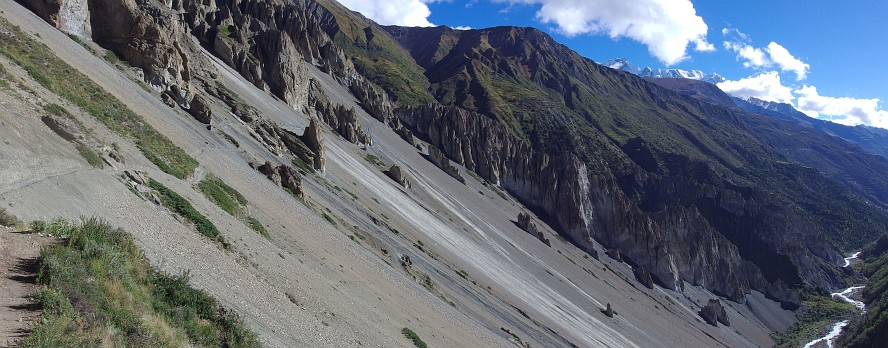
Tilicho Side Trip and Grande Barrière
Read our blog entry to learn more about Tilicho Lake and the Grande Barrière.
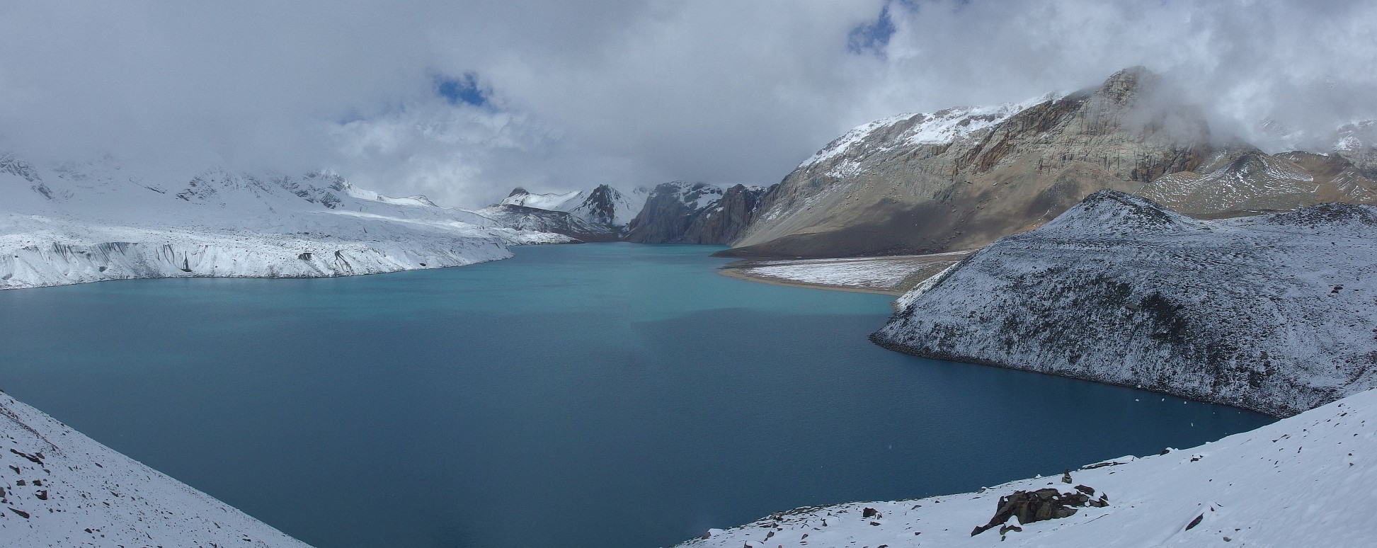
| Clouds lifting above Tilicho Lake. This lake was discovered in 1950 by the French Annapurna Expedition led by Maurice Herzog as they were searching for Annapurna. It is situated at an altitude of 4919m and is said to be the highest lake in the world. Click on the panorama to open a larger version in a separate tab, click again to activate scrolling in the full picture. |

|
| Looking at the Grande Barrière, from the spur above Tilicho Base Camp on the way to the lake. The path leading to the lake can be seen skirting the slope on the right hand side of the picture. Click on the panorama to open a larger version in a separate tab, click again to activate scrolling in the full picture. |
|
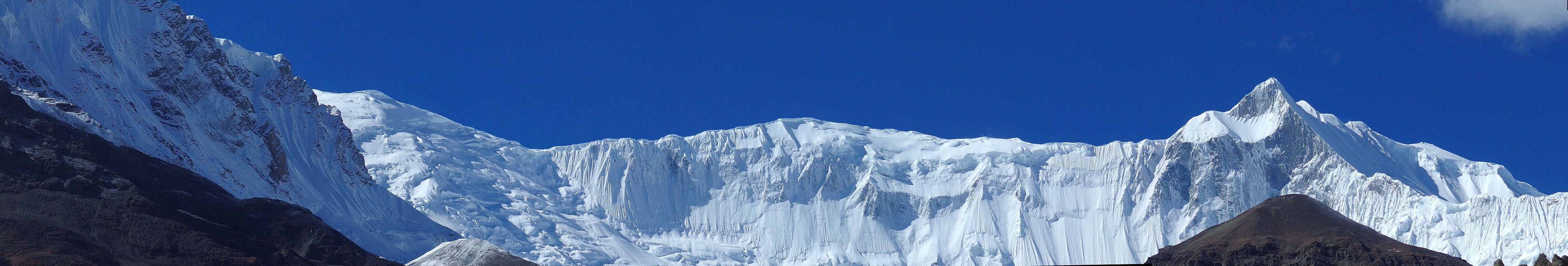
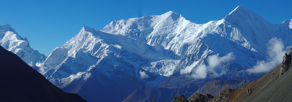
| The Grande Barrière in the morning sun. The rocky triangular peak on the right is Khangsar Peak (also called Roc Noir - 7485m) and at the very end of the ridge starting behind it is the summit of Annapurna 1 (pink - 8091m). Click on the panorama to open a larger version in a separate tab, click again to activate scrolling in the full picture. |
|
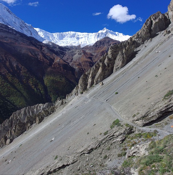
| The path connecting Shree Kharka and Tilicho Base Camp. We are now looking down valley in the direction of Manang. Click on the panorama to open a larger version in a separate tab, click again to activate scrolling in the full picture. |
|
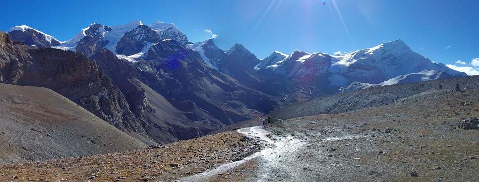
| Looking back on the Grande Barrière, stunning landscape and great colours. Click on the panorama to open a larger version in a separate tab, click again to activate scrolling in the full picture. |
|
[Go to Top]
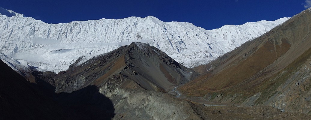
Up to Thorong La
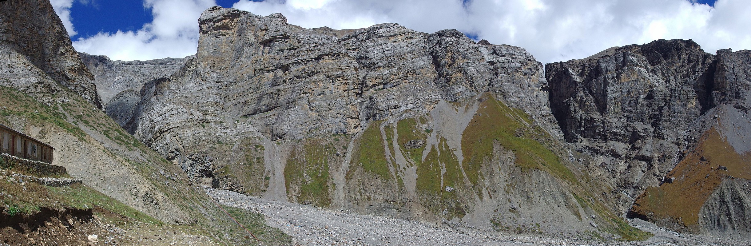
| The dramatic location of Thorong Phedi (4540m), at the foot of an impressive rock wall. Click on the panorama to open a larger version in a separate tab, click again to activate scrolling in the full picture. |

|
| Gangapurna (7455m) in the morning sun, seen from the path shortly after leaving Thorong Phedi. Click on the panorama to open a larger version in a separate tab, click again to activate scrolling in the full picture. |
|
| Going up the path to Thorong La, we are looking back just before reaching Thorong Phedi High Camp. Click on the panorama to open a larger version in a separate tab, click again to activate scrolling in the full picture. |
|
[Go to Top]
Muktinath and Kagbeni
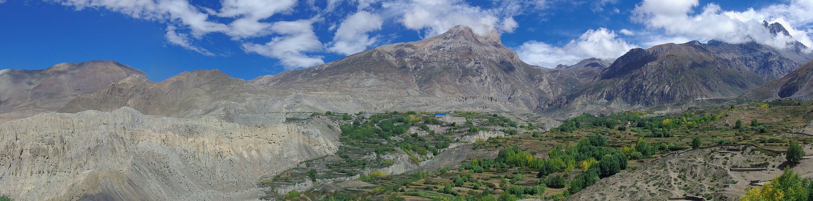
| The desert landscape of Lower Mustang seen from Jharkot (note the greenness around Jharkot: the villages there are real oases in the desert). Click on the panorama to open a larger version in a separate tab, click again to activate scrolling in the full picture. |
|
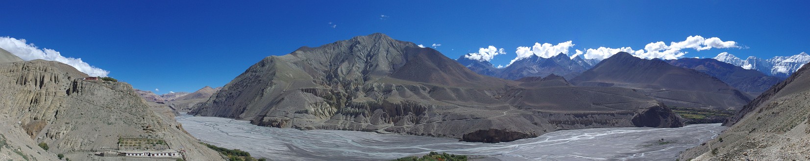
| The Kali Gandaki river and valley, seen from Kagbeni. Click on the panorama to open a larger version in a separate tab, click again to activate scrolling in the full picture. |
|
| The Nilgiris seen from Tiri. From left to right: Nilgiri North (7061m), Nilgiri Central (6940m) and Nilgiri South (6839m). Click on the panorama to open a larger version in a separate tab, click again to activate scrolling in the full picture. |
|
[Go to Top]
Kali Gandaki Valley and Dhaulagiri
| The colours are real, not faked or photoshopped. We were amazed at this view as we were walking along the Kali Gandaki on our way to Lete. Click on the panorama to open a larger version in a separate tab, click again to activate scrolling in the full picture. |
|
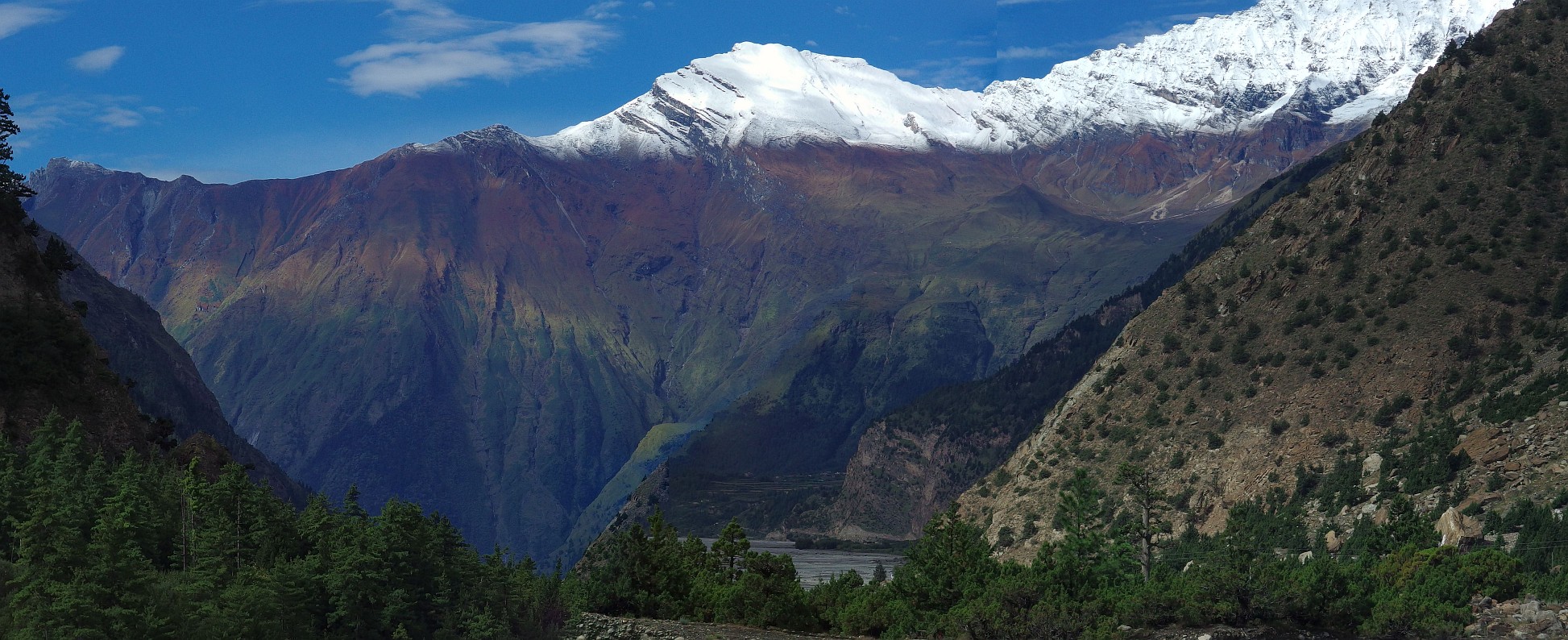
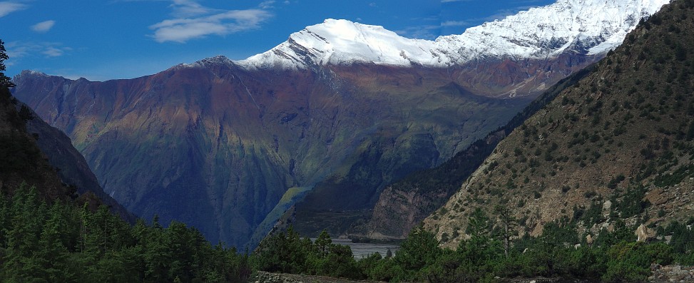
| Sunrise over Dhaulagiri (8167m). Click on the panorama to open a larger version in a separate tab, click again to activate scrolling in the full picture. |

|
[Go to Top]
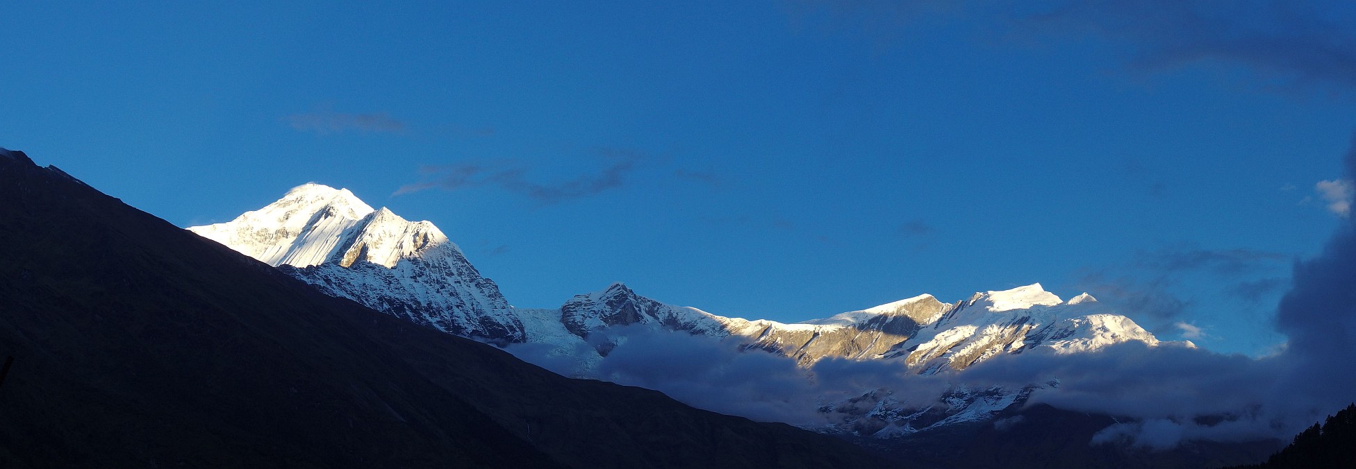
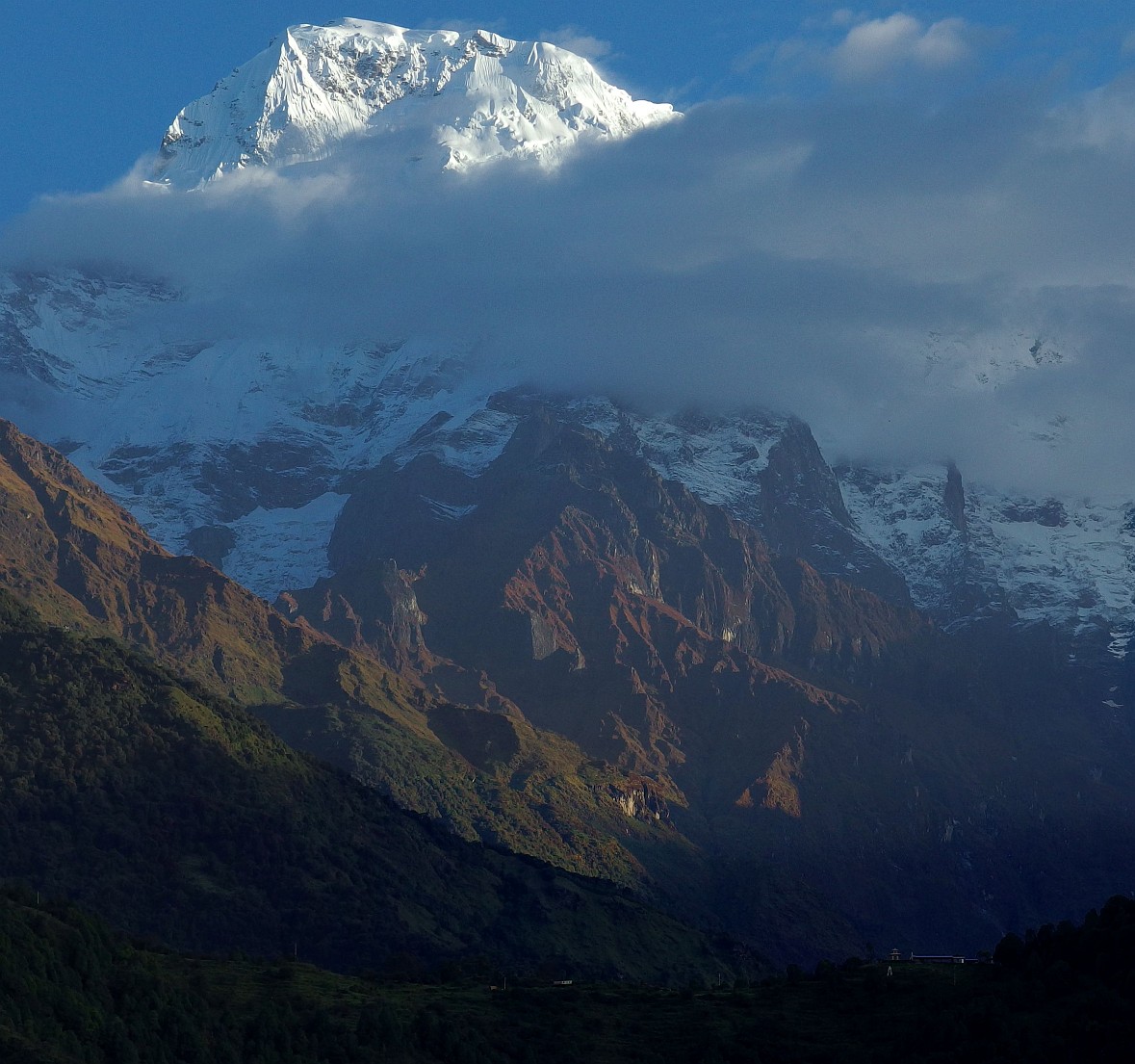
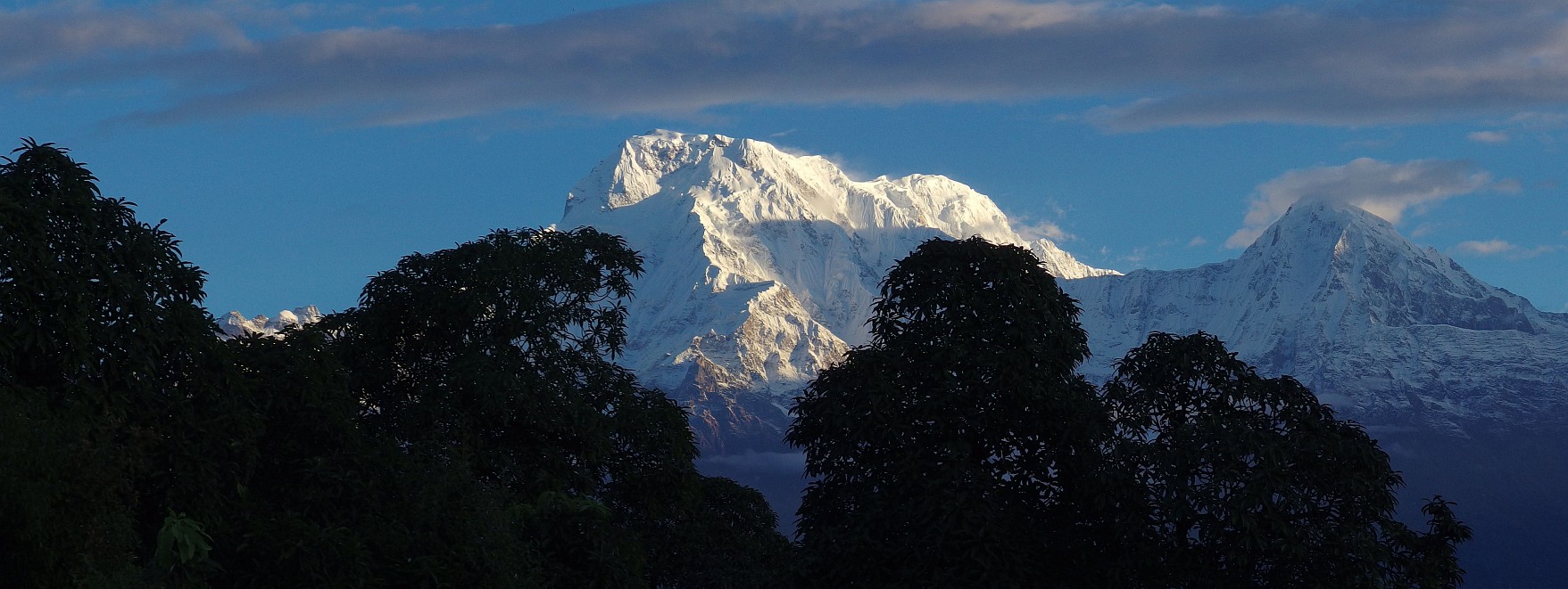
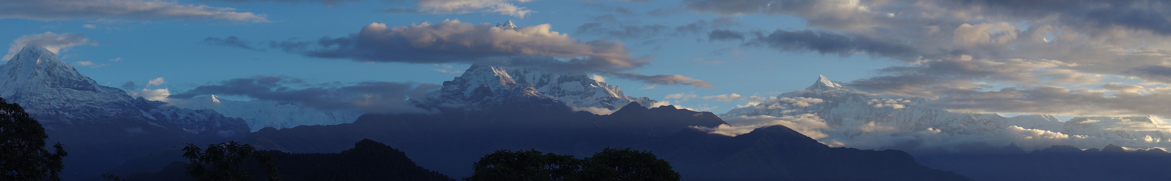
The Annapurna Range from Ghandruk and the Pokhara Foothills
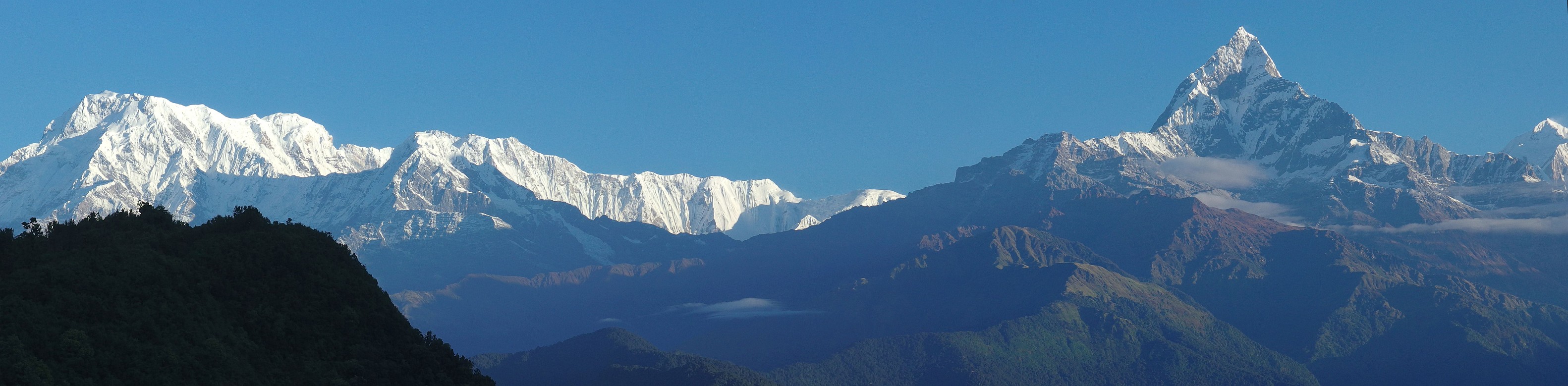
| Annapurna South (7219m). Photo taken from our lodge in Ghandruk. Click on the panorama to open a larger version in a separate tab, click again to activate scrolling in the full picture. |

|
| Annapurna South (7219m) on the left and Himchuli (6441m) to the right. Photo taken in Australian Camp in the morning. Click on the panorama to open a larger version in a separate tab, click again to activate scrolling in the full picture. |
|
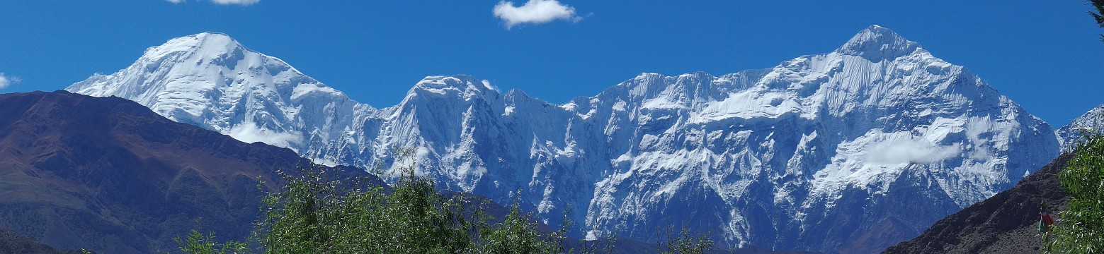
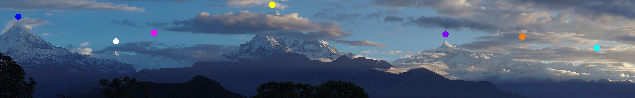
| The Annapurna Range, photo taken from Australian Camp. From left to right: Himchuli (blue - 6441m), Gangapurna (white - 7455m), Annapurna 3 (pink - 7555m), Fish Tail (yellow - 6993m), Annapurna 4 (purple - 7525m), Annapurna 2 (orange - 7937m) and finally Lamjung Himal (light blue - 6983m). Click on the panorama to open a larger version in a separate tab, click again to activate scrolling in the full picture. |
|
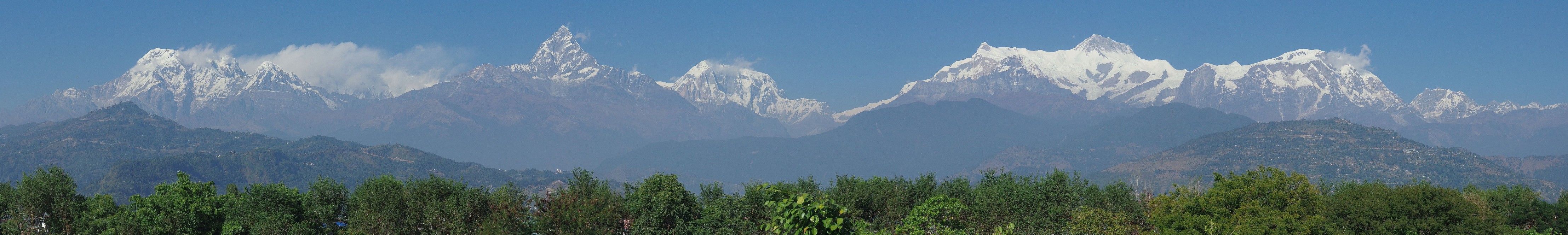
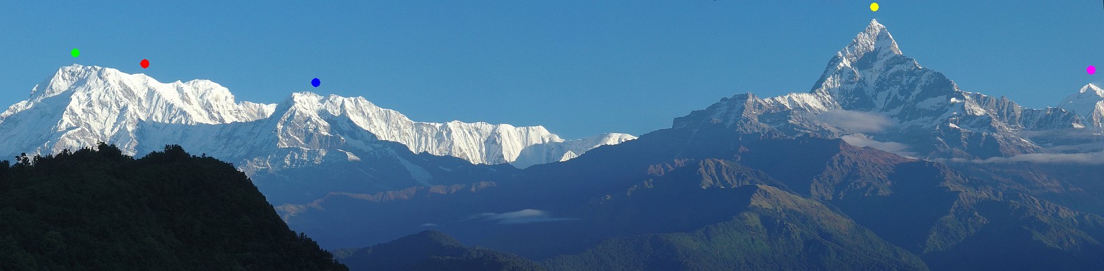
| Panoramic view from Sarangkot. From left to right: Annapurna South (green - 7219m), Annapurna 1 (red - 8091m), Himchuli (blue - 6441m ), Fish Tail (yellow - 6993m) and Annapurna 3 (pink - 7555m). Click on the panorama to open a larger version in a separate tab, click again to activate scrolling in the full picture. |
|
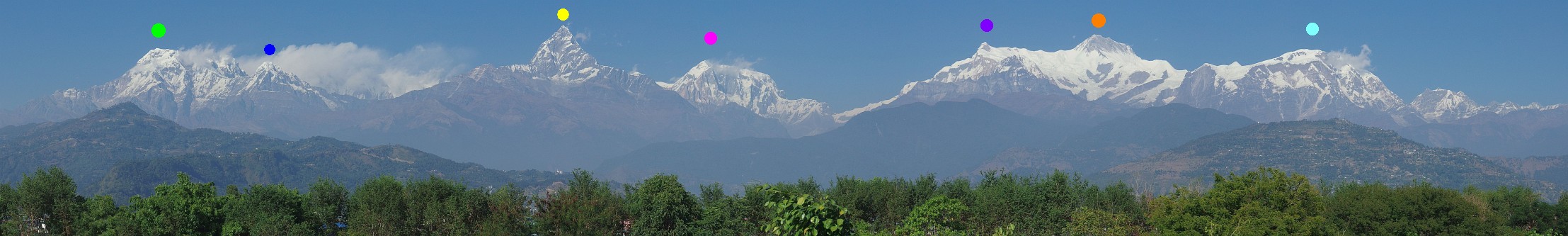
| The Annapurna Range as seen from the gardens of Pokhara's Mountaineering Museum. From left to right: Annapurna South (green - 7219m), Himchuli (blue - 6441m ), Fish Tail (yellow - 6993m), Annapurna 3 (pink - 7555m), Annapurna 4 (purple - 7525m), Annapurna 2 (orange - 7937m) and finally Lamjung Himal (light blue - 6983m). Click on the panorama to open a larger version in a separate tab, click again to activate scrolling in the full picture. |
|
[Go to Top]
Go to Panoramas 2016 Solukhumbu Panoramas or up to Panoramas 2016.
$ updated from: Panoramas 2016.htxt Sun 24 May 2026 15:57:27 trvl2 — Copyright © 2026 Vero and Thomas Lauer unless otherwise stated | All rights reserved $