Welcome FAQs
Links News
We have to admit it: we're certified Nepal addicts, labouring under that affliction since our first visit, in 1994.
After our slightly disappointing outing in the autumn of 2008, we decided to visit the Khumbu region once more, in the spring of 2010.
You'll find loads of tales, photos and information about that three-month trip and Nepal in general here.
Full map of all Nepal 2010 pages
Kunde, Khumjung and ABC
(thomas;2010-Jul-15)
Kunde, Khumjung and ABC (5 days, 28 Mar 2010 to 01 Apr 2010)
28 March: Thame to Khumjung via Kunde
29 March: Daytrip around Khumjung: Namche, Sanasa
30 March: Daytrip around Khumjung: Kunde and Ridge Above
31 March: Khumjung to Pangboche via Phortse
01 April: Daytrip around Pangboche: Ama Dablam Base Camp and Southwest Ridge
See also:
28 March: Thame to Khumjung via Kunde
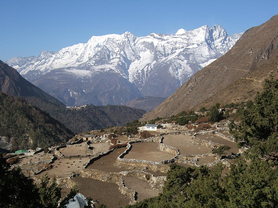
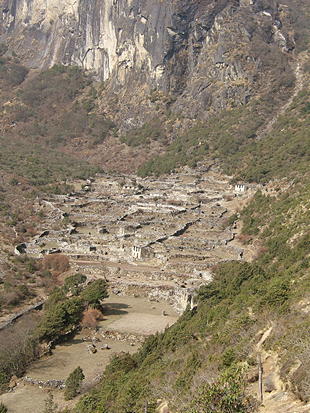
From Thame to Kunde and further to Khumjung, where we will stay a few days to clean us and our gear and recharge the batteries. We prefer Khumjung to Namche because it's a much more authentic village. It's also almost 400m higher so we won't lose too much of our hard-won acclimatisation.
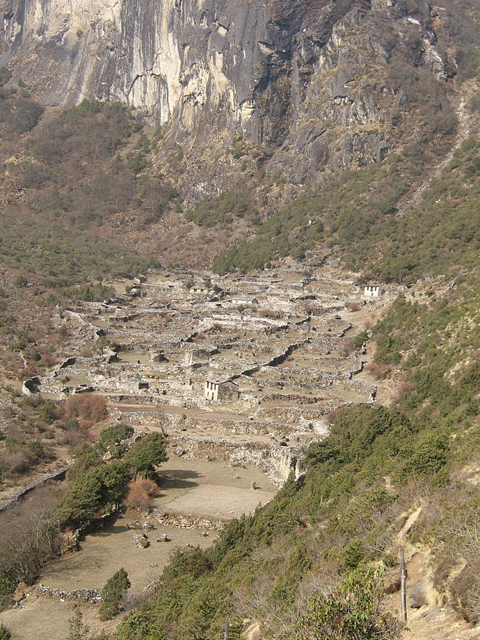
| A small village amidst some greenery, slightly below Thame. |
 |
 |
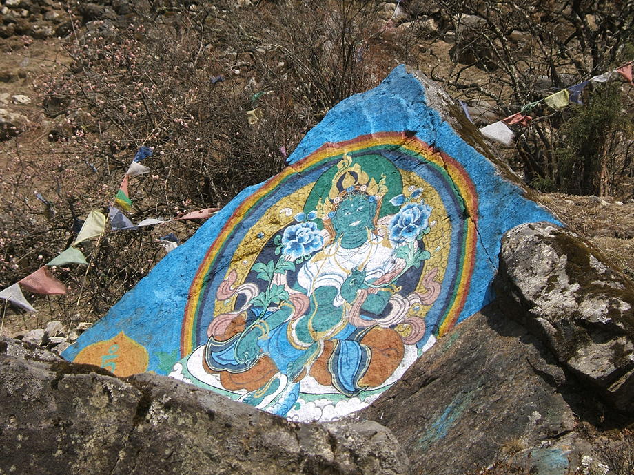
A rock painted with a colourful flying lama. |
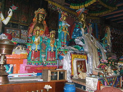
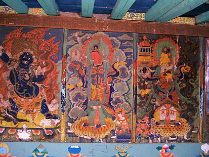
| Inside the Khumjung gompa. |
 |
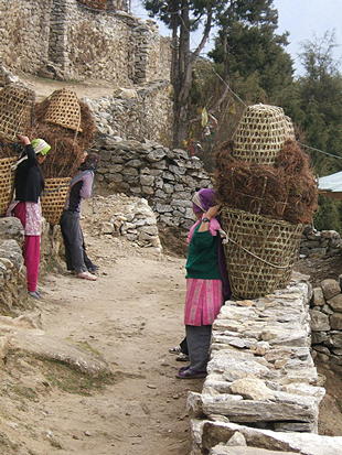 |
Local girls return after collecting leaves and dead branches in the surrounding forest. This is mixed with human waste and then used as fertiliser in the fields. |
[Go to Top]
29 March: Daytrip around Khumjung: Namche, Sanasa
A daytrip around Khumjung, first to Namche, to do some shopping (noodle soup and the inevitable Coconut Crunchies, plus a loaf of bread and a tin of tuna fish). After that to Sanasa and looping back to Khumjung.
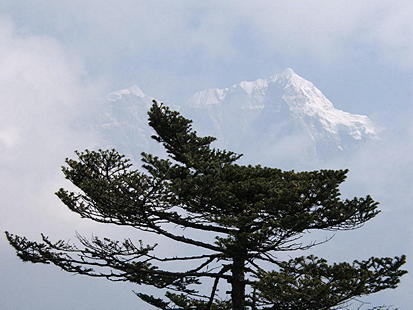
| Thamserku in the clouds. |
 |
 |
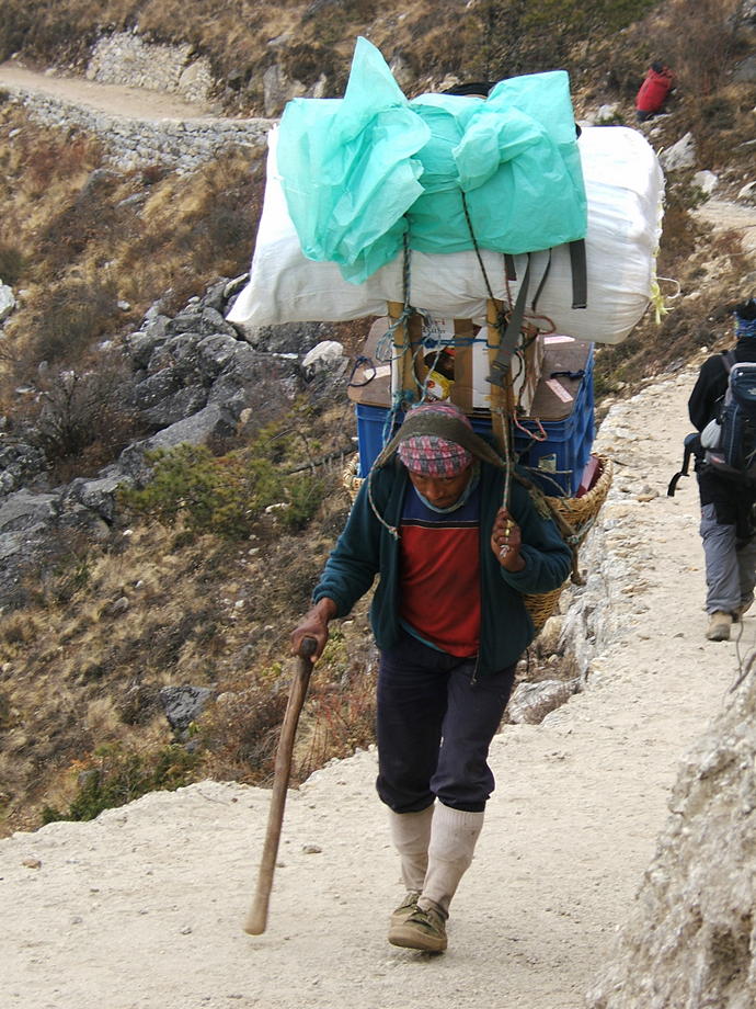
Porters in Nepal carry impressive loads, although this guy is clearly part of a tourist group and as such shouldn't carry more than 35kg (this rule is sometimes flouted). Porters coming up from Jiri though carry at least 70kg, some even 120kg (the rules don't apply to them). |
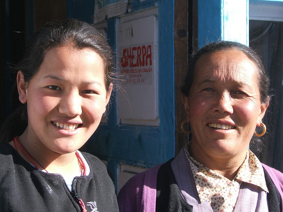
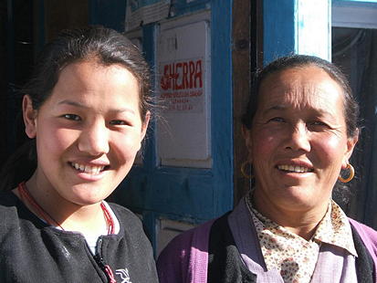
| Our always cheerful hosts from the Himalayan Guest House: Pem Futi Sherpa and Nima, her lovely daughter-in-law. |
 |
[Go to Top]
30 March: Daytrip around Khumjung: Kunde and Ridge Above
Another daytrip around Khumjung: up the ridge to the west of Kunde for fabulous views, then down to Kunde gompa and into a veritable snow blizzard. Wet and cold back in the lodge: thankfully the stove is quite powerful.
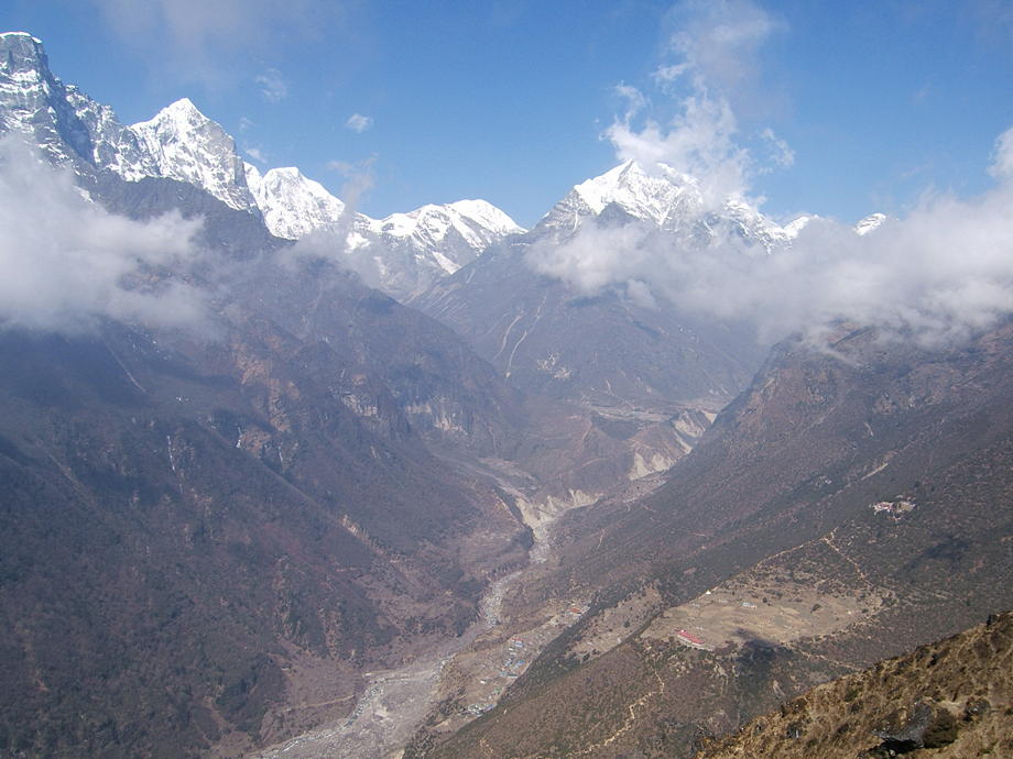
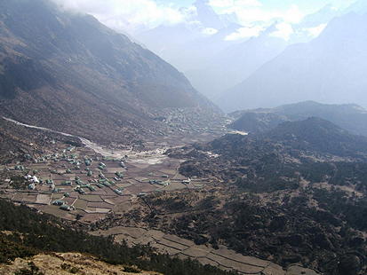
| View from the ridge above Kunde, down to the villages of Kunde (in the foreground) and Khumjung (in the background). |
 |
 |
Same spot, other side with a vista towards the Thame valley. |
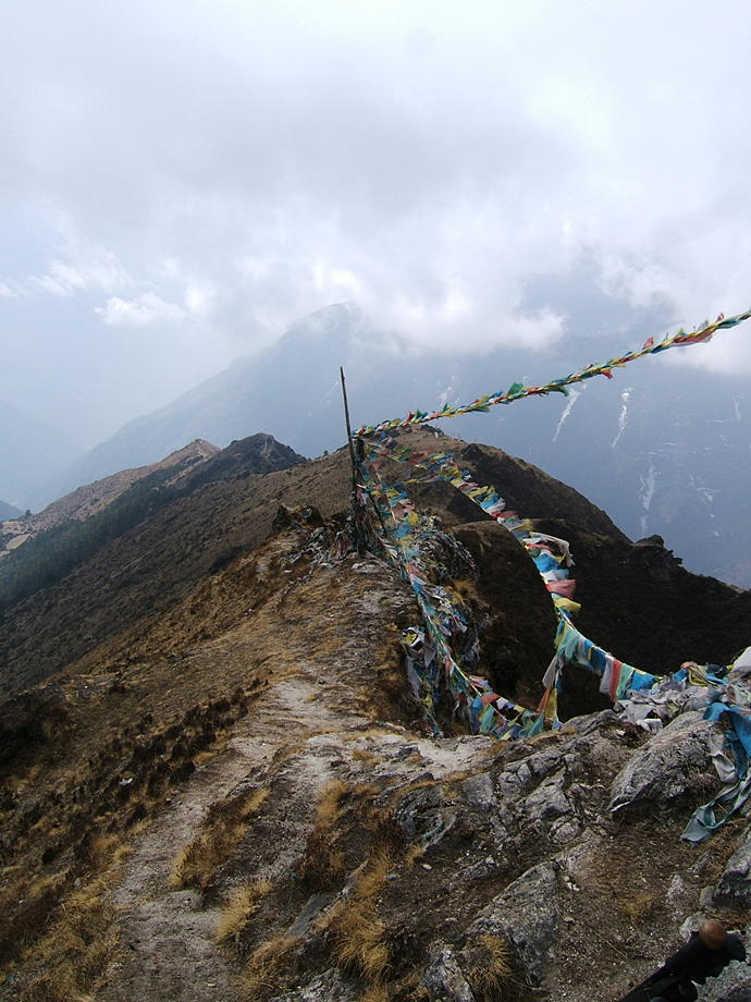
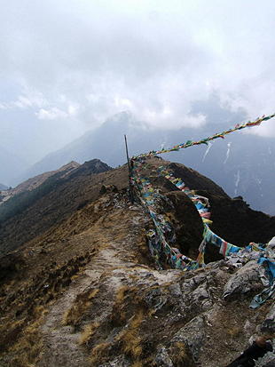
| The ridge itself… with some nasty looking clouds approaching. |
 |
 |
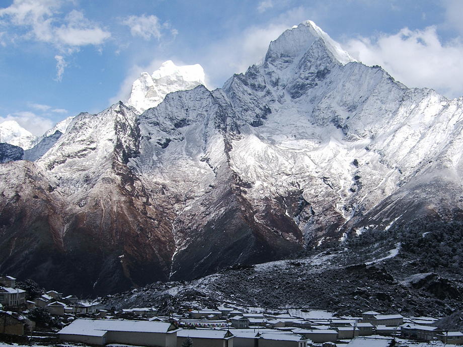
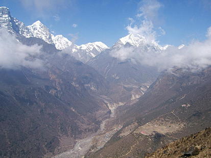
Khumjung village, Thamserku and Kang Tega after the blizzard. |
[Go to Top]
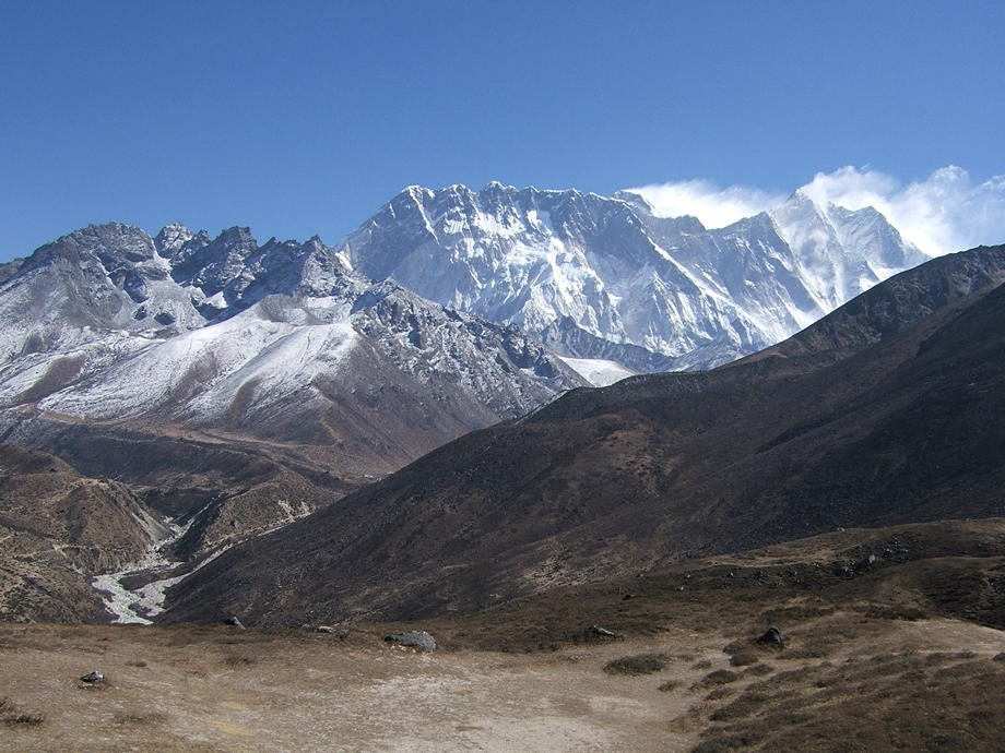
31 March: Khumjung to Pangboche via Phortse
We retrace parts of our earlier walk to Lobuche: first to Phortse and on to Pangboche.
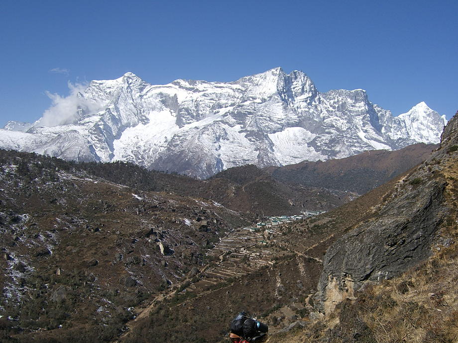
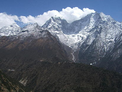
| Look back to the houses of Khumjung. In the backdrop, Kongde Ri. |
 |
 |
Tengboche on its spur. |
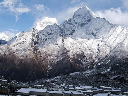
| Kang Tega in all its glory. |
 |
 |
Inside the old gompa of Pangboche (built around 1630). |
[Go to Top]
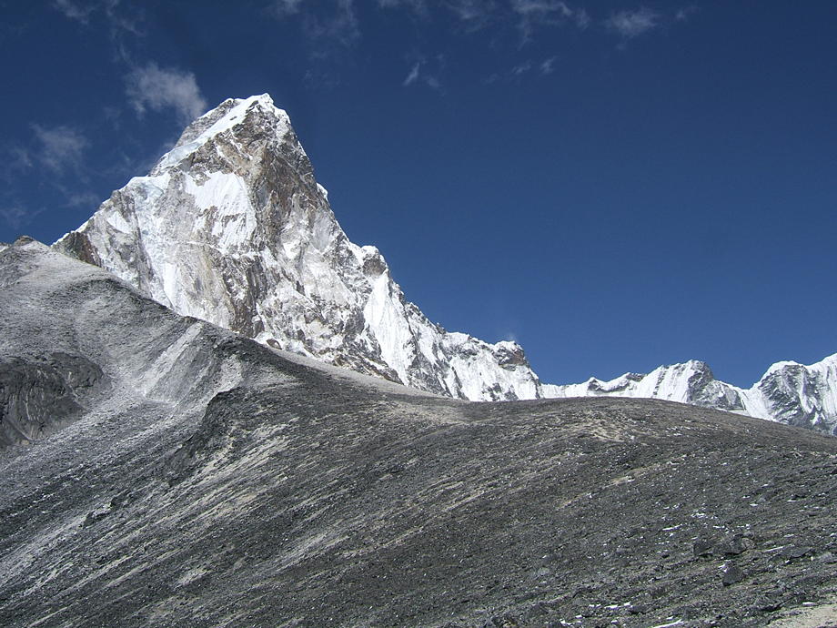
01 April: Daytrip around Pangboche: Ama Dablam Base Camp and Southwest Ridge
A daytrip from Pangboche: first up to Ama Dablam base camp (at around 4800m), then further up the mountain on the southwest ridge. On the map, this ridge doesn't look too difficult up to an altitude of 5800m, possibly even to 6000m. However, no chance to get that far in one go: from Pangboche, that would mean a vertical gain of around 2000m… and then back again!
| The fields of Upper Pangboche. |
 |
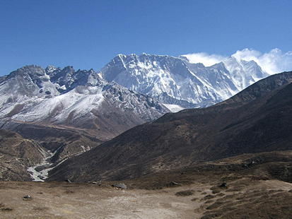 |
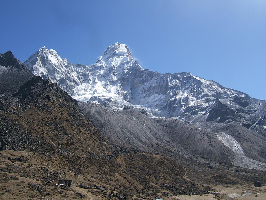
Nuptse, Lhotse, Everest. Nangkartshang Peak is also visible, roughly where the ridge coming down from Nuptse ends. |
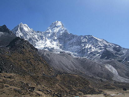
| Approaching Ama Dablam, from the west. To the right side is the ridge we will go up later today. |
 |
 |
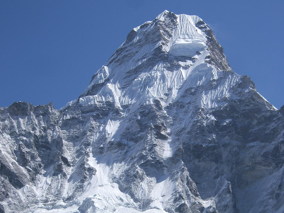
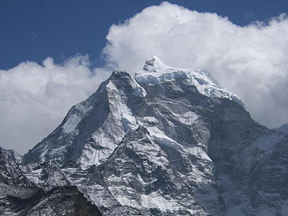
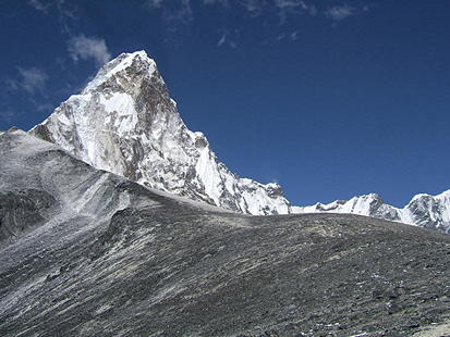
The main summit with the famous hanging glacier. |
| Still Ama Dablam: we have now walked partway up and around the mountain (we're at an altitude of around 5200m) and are taking this shot from the south. The ridge in front continues further up and is “trekable” for at least another 500 or 600 vertical metres. Next time, perhaps;-). |
 |
[Go to Top]
Go back to The Gokyo Valley or forward to The Chukhung Valley.
$ updated from: Everest Trek.htxt Sun 24 May 2026 15:57:32 trvl2 — Copyright © 2026 Vero and Thomas Lauer unless otherwise stated | All rights reserved $