


Panoramas 2010 Gokyo Valley
(thomas;2010-Jul-14)
The Gokyo Valley: Frostbitten Fingers, Gokyo Ri and Renjo La (12 panoramas)
(Clicking on a panorama will open a larger version in a separate tab.)
After the Lobuche valley, we moved west, to the Gokyo valley (we wanted to get these two, the main valleys in the Khumbu, out of the way before the big groups start to flow into the area and clog them). In our opinion, Gokyo and its valley are more interesting than the Lobuche side and also sport nicer views: Gokyo Ri shows you four 8000ers in one big sweep. And that's just one of the many viewpoints in the Gokyo valley.
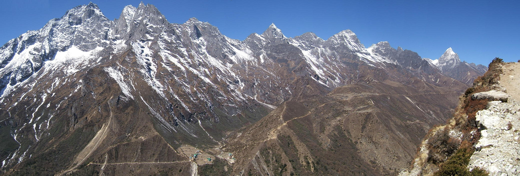
| Gokyo can be approached on the western valley side (on a major path coming up from Namche) or the eastern side: this is the way to take if you come down from Lobuche and don't want to cross via the Chola pass. We avoided the Chola this time, mainly because there had been a recent heavy snowfall. This shot shows the western side of the valley, with the path from Namche clearly visible. The village in the left foreground is Dole (4000m), more a collection of lodges than a real village. The tiny hamlet on the plateau further up is called Lhabarma (4400m). We are another 200 metres higher. |
 |
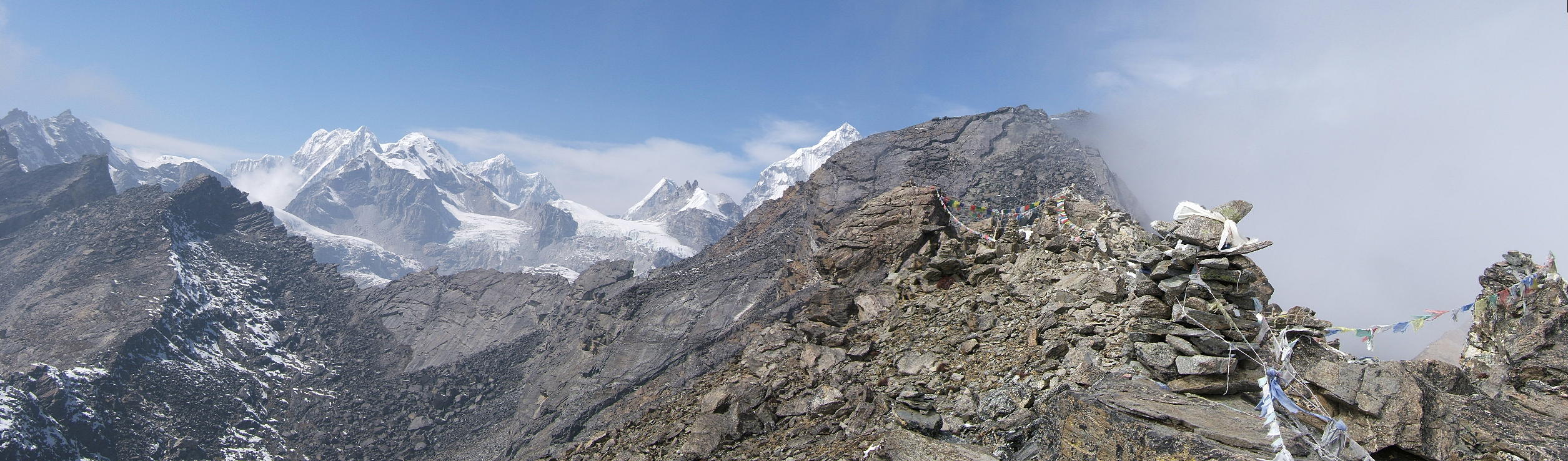
| Next morning, at 11am, we arrived in Gokyo (4700m), the main collection of lodges in the valley. And though clouds were already rolling in from down valley, we decided to tackle Gokyo Ri. This is a steep hill next to Gokyo offering stupendous views, about 700 metres above Gokyo. Even while we sweated up, the clouds overtook us. However, the weather in these parts is fickle and often changes within minutes, so we decided to carry on. We reached the summit shortly after 1pm and although the clouds were coming and going, we only caught glimpses of Everest and Cho Oyu (8201m): not a good time to shoot a panorama. However, the western half of the valley was mostly free of cloud and that is the view you see below. Cho Oyu is hiding somewhere in the clouds above the prayer flags. |
 |
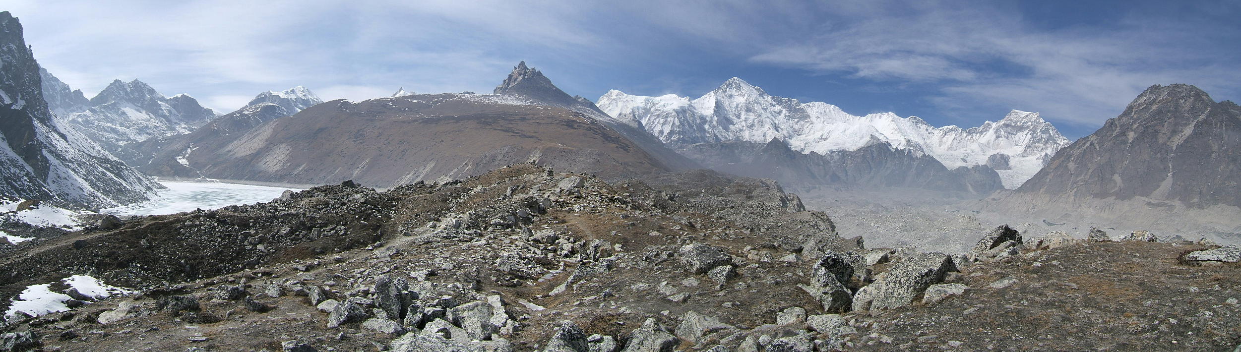
| The following day, we walked up valley (Gokyo is a great base for day trips). About three hours from Gokyo there's a summit called Frostbitten Fingers (5800m, but the last 200 vertical metres (the actual Fingers) are simply too steep). This is the view down valley with Cholatse (red dot), Kang Tega (blue) and Thamserku (red). You will also notice the clouds that are already forming at the base of the valley. |
 |
| Same place, but a view up valley towards Cho Oyu (red dot), Gyachung Kang (7952m, blue) and the connecting wall between those two. Gyachung Kang is the 15th highest mountain in the world or, put differently, the highest non-8000er. Note the huge glacier flowing down Gyachung Kang's south face. |
 |
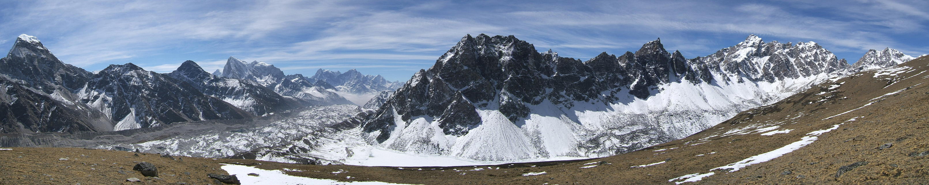
| Still the same place, now with a view towards the Everest massif: Gyachung Kang (red dot) to the left, Everest (blue) and Lhotse (red). Further down, there's also Cholatse and the Kang Tega/Thamserku combo. |
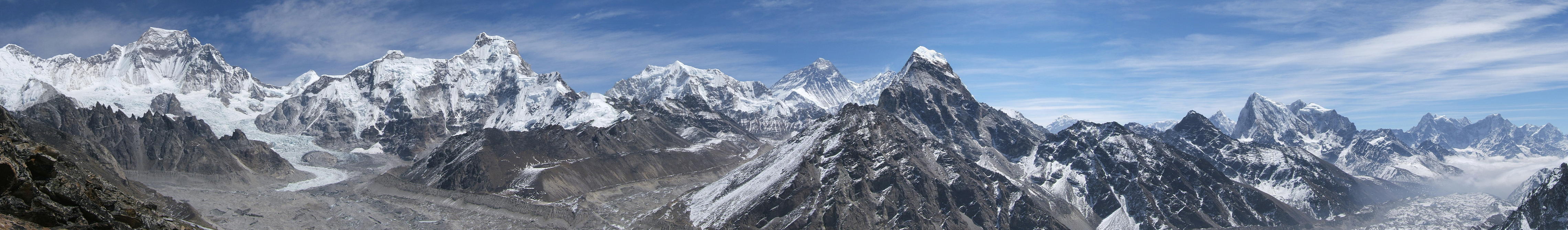 |
| Same day, this shows the view back towards Frostbitten Fingers (red dot). To the left of this is the so-called Fourth Lake: the Gokyo valley is graced with many lakes and they get more beautiful the higher you climb. In the background to the right, there are once again Cho Oyu and Gyachung Kang. |
 |
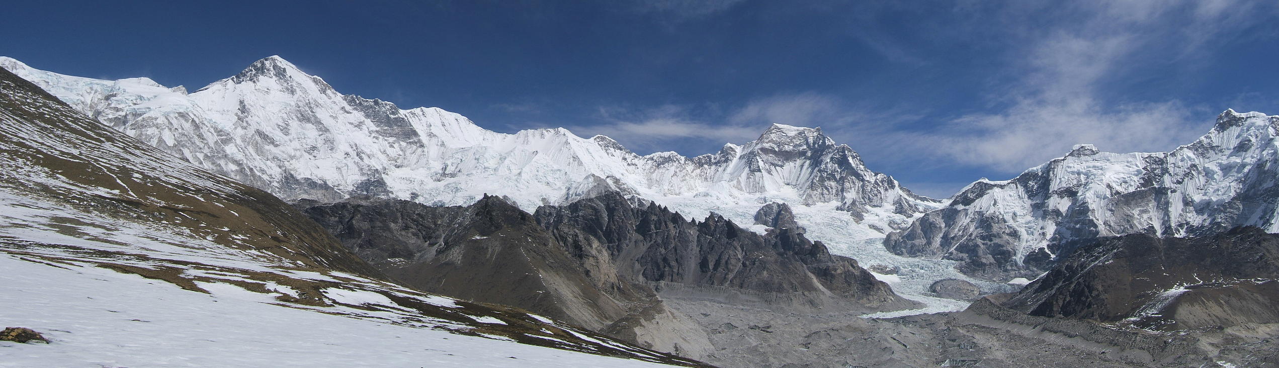
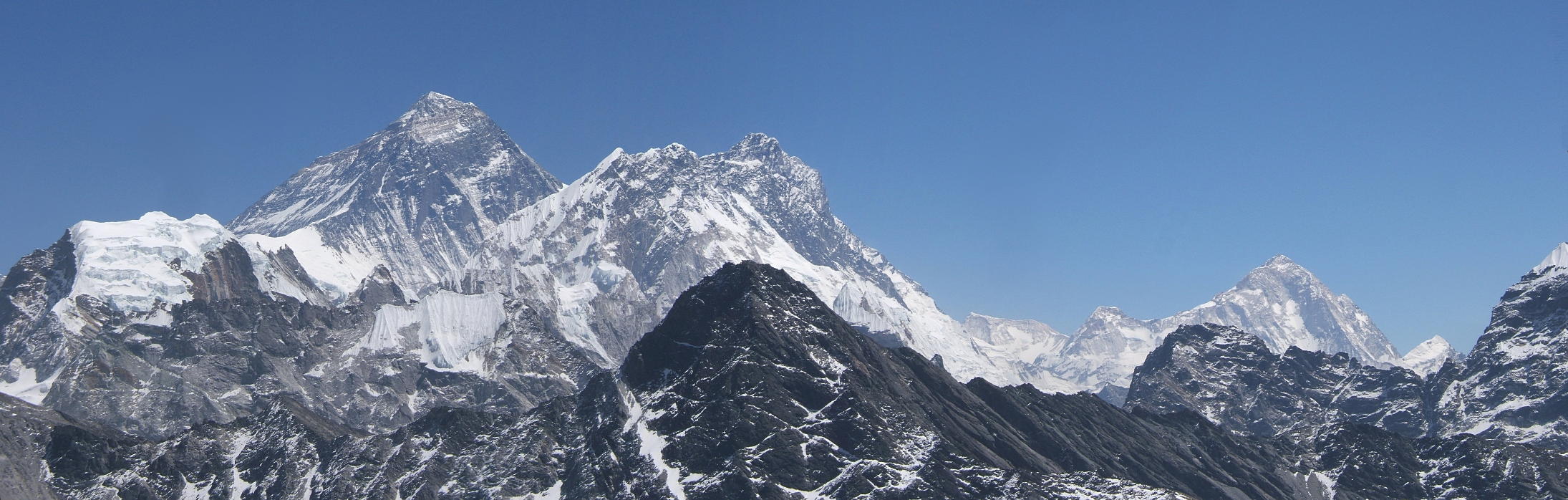
| Next morning, we again went up to the summit of Gokyo Ri. The weather was perfect for the whole day and we stayed up there, luxuriating in the sun and the views, for about six hours. This shot shows one of the nicest views the Khumbu has to offer: four 8000ers and “a galaxy of lesser summits” (H.W. Tilman). There's Cho Oyu (red dot), Gyachung Kang (blue), Everest (red), Lhotse (blue) and Makalu (8463m, red). These five peaks represent fully a third of the 15 highest mountains on Earth! |
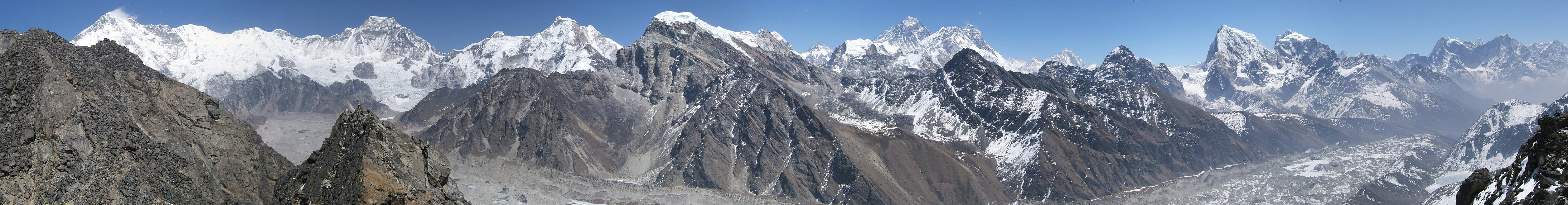 |
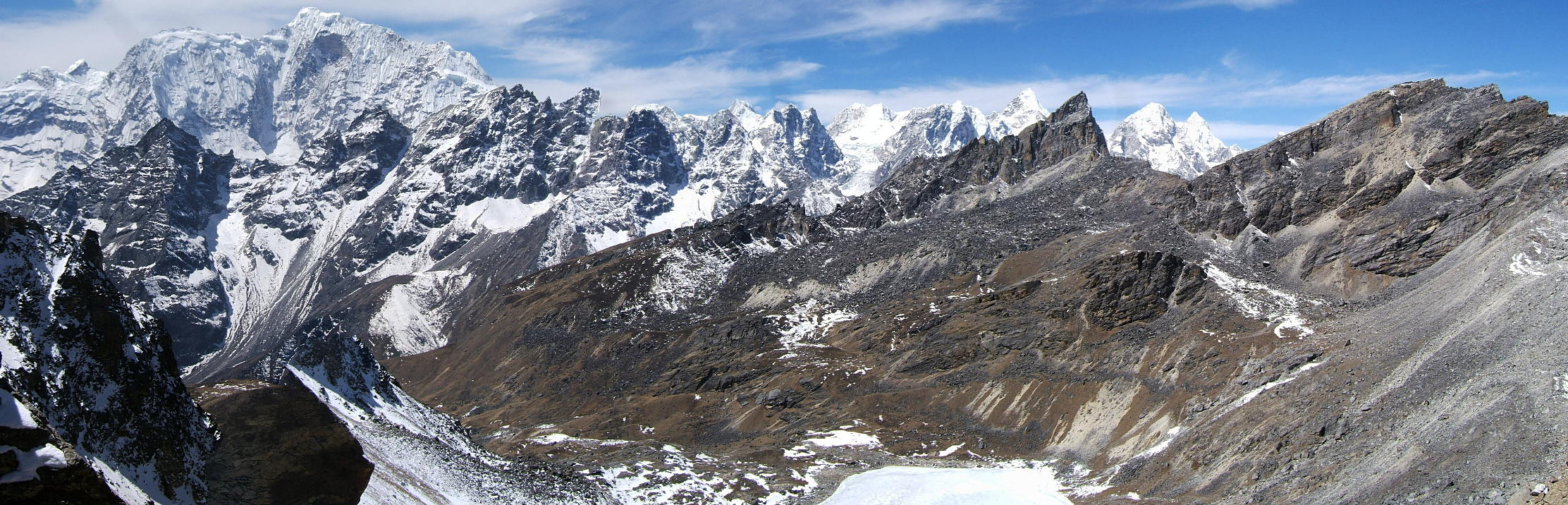
| Still Gokyo Ri: this is the view towards the north. No famous mountains but an amazing landscape nevertheless. |
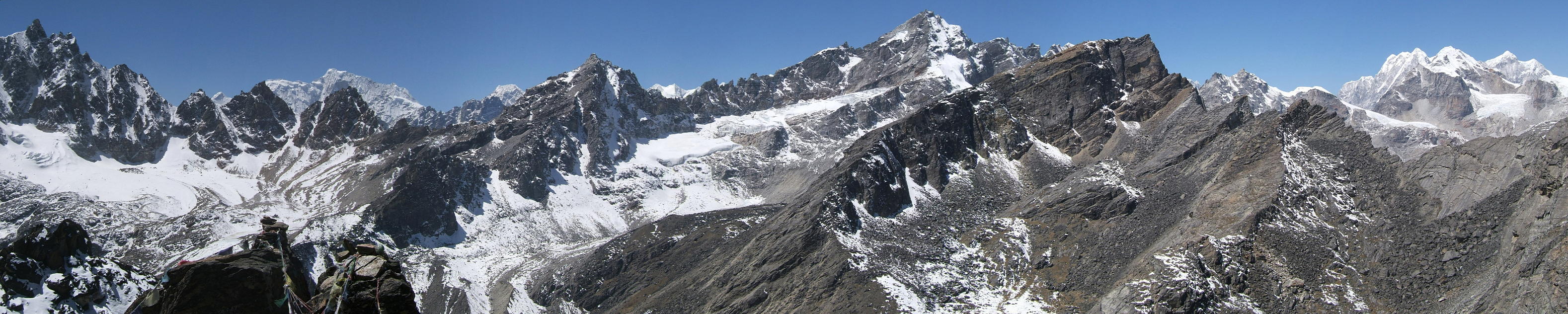 |
| A close up of Everest, Lhotse and Makalu. The so-called Yellow Band and the South Summit of Everest are clearly visible here. |
 |
| It's getting late in the afternoon and the clouds bubble up in earnest now. Down valley, there's a nice view towards Cholatse and Taboche as well as the Second Lake. |
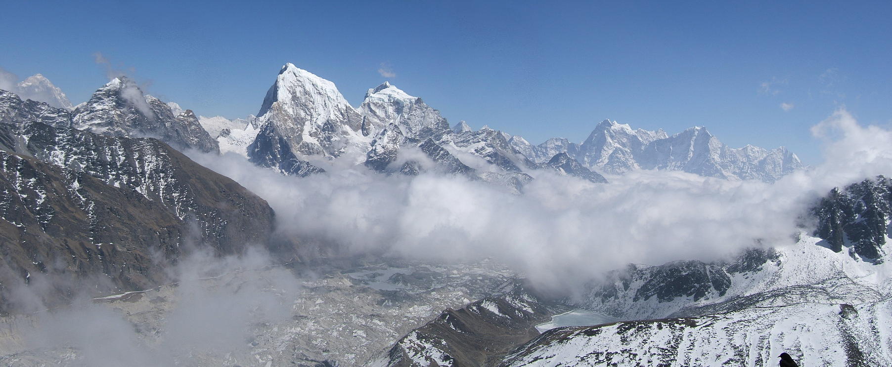 |
| Final day in the Gokyo valley: we are now on top of Renjo La (5417m), a high pass that leads into the Thame valley, the next valley to the west. This shot shows the views down the Thame side of the pass. The bulky white mountain to the left is called Tangi Ragi Tau (6940m). |
 |
| Again, the Renjo La with a view back towards the Third Lake and Gokyo (red dot). In the background Everest, Lhotse and Makalu beckon. |
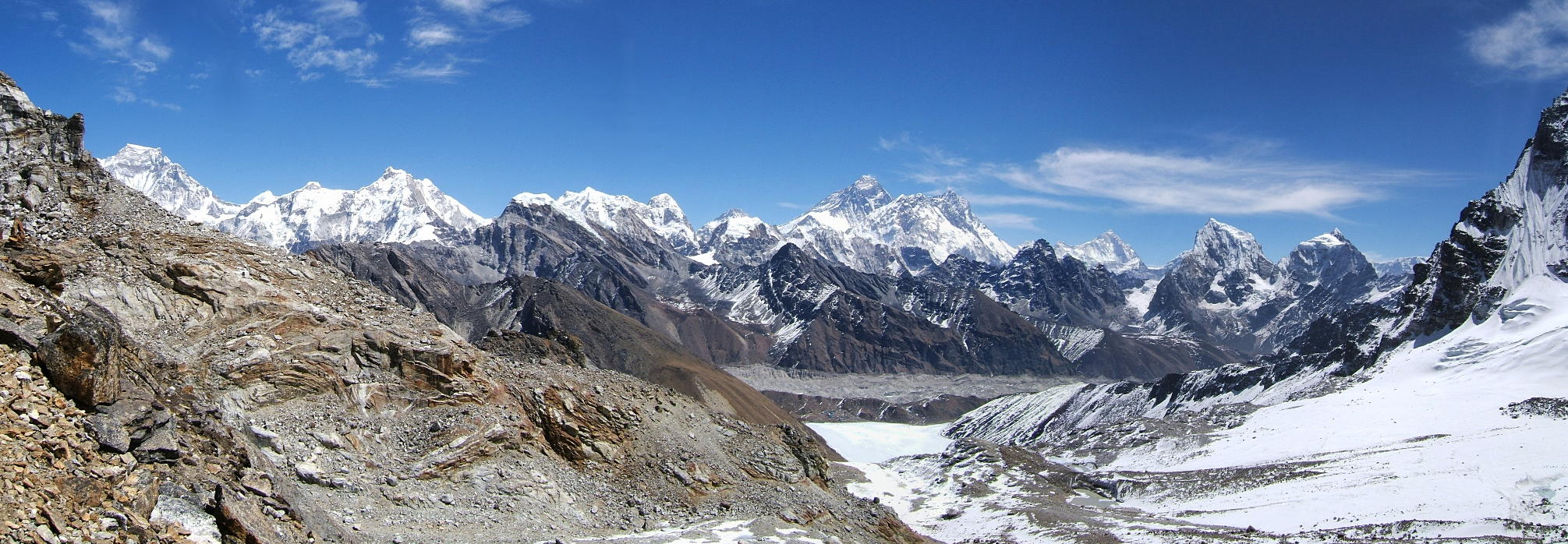 |
Go to Panoramas 2010 Khumjung and ABC or up to Panoramas 2010.
$ updated from: Panoramas 2010.htxt Sun 24 May 2026 15:57:32 trvl2 — Copyright © 2026 Vero and Thomas Lauer unless otherwise stated | All rights reserved $