


The Lobuche Valley
(thomas;2010-Jul-15)
The Lobuche Valley (8 days, 13 Mar 2010 to 20 Mar 2010)
13 March: Daytrip around Namche: Saturday Market, Everest View Hotel
14 March: Daytrip around Namche: Syangboche, Khumjung and Kunde
15 March: Namche to Phortse via Mong
16 March: Phortse to Dingboche via Pangboche High Route
17 March: Daytrip around Dingboche: Nangkartshang Peak
18 March: Dingboche to Lobuche
19 March: Lobuche to Dingboche via Kala Pattar
20 March: Dingboche to Phortse via Tengboche
See also:
- the panorama shots for the Lobuche Valley
- and the topographic map (based on Google Maps) for the Lobuche Valley
- or the next page: The Gokyo Valley
13 March: Daytrip around Namche: Saturday Market, Everest View Hotel
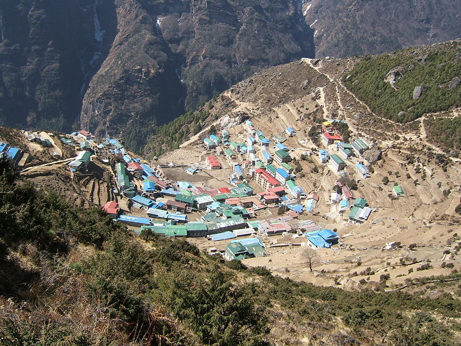
We normally stay in Namche for at least a day or two, first to rest a little, wash our dirty clothes etc and second to aid acclimatisation. And of course we have a few old favourites to visit: the famous Saturday market (luckily we arrived on a Friday, so today is market day) and the walk up to the Everest View Hotel (so named because Mt Everest is visible from there) as well as the twin villages of Khumjung and Kunde.
So first thing in the morning, we go to the market. This is a rather lively and smelly affair on a set of terraces balancing precariously over the Dudh Kosi, near the entrance to Namche. The sun is already out in force and many people throng the three terraces. The sellers put all their wares in front of them on huge plastic sheets: there's everything you need to operate a lodge, all sorts of foodstuffs and drinks, Chinese gadgets, kerosene, incense… There are also a few butchers offering “yak steaks” (in fact lowland beef brought up by porters in conditions which make us avoid this sort of delicacy) and people from villages further down selling their home-grown vegetables. Namche is a great centre for the locals and many come here from a distance of a day's walk or even more to sell or buy stuff. Later, in the afternoon, the market place will be empty; the locals will have some rakshi before they set out along the dusty trails to their home villages or lodges, the yaks heavily loaded with their shopping.
We buy 20 packs of Coconut Crunchies (an important part of our diet further up and easy to transport because they are nearly unbreakable) and 20 packs of noodle soup, also as provision for the next days. Prices here in Namche are quite reasonable, given the transport cost up here. However, in the lodges further up the valleys prices really explode: a single pack of Coconut Crunchies, which goes for 13 rupees in Kathmandu and 20 in Namche, will cost 80 or even 100 rupees. As the big-group-tourists pay this and similarly crazy amounts for Mars bars or beer without a blink, some locals have lost every sense of proportion. In the lodges, we generally buy bulk and so we can haggle for a somewhat more realistic price. Still, Namche is easily the best place to buy provisions.
After delivering our shopping to our lodge, we start the long, breathtaking trek up to the tiny airfield of Syangboche. This lies about 400m above Namche; it's used for small planes and helicopters which ferry building materials and expedition gear between Jiri (the roadhead) and Namche. From there, a nice trail contours around the hills to the Japanese-built Everest View Hotel where a room is US$ 200. In return, this gets you unforgettable views of Everest, running cold water and an oxygen outlet for emergencies. However, since the views from the hotel's terrace are just about as good, we don't bother with the rooms;-)
The sights are, as ever, fascinating: not only Everest but a whole universe of high mountains, razor-sharp ridges, ice falls and glaciers. Kongde Ri, the massif to the west of Namche, looks unusual and it's only after a few seconds that we realise why: its lower slopes are covered in snow, something we've never seen before.
Well, we're pretty early in the season, so some snow is to be expected. On the other hand, the stream of tourists will only start in earnest in a few weeks' time, so we should have Namche and the four valleys above it (from east to west Chukhung, Lobuche, Gokyo, Thame) more or less to ourselves. We already sensed this while we were at the market: it was crowded alright, but more with locals than tourists. Later in the season it will be the other way round. Also, quite a few lodges are still closed or just in the process of being spring-cleaned and opened. In the Khumbu, mid-March is traditionally the time to plant the potatoes; this is much more important than catering for a handful of tourists.
| Saturday Market in Namche. There's also a gallery in the Photos section with some more snaps. | 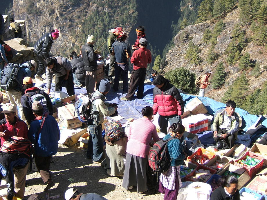 |
 |
On the way up to the Syangboche airfield, a look back and down to Namche Bazaar. The bowl opens towards the southwest so the village is well protected against high winds from the mountains in the north. |
| The beautiful trail leading to the Everest View Hotel. Mt Everest is the small triangle with clouds streaming off. The conspicuous mountain to the right is Ama Dablam… this will be our companion for the next days. | 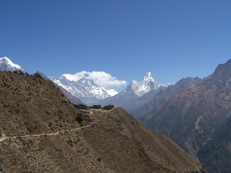 |
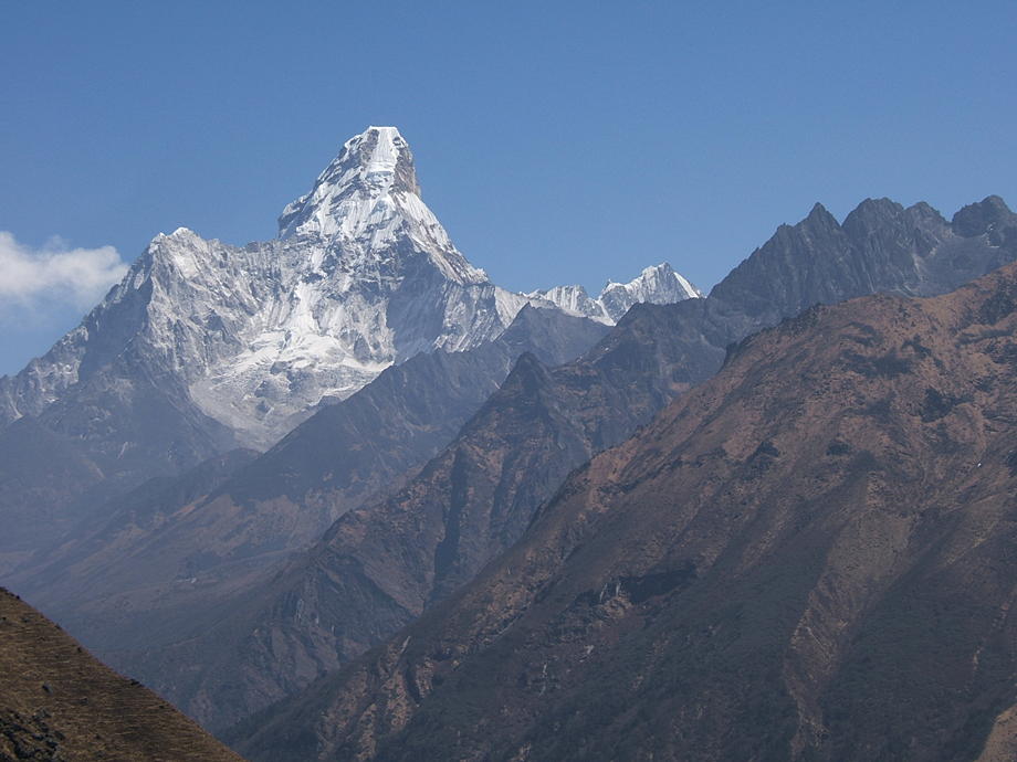 |
A close up of Ama Dablam. |
| Everest and the long ridge between Nuptse and Lhotse. Lhotse is the peak to the right of Everest; the fearsome south wall of Lhotse is also clearly visible. | 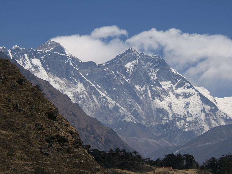 |
14 March: Daytrip around Namche: Syangboche, Khumjung and Kunde
Another day of rest which we spend with a leisurely walk above Namche. We leave Namche early, via its monastery, in the general direction of the village of Thame. After about 30 minutes the trail splits: straight ahead to Thame, right up to Kunde. We turn right and slowly march up towards Kunde. On the way up, we pass, once again, the airfield of Syangboche and just as we arrive, a helicopter touches down. Thomas, ever curious, buttonholes the pilots (two Russians) about the stuff they ferry up (mostly plywood to build lodges as well as big blue plastic barrels full with expedition gear: the climbing season gets underway).
The flight engineer, another Russian named Albert turns out to speak very good English and, among many other things, tells us that he has thousands of pictures taken during his many, many helicopter flights. He actually invites us to his Kathmandu home, once we're finished with the trek, to have a closer look at his collection, with a view to put some of his photos on the web. Of course we swap addresses; we will definitely try to see him in KTM.
We watch the now empty helicopter (unloading time is 15 to 20 minutes; flight time back to Jiri a mere 17 minutes) getting airborne, wave Albert and his pilots a good-bye and continue our walk towards Kunde. The landscape up here is one of the nicest, most relaxing places on earth: a peaceful mixture of forest, meadows, stupas and large rock boulders with the occasional yak thrown in, the whole under a deep blue sky.
Kunde is a pretty big village, with a well-used hospital (built by Hillary in 1966) and a famous, if slightly neglected gompa. Compared to Namche, it looks like a backwater: there are almost no shops and just a few simple lodges; instead the village is surrounded by potato fields. However, that's on purpose: the Kunde people are among the most conservative in the whole Khumbu. Every family round here has a few members in the trekking business: as guides or porters or in a business down in Namche. But they prefer to keep the tourist masses away, and consequently Kunde has changed a lot less than Namche during the last 30 years.
We quickly peep into the hospital (we've visited the place before) and then climb up to the gompa. The monks don't see many tourists and they always hand us some hot tea which is very welcome after the climb. We sit there in the half-light for quite a while as the weather has a bit deteriorated and small-talk, as good as we can, with the monks. Finally we start again and head down to Khumjung, the slightly bigger twin village of Kunde.
Khumjung is justly famous for its Edmund-Hillary-founded school: this was the first big project Hillary's Himalayan Trust undertook in the Himalayas (1961). We actually saw the great man in 2003 when he visited the people of Khumjung. He was frail though in good spirits; sadly, it turned out that this would be his last visit to his beloved Khumbu.
From Khumjung we slowly climb up to the Everest View Hotel where we again have a rest and admire the mountains. The weather is still not stable and there are many clouds drifting around the summits. Later, shortly after we arrive in Namche, it actually starts to rain; there's even some hail and thunder mixed in.
We'll have to wait and see how the weather turns out tomorrow: the spring weather in Nepal is said to be less reliable than the autumn weather. So far, however, we have no reason to complain: we're now on the trek for 12 days and till now, the weather gods have been kind.
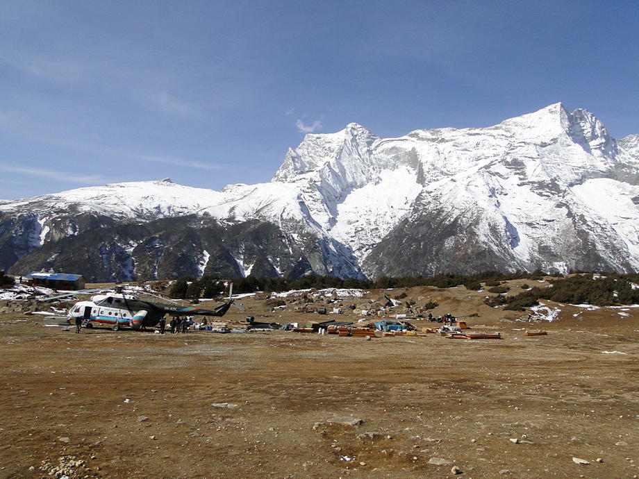 |
The airfield of Syangboche, with Albert's helicopter and loads of stuff. In good conditions they fly about seven to eight missions per day. |
| The village of Kunde. The mani wall and the stupa traditionally mark the entrance to the village. |  |
 |
Clouds and summits. |
| An old lady on her way to the gompa. | 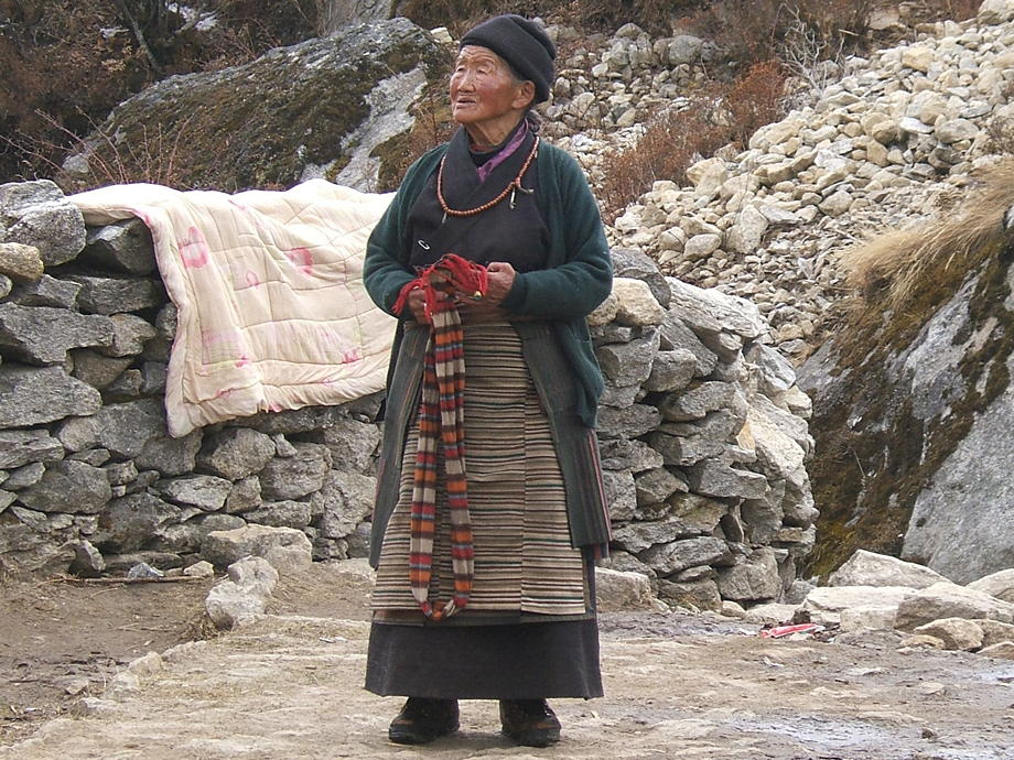 |
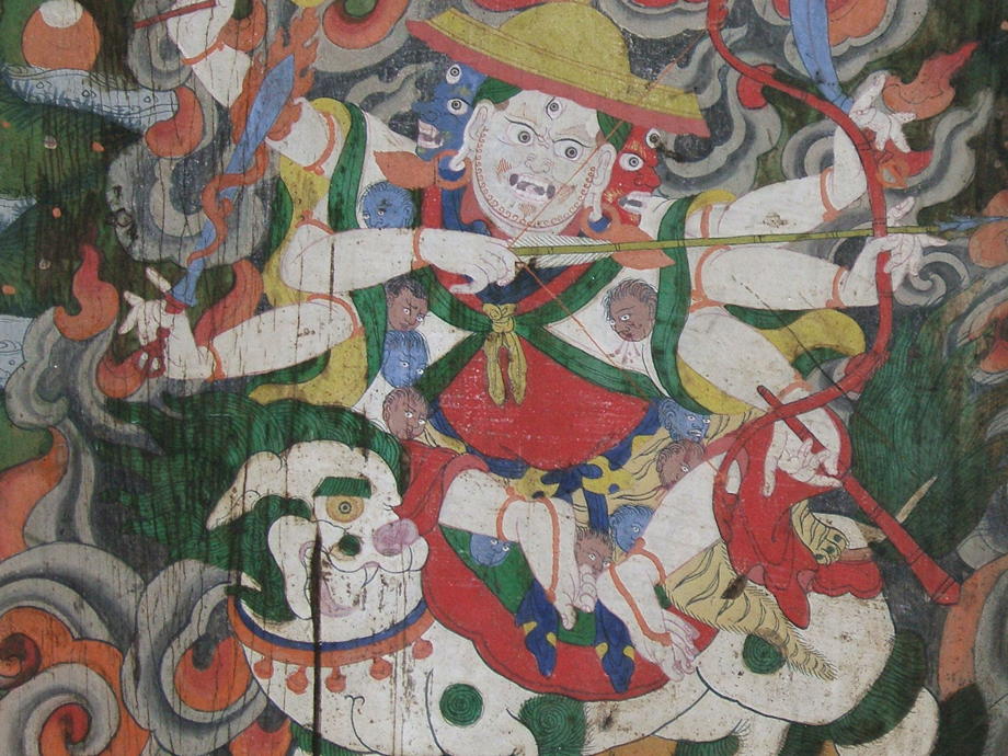 |
A painting in the gompa: a helpful (or nasty?) Buddhist deity. |
15 March: Namche to Phortse via Mong
Well, guess what? As we wake up, we see that all of Namche is covered with about two inches of snow. We've never seen so much snow down in Namche: literally the whole landscape is transformed by it. A surprise and a definite treat. The weather, fortunately, had over night cleared somewhat: a mixture of clouds and sun, not too bad.
We start early, after a frugal breakfast, towards the village of Sanasa. There the trail splits into three: one leads up left, to Khumjung and Kunde; another goes straight ahead to a pass called Mong and the entrance of the Gokyo valley; the third turns right and downwards to cross a river and then climbs steeply to the gompa of Tengboche.
Though we don't want to go into the Gokyo valley right now we still follow the route to Mong: shortly after Mong the trail splits again between Gokyo (left) and Phortse (right), one of the nicest and most unspoilt villages in the Khumbu. The main reason why we follow this slightly unusual route towards the Lobuche valley and Kala Pattar is that this way we will not see as many tourists as if we went via Tengboche. Also, there's a great, if vertiginous high route between Phortse and Pangboche which we love to walk. Today though, we will be content once we're in Phortse.
Mong is roundabout 600m higher than Namche, so it's a piece of work to get us and the backpacks there. The intense cold makes the walking relatively easy and the snow adds interest. Nevertheless, on arrival in Mong (there are a few lodges directly on the pass), we are sweating properly. We rest for a good while, because the climb up here was the hardest bit for today: now we go down a couple of hundred metres to the river, cross the bridge and trundle up to Phortse… easy.
From Mong, the views across the Dudh Kosi valley, to the south, are breathtaking: there's Thamserku, Kang Tega (this means “Horse Saddle”) and of course the bulk of Ama Dablam, seemingly direct in front of us, as if we could just reach out and touch it.
The trail down to the river is steep and, with the snow, at times tricky. However, we make it down in one piece and on the other side, pause for an hour or so in the sunshine. There are a few hairy yaks around which are quite interested in our noodle soups but we are not in sharing mood.
The way up to Phortse zigzags through a beautiful forest of birches, conifers and also rhododendron — alas, we're way too early in the season to see the latter in bloom. As compensation we have the good luck to spot a musk deer between the trees, an animal that is very shy and not seen very often (though we have before spotted one in the vicinity).
In Phortse we quickly find a simple lodge. It turns out that the daughter of the lodge owners runs the local library. This is a private aid project financed and established by an American benefactor. After a quick wash (it's rather cold in the lodge, despite the sun having burned away most of the snow outside) we visit the library, together with the girl (who speaks a rather fluent English).
It turns out that the good American had more money than good sense: it's a library alright… but the books (mostly reference works and children's books) are all in English! As most of the Phortse peasants, let alone their kids, can't read the Western script, most of these books are at best used as picture books. The girl confirms that the only books ever loaned out (not many anyway) are the colourful children's books… the rest just gathers dust.
We ask her whether she wouldn't like to get her hands on some Nepalese-language books, but these, she thinks, are just boring. She fully understands that, as things stand, no adult local will use the library for the next ten years but she doesn't mind: she can and does read some of the books and while doing that, she gets paid by the foundation the American guy has installed. In a nutshell, this episode illustrates why so many Western development projects, even those done by big, professional aid agencies, don't have any effect: they're designed with a Western mindset and the locals simply have no means (and often no interest) to influence the design and the outcome. A lot of money is wasted but the donors nevertheless feel good.
| Namche Snow Alert! We have never before seen the whole bowl of Namche Bazaar covered in snow… an amazing sight. | 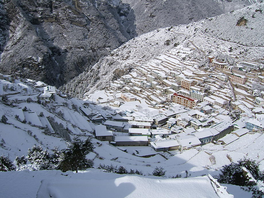 |
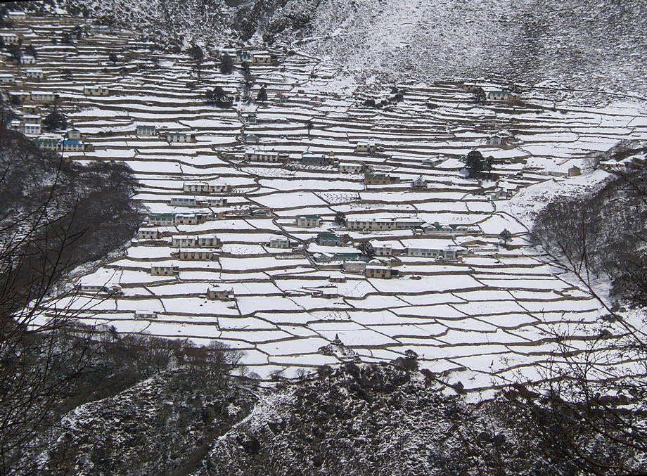 |
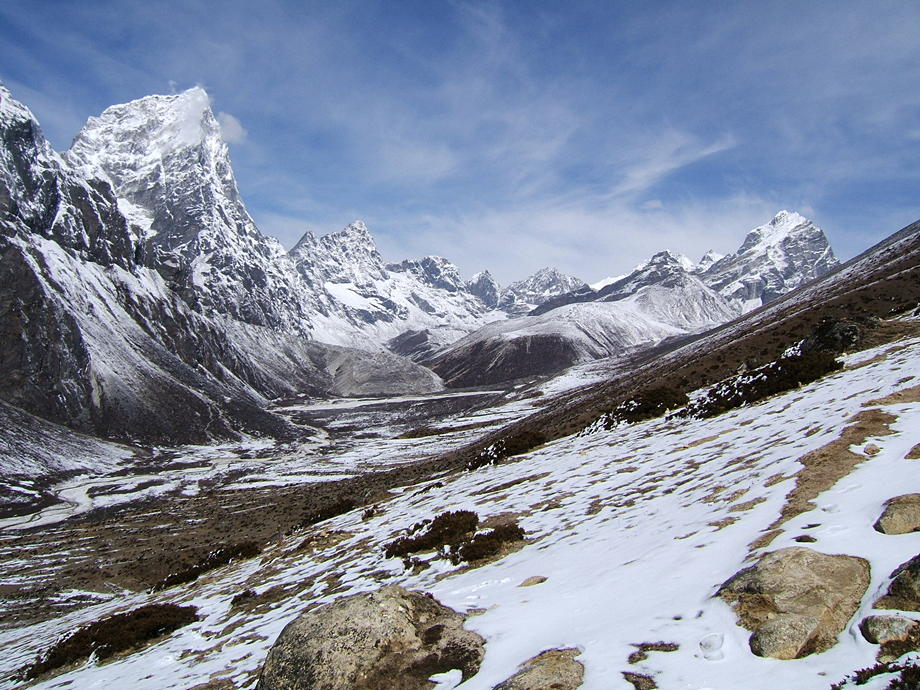
The plateau and village of Phortse, as seen from the pass of Mong. Looks pretty easy but as ever in the Himalayas, there's a deep valley between where we are (Mong) and where we want to be (Phortse). We will have to lose around 200 vertical metres until we can cross the river separating our ridge from the Phortse ridge… most of which we will have to sweat up again. |
| Kang Tega, the Horse Saddle, from the lodges of Mong. | 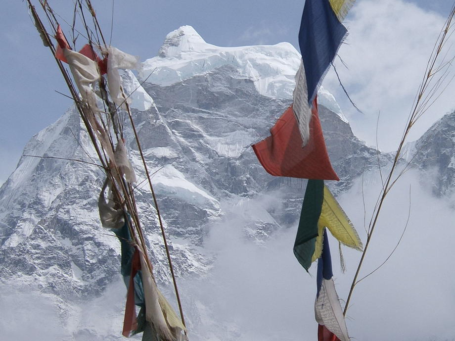 |
 |
Some of the houses of Phortse. Afternoon and most of the snow is gone. The thin, roughly horizontal line in the middle of the shot (click to enlarge) is the high trail to Pangboche, our first objective for tomorrow. |
16 March: Phortse to Dingboche via Pangboche High Route
The direct route from Phortse to Pangboche, our first goal for today, is short and sweet. It's a high route partly hewn out of the sheer rock face, often narrow and a bit rough. It is by no means a dangerous trail, but for people suffering from vertigo it's perhaps not the most comfortable of walks. On the other hand, the path contours almost all the time, so there are no really great height gains. Having said that, the Nepalese have a way of constructing their trails in such a manner that they are never flat: it's always either up or down.
We start relatively early, and for the first half hour we're constantly climbing, in order to reach the point where the high route starts. We have nice views across the deep valley of the Imja Khola (that's the river originating from the Khumbu glacier, below Everest) towards the monastery of Tengboche on its spur. The walking is easy, it's cold but sunny. And anyway, we have done that route a few times already, in both directions.
Pangboche consists of two parts: Lower Pangboche and, you guessed it, Upper Pangboche, about hundred vertical metres higher. The lower part is an entirely artificial creation: it's simply a collection of big, comfy lodges. Most people (especially groups) coming from Tengboche don't bother climbing up to Upper Pangboche although this is a real village and a lot more interesting than Lower Pangboche. Pangboche used to be the last village where Sherpas lived all year round; the higher places, like Dingboche, today's destination, were used only as pastures for the yaks during the spring and summer (these places are called yersas). These days, of course, locals live up to 5000 metres almost the whole year, for instance in Lobuche.
The high route (as the name implies) delivers us to Upper Pangboche; so we can completely avoid the hullabaloo of the lower part (not that there's currently much traffic either way; we're too early in the season). There are a few basic lodges and a shop in Upper Pangboche and also a famous gompa where they used to have a preserved yeti skull on display. Alas, this was stolen a good few years ago but they now have managed to lay their hands on a new one (it's an anti-climax though: the monastery itself, which is more than 350 years old, and its painting are much more interesting).
We have our midday rest (with noodles and Coconut Crunchies) in the sunshine next to the monastery, with the gleaming bulk of Ama Dablam more or less directly opposite us on the other side of the valley. An amazing sight and one reason why we like to come to Pangboche. Another are the many old houses with their beautiful windows: this is still a real Sherpa village. Many Nepalese Everest summiteers originally come from Pangboche.
After a long rest, we continue. The walk between Pangboche and Dingboche (the suffix -boche originally meant big hill but nowadays it simply means village) is one of the nicest bits of trail in the Khumbu: there's Ama Dablam to the right, sights of Everest and Lhotse ahead, and the trails is strewn with mani walls and stupas. It's also pretty easy, since it contours most of the time.
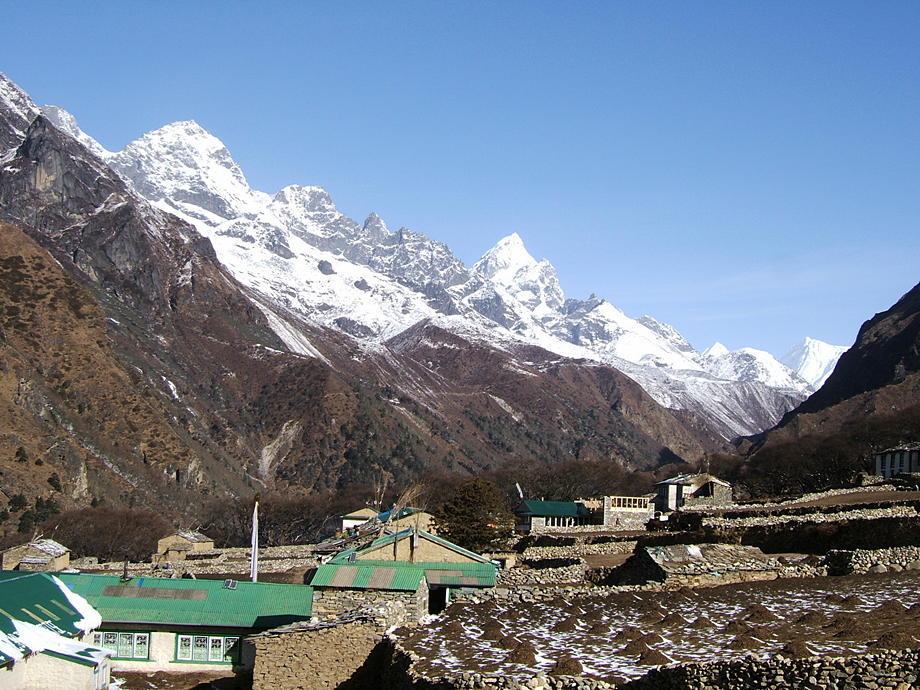
We walk for about an hour through this incredible landscape, until we can see the hill of Dingboche, then we rest again: we're in no hurry. Shortly before this hill, the trail splits: left towards Pheriche and further to Lobuche; right up to Dingboche. We always stay in Dingboche, not in Pheriche: it's a much nicer village; it's better protected against the cold winds from the north and it has plenty of interesting day trips on offer. This is important as we will stay a further day in Dingboche, to aid with acclimatisation.
We already know the lodge we're heading to; it's a basic family lodge (called Ama Dablam Lodge) and we have stayed there already a few times (last in autumn 2008). Hopefully the owners, a medium-aged lady and her slightly older husband (the latter never very far from the chang and rakshi bottles), have already opened the lodge.
Yes, they're indeed open. What's more, the two of them, Dadoma and Ang Pura, immediately recognise us and herd us, backpacks and all, into the kitchen, to have some warming black tea (Ang Pura also tries to press Thomas into having some rakshi but he refuses). Since the lodge is pretty basic, there are only a few other individual trekkers but no groups, just as we like it. (Groups stay in the shiny, big lodges which loudly advertise their hot showers and the crucial fact that they have indoor toilets.)
We stroll around the village; it hasn't changed a lot, though there's now a permanent internet cafe (!). They're connected via satellite, the connection is stable but not very fast: half a megabit. Still, it amazes me that even here the internet is now a firm reality. A girl in the computer room though complains bitterly: her Facebook screen is updating soooooo slowly. Thomas suppresses a sarcastic remark and just shakes his head;-)
| The rocky spur on which Tengboche and its monastery are located. The gompa is to the right of the houses (click to enlarge). The snowy mountain is Thamserku. | 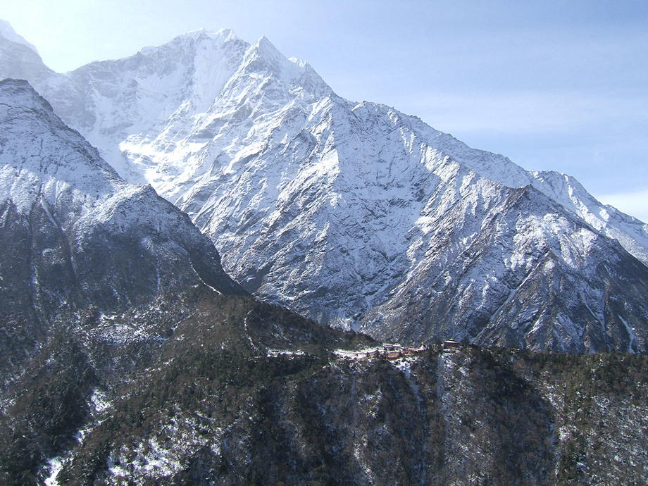 |
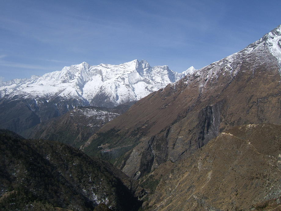 |
A view back towards Everest View Hotel and the general direction of Namche Bazaar (not visible). The thin upper trail on the right-hand side is the high route between Phortse and Pangboche. The chain in the background is Kongde Ri. |
| Ama Dablam in all her majestic glory. | 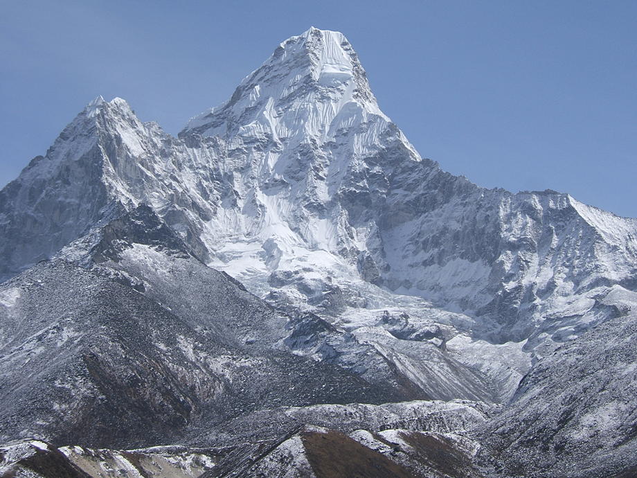 |
 |
Stupas, mani walls and prayer flags along the route. In the background, the inevitable Ama Dablam. |
| Dadoma and Ang Pura, our ever friendly hosts in the Ama Dablam Lodge in Dingboche. | 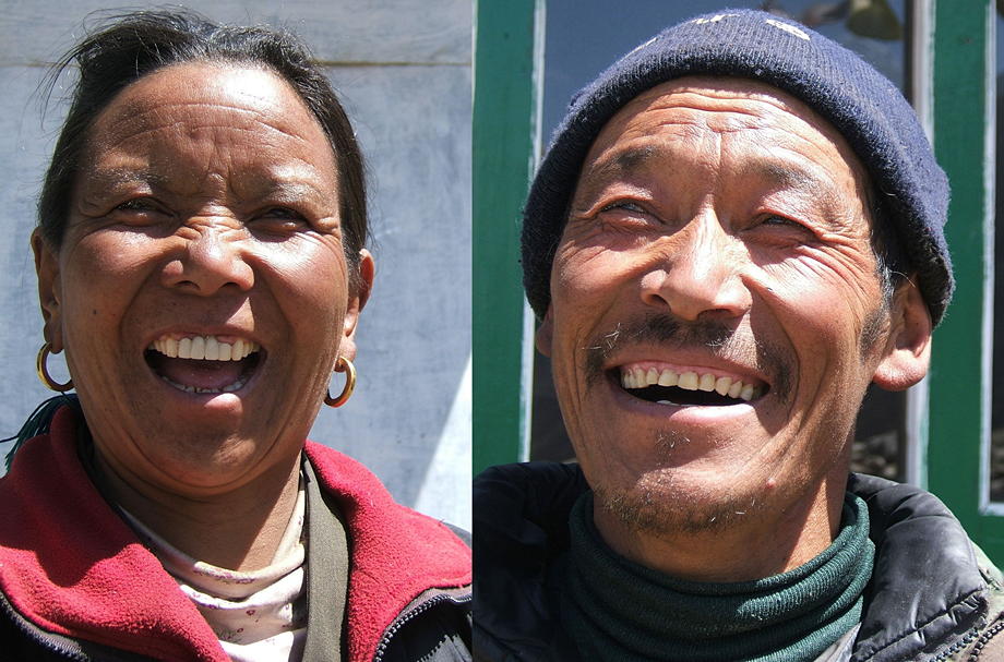 |
17 March: Daytrip around Dingboche: Nangkartshang Peak
Another day of rest… though we're not exactly resting: today we'll climb to the summit of Nangkartshang, a small peak to the northeast of Dingboche. The top is at an altitude of 5100m, so we'll have to climb around 700 vertical metres. A breathtaking excursion (in more than one sense), but it'll help our acclimatisation.
After a cool breakfast (in the morning, the stoves in the lodges are not always put on) we first scramble up to a tiny ridge above Dingboche. There are a few stupas and many prayer flags up here and the views are already widening significantly. Ama Dablam, from this spot, does look like a completely different mountain and the view down the valley is simply amazing. Even here, there's some snow on the ground, so the walking further up will be interesting.
After a short rest (the altitude makes itself felt) and with a sigh, we start our climb up Nangkartshang. The first half is steep but easy: a good trail winds up and thankfully, there are many cairns. It's not hard to get lost in misty conditions and in the Himalayas, the weather can turn nasty within a few minutes. Though currently there are only a few high clouds in the sky… looks good. After about an hour of steady climbing we again rest for a while… we have loads of time.
The second half up that peak turns out to be a lot less pleasant. First, the nice path disappears when the hillside turns into a rough collection of rocks, small and big. Then more and more snow is lying on the ground, making walking on the rocks a bit slippery. Add to that the fact that the slope is steadily steepening and you have all the necessary ingredients for some shots of adrenaline. Walking up in these conditions is still relatively straightforward, but we know that sooner or later we have to come down again — and that will be a lot more difficult.
Still we doggedly continue our scramble and after another hour we reach the top. The views, in all directions, are fantastic. The sun is burning down and though it's a bit cool up here, we decide to have a long rest. A few other people (though not many, given that there are about 50+ tourists down in Dingboche) also come up and join us. One, a young woman, has a quick look around and shares some peanuts with us. But it seems the cold gets her and so she quickly starts walking down (it may well be that she also is a bit frightened about the prospect of having to negotiate the rocks and the snow).
We stay for some two hours, taking photographs all the time. This peak is definitely one of the greatest viewpoints in the Khumbu, even if Everest itself is not visible. The two giants across the main valley, Taboche and Cholatse, are imposing and the bulk of Ama Dablam looks frightening.
But at some point the cold gets us as well and after finishing off our cookies, we grab the walking sticks (indispensable in such terrain) and head down. The rocks are not really nice but it's not as bad as feared. We're back where the nice trail start after less than 30 minutes — it's, even after we've done so many treks, always astounding how slow one is when going up and how fast all that hard-won vertical gain melts when going down.
We still have a few hours to kill, so at some point we decide to leave the trail and to walk into the steeper hillside to the right: we know from the map that there's a tiny monastery somewhere over there and we hope to locate it. After a bit of searching and some scrambling we indeed see some prayer flags and a stone roof… unfortunately a good way below us. One way or another, we descend through the rocks and the half-dried shrubs until we reach the monastery.
As expected, it's empty and locked. And it is indeed tiny; there is at most space for three or four people. We rest once more and finally start the final stretch, first back to the trail and then down to Dingboche.
Back at the lodge, Ang Pura, our landlord, tries once again to lure us with offers for his spiritual drinks but we refuse. He mutters something but shuffles back into the kitchen. We quickly join him and his wife since it's nicer in the warm kitchen than in the cold dining room. (Though not always: sometimes it's not easy to strike a balance between the heat of the fire, pulling you in, and the acrid, tear-inducing smoke, pushing you away.)
We're content: today was a perfect day. A big dal bhat later and all will be well.
| On a small ridge above Dingboche, a stupa and a view towards the steep south and east walls of Cholatse. | 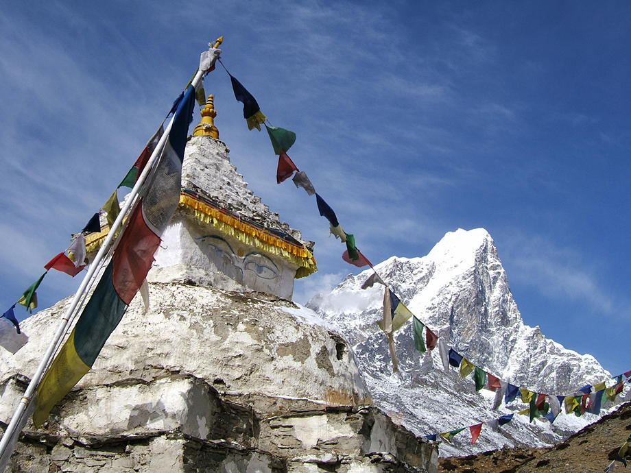 |
 |
The vista up valley: again there's Cholatse and the ablation valleys of the two glaciers which flow down from the north. |
| View towards the mountains in the south: Thamserku and Kang Tega. | 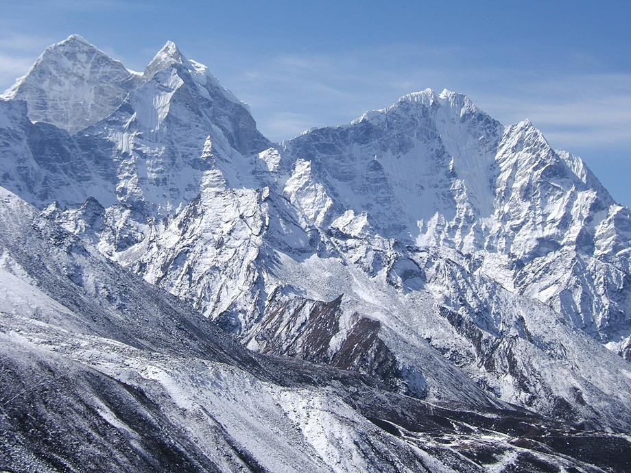 |
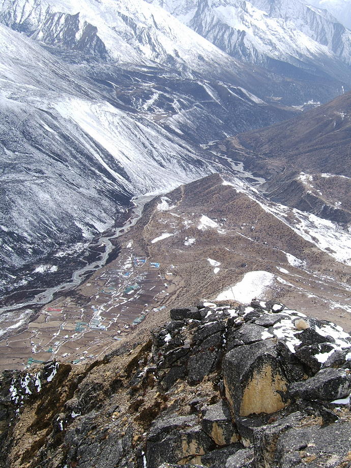 |
A view from the summit. Down in the valley are the houses of Dingboche; still further down there's the point where the trails (and valleys) to Pheriche and Dingboche split. |
| The wooden door of the Nangkartshang monastery. This has a height of less than five feet. | 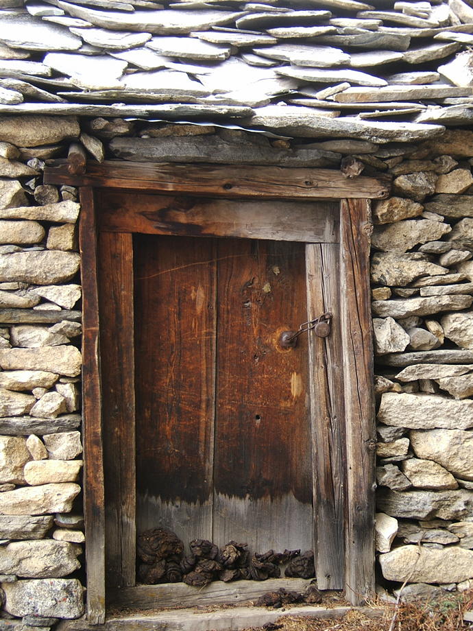 |
18 March: Dingboche to Lobuche
Today will be a relatively short stage, so we don't hurry the breakfast. The weather is perfect, after yesterday's high clouds we're greeted by a deep-blue sky. We first have to gain the same small ridge above Dingboche we already climbed yesterday. From there we stroll leisurely northwards on a great plain, always slightly above the valley floor which is down to our left. The walking for this first part is easy as we have to gain almost no altitude.
After about two hours we reach the Imja Khola, the river that tumbles down from the Khumbu glacier, and the end moraine of the glacier. We cross the river on a shaky wooden bridge… along the banks there are many icicles, so falling into that seething, grey mass of ice-cold water wouldn't be great fun.
On the other side we climb up the moraine for a while until we reach the two lodges of Duglha. This is a pretty bleak place, wind-swept, dusty and cold. But many people, if they run into problems with their acclimatisation, have to stay here: Lobuche, our destination for today, is another 300 vertical metres higher and for someone who is already struggling with the altitude, that makes a dangerous difference.
We rest a good while, for our usual lunch munch of noodles and cookies, and watch the groups who sit around the rough wooden tables. It always amazes us what these people bring with them: all sorts of cosmetics, a fascinating variety of electronic gadgets, bulky camera equipment worth thousands of pounds, delicacies like giant Toblerone packs or huge slabs of yak cheese… then again, they all have porters who carry that and more.
An hour later, we pack our bags and start the final push up the moraine towards Lobuche. The trail is steep and washed out and it requires a lot more effort than the morning stroll from Dingboche to Duglha. The yak trains don't really help but we slowly but steadily gain height until we reach a large plateau. Now the worst is behind (or rather below) us. On the plateau, there are hundreds, if not thousands of cairns, some small, some bigger than a man. Many of these commemorate the deaths of trekkers, climbers, porters or other people who have been killed either by the weather, the mountains or the altitude. Indeed, this spot is famous for being a sort of informal Everest cemetery: there are also memorials and plaques for well-known mountaineers who died on Everest, for instance Scott Fischer who was killed during the infamous 1996 storm.
The rest of the way to Lobuche is once again an easy stroll along a frozen rivulet. It's not that far; about half an hour later we're approaching the first lodges. The place has changed significantly since we've been here last time, in 2003: there are more lodges and they are much bigger now. In the past Lobuche was a great bottleneck with too few places to sleep; even nowadays, it must get pretty crowded during the high season (not least because many people stay for two nights). But it's no comparison to the cramped conditions we experienced in 1994 when we slept with twenty other people in a dirty dorm that was designed for perhaps eight.
“Our” lodge (ie the one we also used in 2003) is also much bigger, with a brand-new dining room. But it's practically empty: they have twenty rooms but only three are currently occupied. Yeah, it's early in the season. The prices for food are eye-wateringly high here (a dal bhat is 430 rupees but at least they refill) but that's always been the case in Lobuche. And there's another thing that hasn't changed: Lobuche is still a complete dirt hole. There's rubbish, mud, yak shit everywhere. Not at all a charming place.
It's still early in the afternoon and Lobuche is quickly explored, so we grab a few packs of cookies and head north, to the “Pyramid”. This is an Italian-built high-altitude laboratory in the shape of a pyramid, made from glass and steel. Looks quite futuristic as it sits bang in the middle of the mountains. Alas, it's filled with extremely unfriendly personnel (if they could they would probably shoot all trekkers). Even when you just sit outside the compound they make you feel you're a transgressor. Well, we're probably disturbing the fine-tuned and of course extremely important experiments going on inside the pyramid.
The evening in the lodge is not too bad: heaps of yak shit get burned in the stove, so it's warm, almost cosy even; the dal bhat is filling and there are no noisy groups around. Just as well, because tomorrow will be a hard day: Kala Pattar is on the cards.
| On the plain between Dingboche and Duglha: a look down the valley. The big mountain on the left is Ama Dablam; in the far right, there is the conspicuous saddle of Kang Tega. | 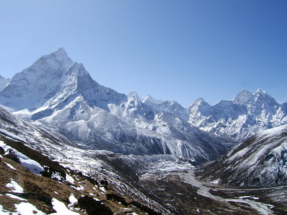 |
 |
Across the valley, the towering twin summits of Taboche (left) and Cholatse. |
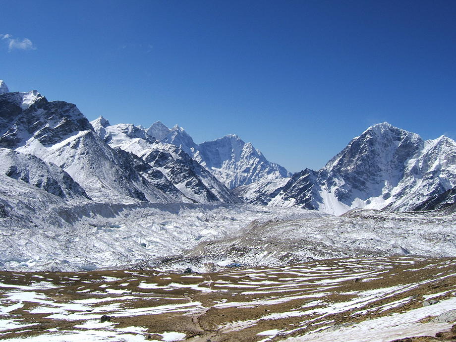
| About 300m further up, near Lobuche: the Khumbu valley really starts to close in. |  |
19 March: Lobuche to Dingboche via Kala Pattar
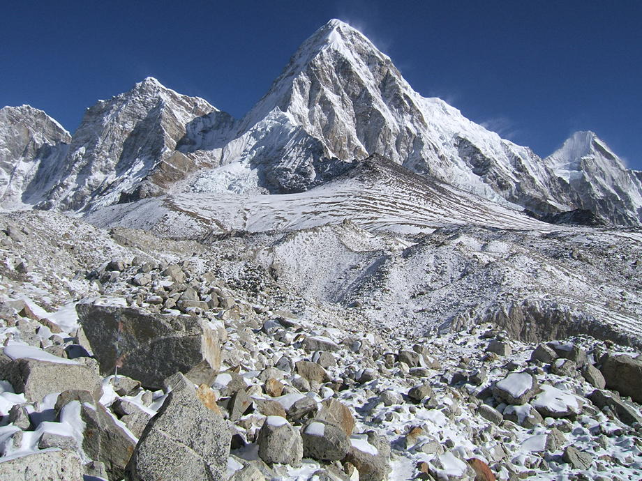
Shortly before seven, we start our peregrinations towards Kala Pattar. This is a hill some two hours north of Lobuche with twin summits: the first, lower one, has an altitude of around 5550m; the higher one reaches more than 5600m, depending on how far one pushes oneself up. We have already been on the higher one, during our first trek in 1994, and have spent a lovely afternoon in the sunshine. Whether we will be able to do that today is not clear: it is horrendously cold and there are ominous clouds in the far north.
The first bit is not easy walking: we first pass the side valley with the Italian pyramid and then have to cross a side moraine, a rough glacier and again a moraine. This makes for much up and down and much panting. It's not helped by the fact that the trail is covered either in snow (that's ok) and ice (not ok). Despite the walking sticks the walking is literally hard going and we have to be pretty careful.
Nevertheless, 80 minutes later we approach the lodges of Gorak Shep. This is a huge flat area (around 5200m high) which almost looks like a dried-up lake, with the bulk of Kala Pattar rising behind the area. Incidentally, Gorak Shep proves that you can have nice, clean lodges at such an altitude: we always found it to be a much more attractive location than Lobuche. There are only two problems with it: it is even harder to find a room (in 2003, we were lucky as we got the last available room) and it is almost 300 metres higher than Lobuche, and therefore even colder and harder to acclimatise to.
We rest for a while. The weather has not really improved: though the sky immediately above us is blue and clear, there are still clouds in the north and east. And alas, Everest itself (let's remember: our main objective today) is not clearly visible. What's even more disappointing is the wind: there are strong gusts, icy blasts from the north: this ain't no picnic.
We cross the flat area and start to climb; amazingly enough we're almost alone on the hill. First it's steep but after a while the slope turns gentler. Though this makes the walking slightly easier, we're now exposed to the full force of the icy blasts. The gusts are so powerful that we have trouble advancing: we can actually lean into the wind and it will carry us.
We grit our teeth and continue. Up and up and ever up. The altitude is no problem, the slope is no problem. The f***ing wind is the problem. And the general mood is not helped by the fact that most of Everest is still in the clouds.
Shortly below the first, lower summit, at about 5500m, we finally accept defeat. It just doesn't make sense to continue. Fifty more vertical metres won't make the views any better; and as to having a rest in these conditions, that's out of the question. As it turns out, even taking a few quick photographs is almost impossible. We cower behind a boulder (now we're alone: no wonder) and wait a little, until there are at least some bits and pieces of Everest visible. We take a few snaps and then stagger back to Gorak Shep. Fortunately, we have been here twice before in perfect conditions… this tempers our disappointment.
Back in Gorak Shep we rest for a good while and discuss what to do. We could either stay another day in bleak Lobuche and then try again. Or we could come up to Gorak Shep for a second go. If (a big if though) the weather is fine tomorrow that wouldn't be such a bad idea… but who knows!?
In the end we decide not to stay another day. We had our views, though not brilliant, and while Lobuche is too bleak, Gorak Shep is too cold. So next day, we'll head towards the Gokyo valley. But now, there's another decision looming: we could either go there via the Cho La, a high pass with a nasty glacier to cross (like we did in 2003), or head back to Dingboche and then on to Phortse, and from there walk up the right side of the Gokyo valley (most people coming from Namche take the left side). We know this route: it's a long but beautiful trail.
We postpone that decision and instead start to walk back to Lobuche. The trail is still icy and very treacherous and Vero doesn't look too happy with the prospect of walking a whole day on ice and snow. So, back in Lobuche, we have a snack and some tea and decide, since it's still early in the day, to race down to Dingboche. Down there it will be a lot warmer (sounds good) and the lodge of Ang Pura and Dadoma is a lot nicer than anything in Lobuche (sounds even better).
And so, barely one and a half hour later, we're back at the Ama Dablam lodge. Ang Pura seems a bit puzzled to see us back just a day later, but quickly leads us into the kitchen. Ah, a cup of hot lemon tea… what a luxury!
| As we set out from Lobuche early in the morning, a look back down valley, to the south. Though the sky is blue there, the weather to the north is a lot less promising. | 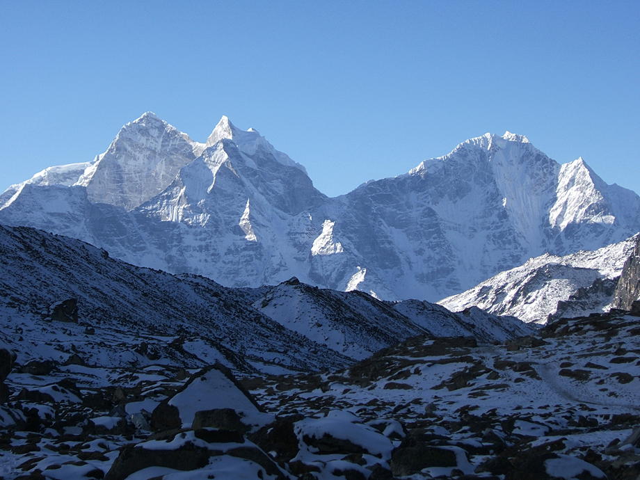 |
 |
The summit of Pumo Ri, a western neighbour of Mt Everest. Note the snow being blown off the ridges. |
| The great mountain itself. Everest is the big pyramid roughly in the middle. To its right is the bulk of Nuptse, with its imposing hanging glaciers. | 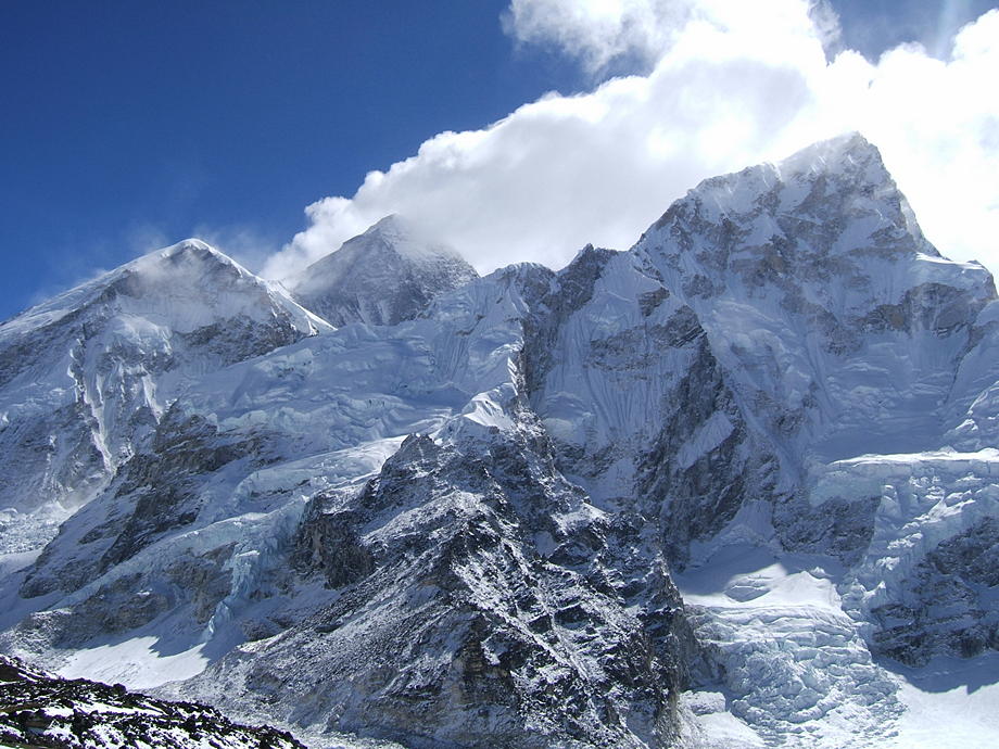 |
 |
Another look back: south of us the weather seems a lot more benign. Note the huge Khumbu glacier as it flows from left to right. In the middle, slightly below the glacier, are the lodges of Gorak Shep. |
20 March: Dingboche to Phortse via Tengboche
So today it's back to Phortse and even more (relative) warmth! For a change we will not take the direct route (ie via the Pangboche high route) but will instead first go to Tengboche, visit the gompa, and then cross the deep valley that separates the two villages.
The weather further up looks much improved but we have no regrets. And anyway, it is difficult to gauge the real conditions from further down. So we start in good mood and slowly walk down-valley until we reach Upper Pangboche. There we rest for a good while in the sunshine and then take a shortcut to the lower trail leading from Lower Pangboche to Tengboche.
The walk from Pangboche to Tengboche is a nice stroll through rhododendrons and birch trees. We spot another musk deer (later in the season this will be a lot harder as there will be a steady stream of trekkers then) and Vero even washes her hair at a source in the forest, about 20 minutes before Tengboche. It is funny how an altitude of 3800m feels cold on the way up and much warmer on the way down. We wait a while in the sunshine for her hair to dry and then trundle up to Tengboche.
We have seen and visited the gompa many times already (in 2003 we actually took part in the Mani Rimdu festival), so we just have a quick look inside (no great changes) and then take our lunch, the usual noodles and cookies. There's a nice viewpoint a little behind the gompa and there we stay for a good while.
Afterwards we start the steep descent to cross the river which separates Tengboche and Phortse. This river is the Imja Khola which has its origin in the Khumbu glacier. The trail down is quite steep and still partly under snow (this is a wooded north-facing slope). So it's wet and the moist mud is very, very slippery (ask Vero). But one way or another we slide and skid down to the river which we cross on one of those shaky wooden bridges (though shaky wooden bridges are much better than shaky bamboo bridges; ask Thomas).
On the other side we start the long and steep climb back up: Tengboche and Phortse are about the same altitude but the valley floor between them is roughly 300m lower. After some 30 minutes we spot a small animal before us in the middle of the trail but it vanishes so fast that we only see a blurred form disappear between the trees. Upon arriving at the spot we see that there is a dead, partly eaten wild goat, probably fallen to its death from the steep slopes above us. (Later in the lodge in Phortse we learn that the animal we saw was probably a snow leopard: about 15 minutes before we crossed that spot the young son of the lodge owners had been there and had watched a snow leopard as it devoured parts of the dead goat.)
In Phortse, sweating and panting, we take the same lodge we had a few days before. The rest of the afternoon is spent with washing and danphe watching. The colourful danphe is the national bird of Nepal; it is a rather timid creature and pretty hard to photograph. We succeed though and bring back a few nice shots.
Meanwhile, in the lodge, the brother of Nawang Karma, the landlady, has arrived: he is Ang Dorjee, a Sherpa from Pangboche and a pretty well-known Everest summiteer (back then in March 2010, he had summited Everest 13 times). So for the rest of the evening, we sit around the stove and drink: tea for us and scotch for Ang (Johnnie Walker, readily supplied by his doting sister), while Ang entertains us with some tall stories about his life and mountaineering exploits.
| Don't look back in anger… the weather seems to be pretty good for budding Everest watchers. Though you never know how it really feels up there short of checking yourself… Anyway, the mani walls are those shortly before Upper Pangboche (if coming from Everest). | 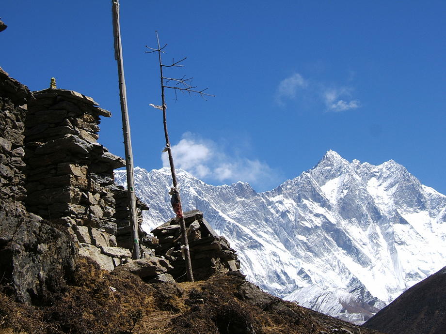 |
 |
… whereas this stupa and the main walls are a little below Lower Pangboche (if walking towards Tengboche). Tengboche and its gompa are on the wooded spur on the left side. |
| Tengboche: main entrance and gompa. | 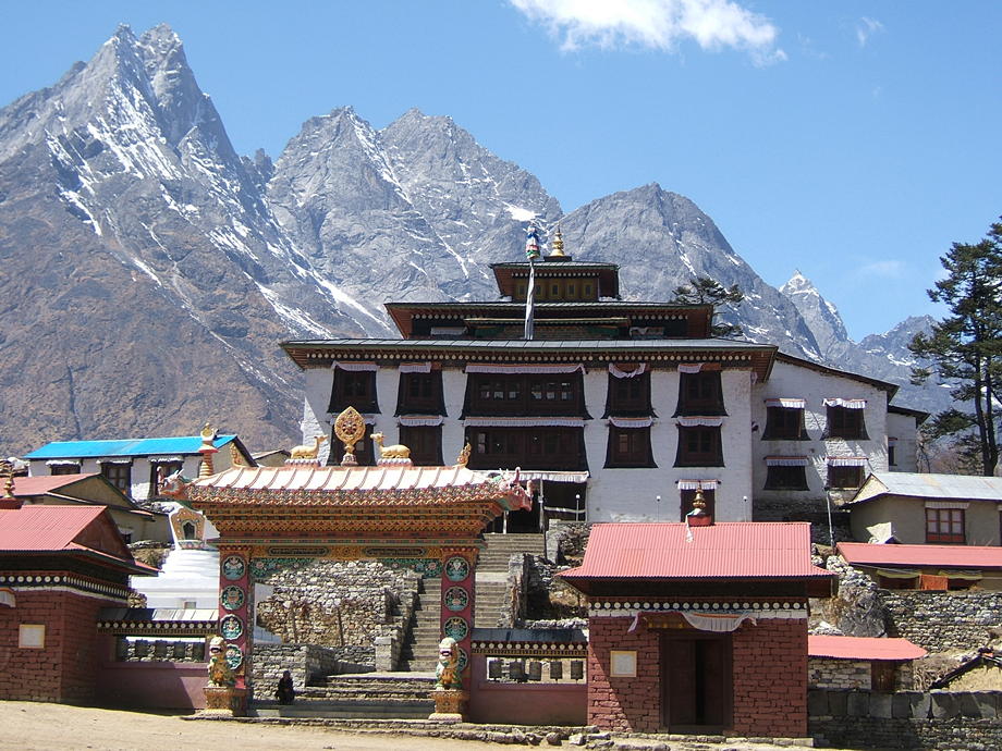 |
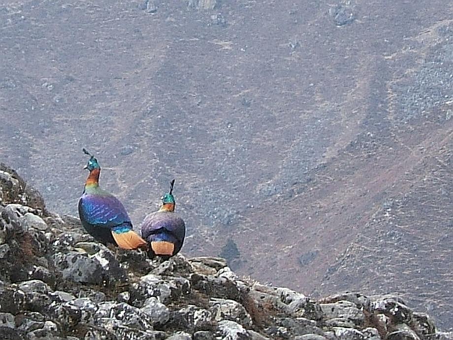 |
Two danphe we spotted in the lower fields of Phortse. This part of Phortse is pretty reliable for spotting them: sometimes there are dozens around, but mostly too far away for a really good shot. This snap has been slightly enlarged. |
Go back to From Junbesi to Namche Bazaar or forward to The Gokyo Valley.
$ updated from: Everest Trek.htxt Sun 24 May 2026 15:57:32 trvl2 — Copyright © 2026 Vero and Thomas Lauer unless otherwise stated | All rights reserved $