


Panoramas 2010 Best of
(thomas;2010-Jul-29)
Best of the Best (5 panoramas)
(Clicking on a panorama will open a larger version in a separate tab.)
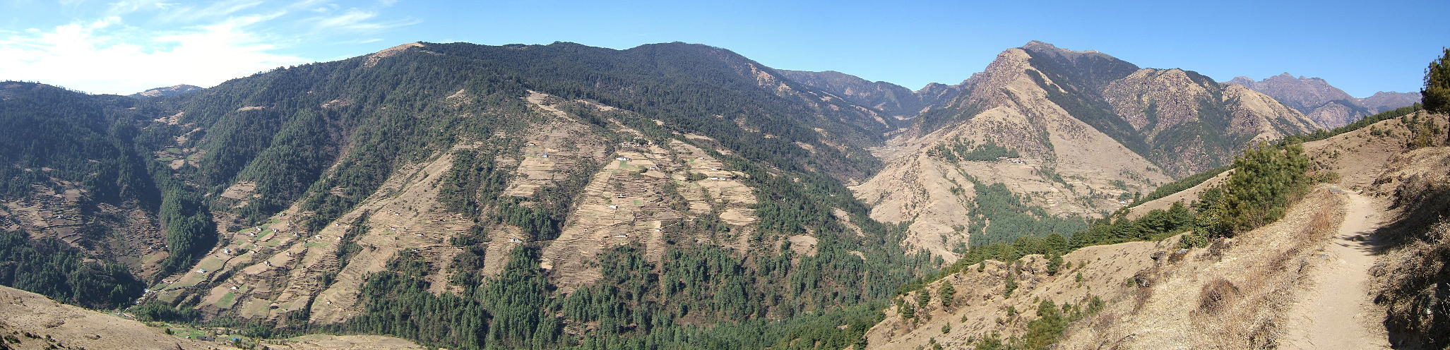
| (7 March 2010.) This panorama was shot on the walk-in from Jiri to the Khumbu. We are on our way from Junbesi to Ringmo along an amazing natural balcony, high above the valley, with views far and wide. The shot shows the scenery around the Lamjura La, with roughly 3500m the highest of the three passes between Jiri and Namche Bazaar. The actual pass, which we had crossed the day before, is below the red dot. |
 |
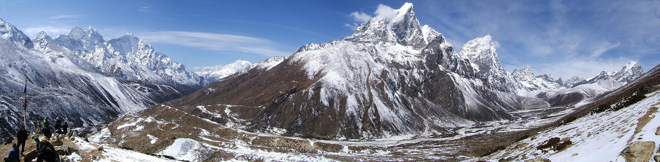
| (17 March 2010.) We are on top of Nangkartshang, a small peak of 5100m, located around 700m above the village of Dingboche. This is one of the most amazing viewpoints in the Khumbu though Mount Everest itself is not visible from here. However, many other great mountains are: Kang Tega (leftmost red dot), Thamserku (blue), Kongde Ri (red), Taboche, the “hausberg” of Pangboche (blue) and finally Cholatse (again red). |
 |
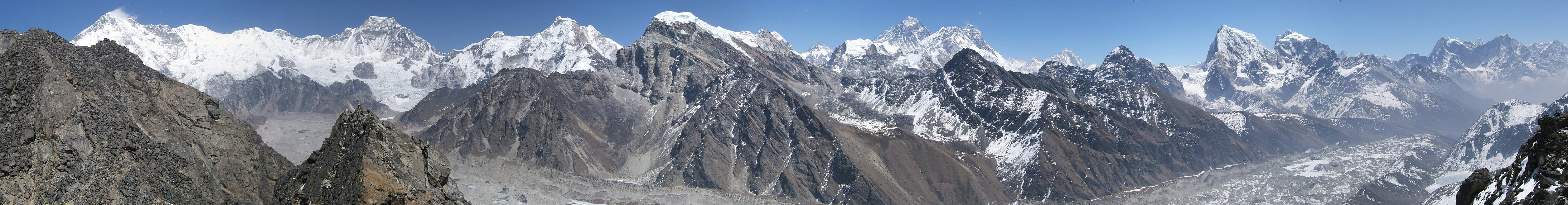
| (24 March 2010.) A view from the summit. This is Gokyo Ri, perhaps the best all-round viewpoint in the region. This shot shows four 8000ers and one “almost”-8000er: there's Cho Oyu (red dot), Gyachung Kang (blue, missing the 8000m mark by just 48 metres), Everest (red), Lhotse (blue) and Makalu (red). These five peaks represent fully a third of the 15 highest mountains on Earth! |
 |
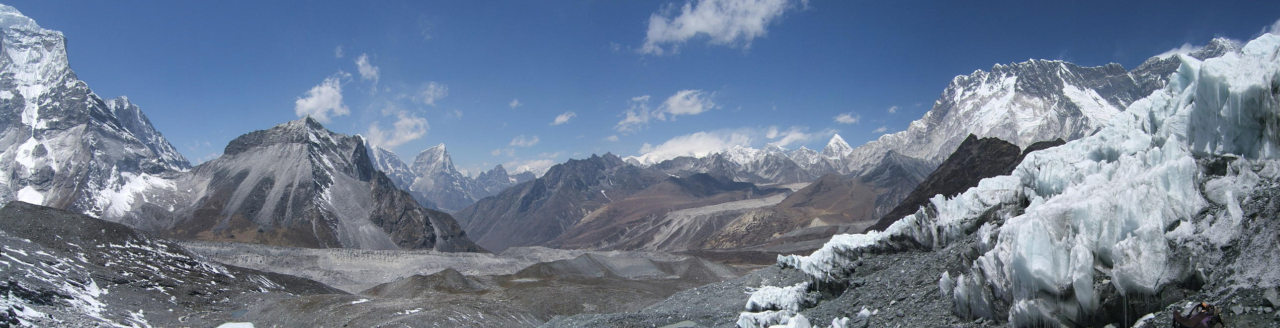
| (3 April 2010.) We're surrounded by the seracs of Chukhung glacier, in the eponymous valley, at around 5200m. This shot shows the whole mountain range to the north, from the bulk of Ama Dablam (far left) to Everest and Lhotse (far right). Everest is the small triangle with clouds streaming off. |
 |
| (4 April 2010.) This is the view from Chukhung Ri (around 5550m) southeastwards, across the Chukhung valley to the Chukhung glacier (red dot) where we had been the day before. Ama Dablam (blue) is to the right; Makalu (red) to the left. The flat white area (blue) is a big lake on a glacier. |
 |
Go to Panoramas 2010 Walk-in or up to Panoramas 2010.
$ updated from: Panoramas 2010.htxt Sun 24 May 2026 15:57:32 trvl2 — Copyright © 2026 Vero and Thomas Lauer unless otherwise stated | All rights reserved $