


Panoramas 2010 Chukhung Valley
(thomas;2010-Jul-15)
Chukhung Valley: Chukhung Glacier, Chukhung Ri and Kongma La (9 panoramas)
(Clicking on a panorama will open a larger version in a separate tab.)
Next valley up from Ama Dablam is the Chukhung valley: our final destination in the Khumbu. As Chukhung isn't on the itinerary of most big groups, the lodges are normally not full; it's actually quite enjoyable even in high season. And like the Gokyo valley it is great for day trips: there are glaciers right, left, up and down and also a few nice viewpoints. Its only (slight) drawback may be that we always felt it was the coldest of the high valleys in the Khumbu.
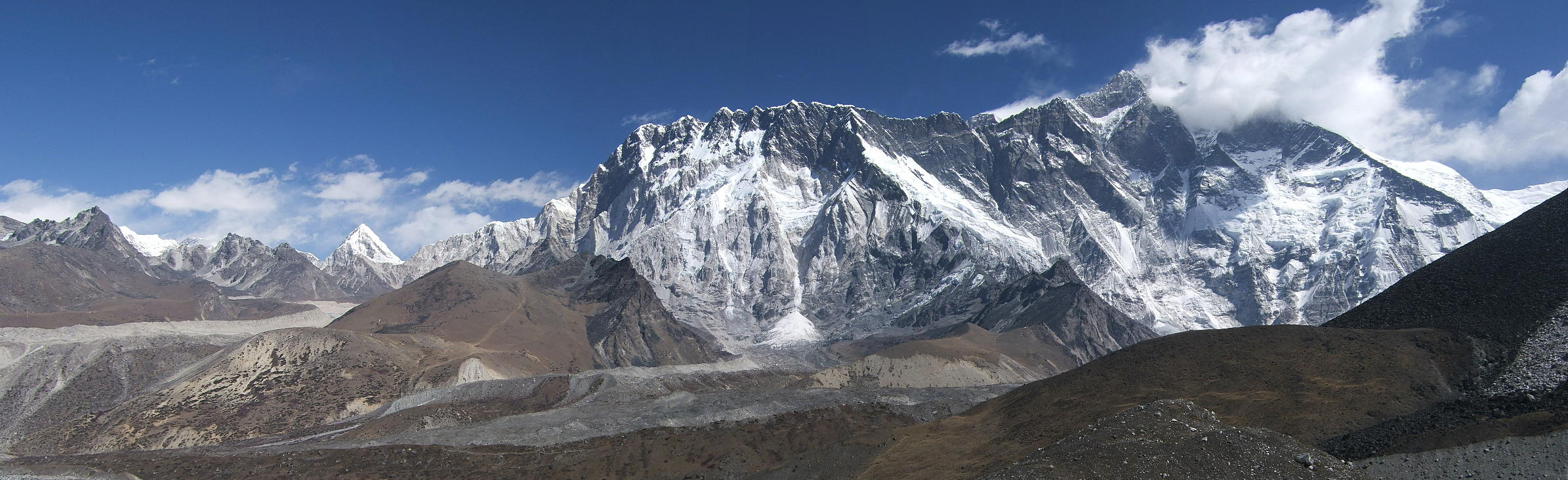
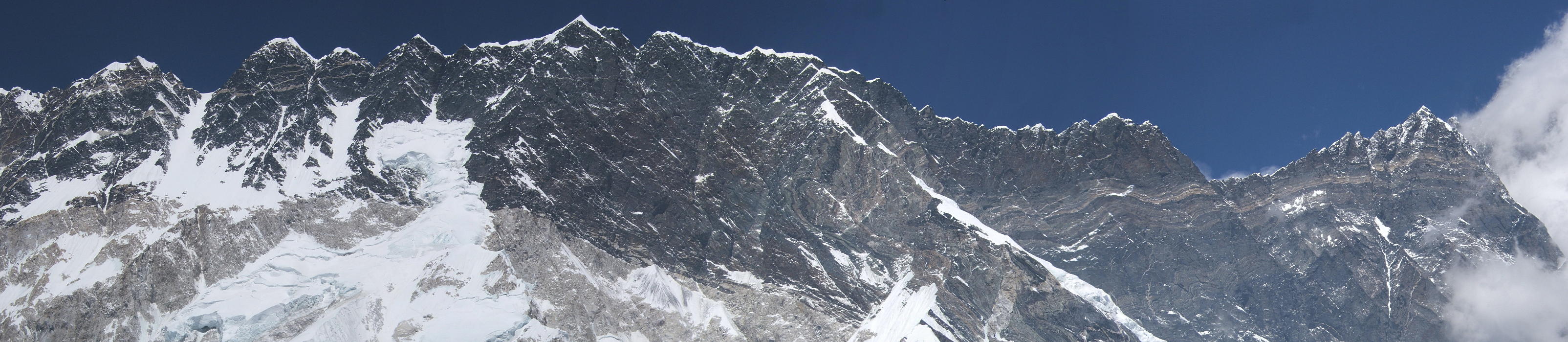
| On our first day in the Chukhung valley we climbed towards the Chukhung glacier, in the south. From there, the views back to the wall between Lhotse (red dot) and Nuptse (red) are breathtaking. Even Everest (blue), which is not visible from the Chukhung lodges, peeps over the wall. The small black hill in front of the Lhotse wall (blue) is the Chukhung Ri, our destination for the following day. |
 |
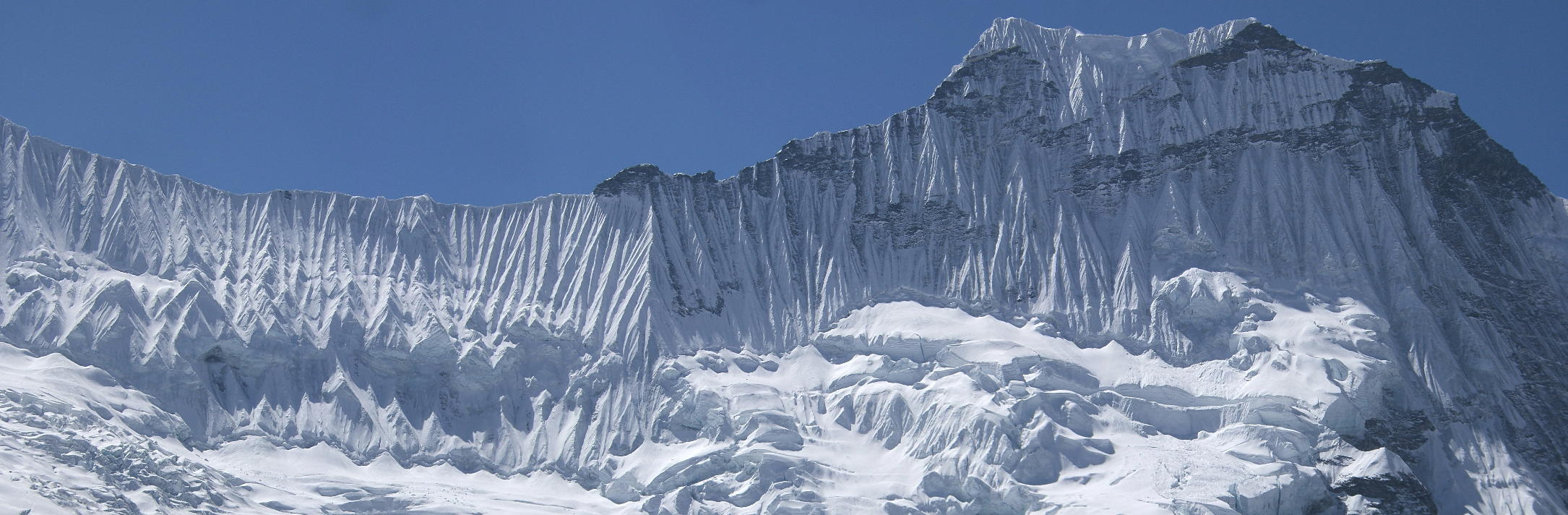
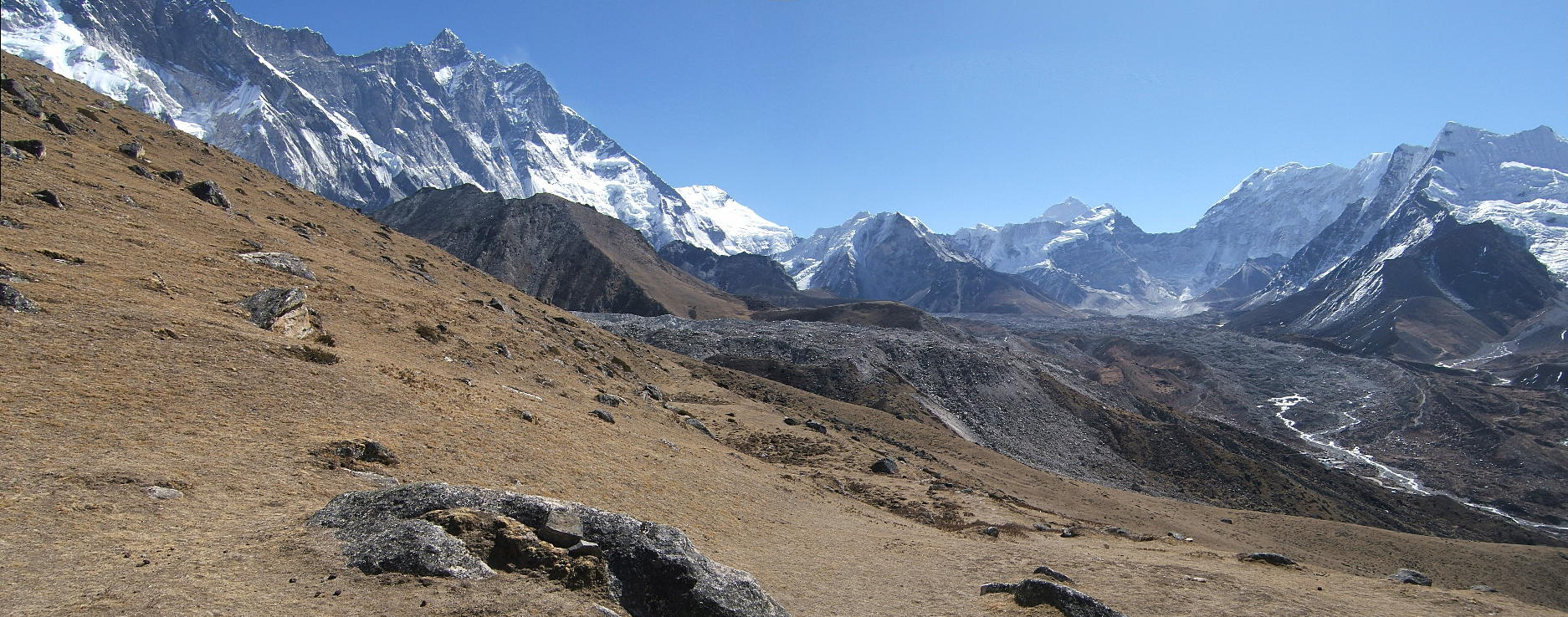
| This is the top of Chukhung glacier. The snowy ridge above the glacier forms part of the southern edge of the Khumbu region. Ama Dablam (not visible) is on the right. |
 |
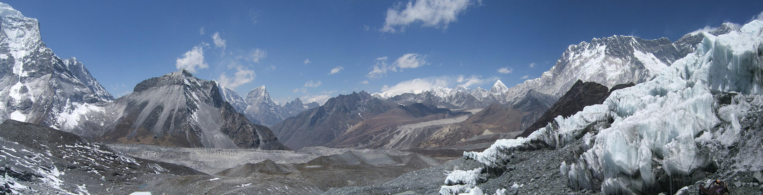
| A panorama showing the whole mountain range to the north, from Ama Dablam (far left) to Everest and Lhotse (far right). In the foreground to the right you'll note the seracs of Chukhung glacier. |
 |
| Next day, we went up to Chukhung Ri (5546m). This photo shows the view to the southeast, ie towards the Chukhung glacier (red dot) where we had been the day before. Ama Dablam (blue) is to the right; Makalu (red) to the left. The big lake (blue) is the Imja Tsho, a GLOF candidate: a big lake formed by melting ice on a glacier which will at some point in the future burst its walls and flood the whole valley below, with disastrous consequences. We had already seen the results of a GLOF in the Thame valley (Dig Tsho, 1985) and it's not a pretty sight. |
 |
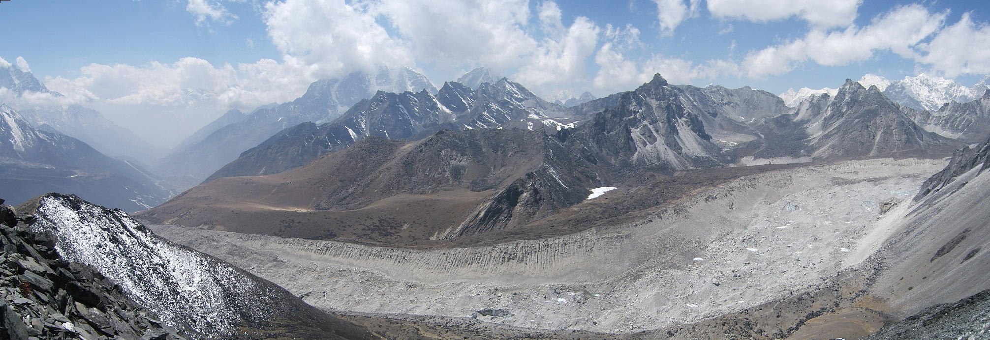
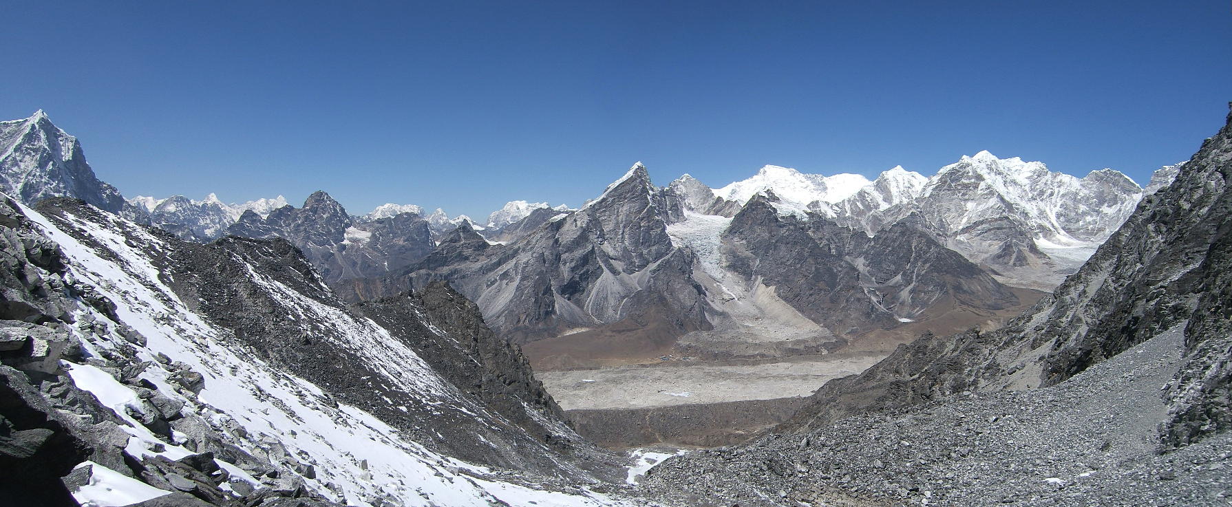
| This is the view from Chukhung Ri across the Nuptse glacier towards the Kongma La, a high pass (5435m) between the Chukhung and Lobuche valleys. The Kongma La (the pronounced dip below the red dot) was the object of the following day's excursion. |
 |
| This is the Lhotse south wall from the summit of Chukhung Ri. There are people who've climbed this wall to the summit of Lhotse (red dot), a total of 3.2km vertical gain, and lived to tell the tale. Unbelievable when you stand in front of it. Everest hides in the dip left of Lhotse. |
 |
| The following day and we're on our way to the Kongma La. This is the view back towards the lodges of Chukhung (red dot in the far right). The big mountain in the background (blue) is Makalu, the smaller one is Island Peak (red, 6189m), probably the most-climbed of all Trekking Peaks. The summit of Lhotse (blue) is also prominent. |
 |
| On top of Kongma La, after a pretty steep climb. This is the view down towards the lodges of Lobuche (red dot). |
 |
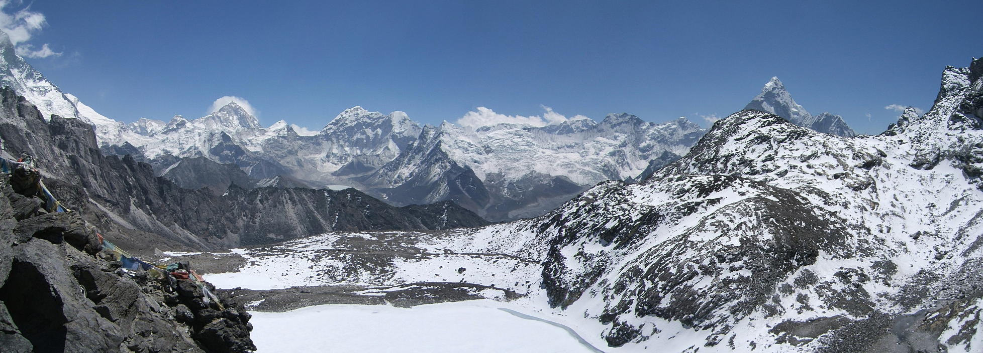
| Turn 180 degrees and you face the west face of Makalu (red dot). The Kongma La is probably the best viewpoint in the whole of the Khumbu for Makalu. Ama Dablam is the pronounced steep peak to the right. In the foreground there's one of the many lakes (not a GLOF) below the Kongma La. |
 |
If you want to see more, there are a further nine panoramas from the Chukhung valley.
Go to Panoramas 2010 Walk-out or up to Panoramas 2010.
$ updated from: Panoramas 2010.htxt Sun 24 May 2026 15:57:32 trvl2 — Copyright © 2026 Vero and Thomas Lauer unless otherwise stated | All rights reserved $