


From Jiri to Junbesi
(thomas;2010-Jul-15)
From Jiri to Junbesi (4 days, 03 Mar 2010 to 06 Mar 2010)
03 March: (Kathmandu to Jiri) Jiri to Shivalaya via Those
04 March: Shivalaya to Bhandar via Deorali
05 March: Bhandar to Sete via Kenja
06 March: Sete to Junbesi via Lamjura La
See also:
- the panorama shots for the walk-in
- the topographic map (based on Google Maps) for the first part of the walk-in
- or the next part: From Junbesi to Namche Bazaar
03 March: (Kathmandu to Jiri) Jiri to Shivalaya via Those
We left Kathmandu at 6am with a “SUPPER EXPRESS BUS” to Jiri. The drive, around 200km, normally takes a whole day (once, years before, we did arrive in Jiri at 9pm, after a bone-rattling 15-hour journey). This time the EXPRESS is indeed SUPPER and we turn up in Jiri at 1pm. An unheard-of arrival time and we decide to start the trek there and then (Jiri is a roadhead and these places tend to be rather dirty and nondescript). It takes us half an hour to get ourselves, the packs and the shoes sorted and then we hit the trail, destination Shivalaya, a small village about three to four walking hours away. These days, there are even buses to Shivalaya, though the “road” is a dirt track with ruts so deep that you could drown during the monsoon season (the bus takes about two to three hours, so this ride seem to be a rather questionable pleasure anyway).
From Jiri (altitude ~1900m) there are two trails to Shivalaya (~1800m), one crosses a pass at 2400m, the other hugs the mountainside (highest point perhaps 2100m), visits a couple of other villages en route (among others Those, once famous for its iron works) and finally drops to Shivalaya (this name means the Abode of Shiva). Given that this is our first day of trekking, we decide to hug the mountain. At times we touch the dirt track for the bus but most of the walk is a good part above the valley floor, with nice views across the valley and over the stepped terraces so typical of Nepal. It is hot and sunny, perfect weather.
When we arrive in Shivalaya it is past 5.30 and there's already a hint of dusk in the air. Despite the relative easiness of the route, both of us feel pretty knackered. Well, the first days are always the same, hard and sweaty, and it's a well-known fact that the backpack is heaviest at the start.
Thomas visits a few lodges (he's quartermaster and better at haggling with the lodge owners). The lodges on the Jiri-to-Namche walk-in are often rather basic, not the luxurious affairs we nowadays ogle with astonishment in Namche Bazaar and above, and it pays to look around (not least because the prices, though cheap by western standards, can vary a lot). We finally end up in a nice lodge with three Canadians and a US guy. Today is one of the Canadian girls' birthday and we're given some of the birthday cake especially prepared for her! A good start.
| The terraced hillside near Shivalaya. The river to the right is the Khimti Khola, coming down from a set of glaciers in the Rolwaling area. | 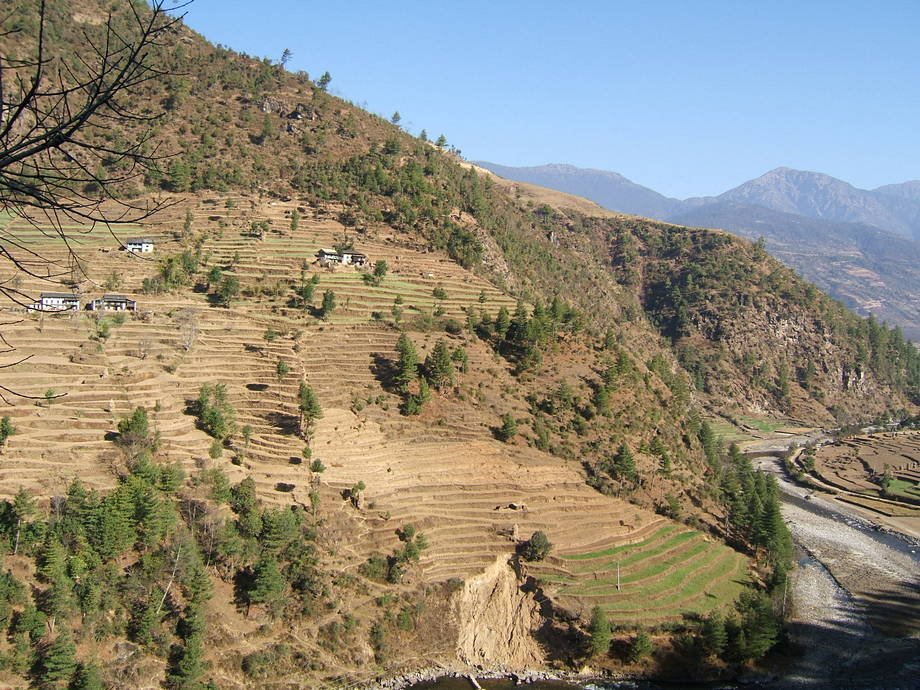 |
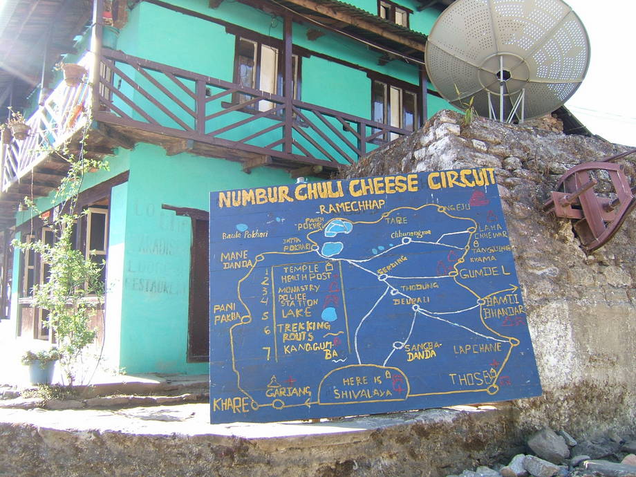 |
A hand-painted map of the newly created Numbur Cheese Circuit greets the weary hiker at the entrance of Shivalaya. This circuit is one attempt (there are others) to capitalise on the tourist boom that Mount Everest has brought to the region. Sadly, most people are flying in to Lukla these days and will never see, let alone set foot to, the delightful middle hills of the Himalayas. |
04 March: Shivalaya to Bhandar via Deorali
Okay, our first full day of trekking! The weather is superb: azure-blue sky and the sun's already out. We get up at 6.30, pack and allocate some tea and biscuits: it is quite chilly so early in the morning, even at this low altitude, but from experience we know that we will sweat a lot once we get up the first hill.
The plan is to walk to Bhandar which is an extended village with a gompa and two famous twin stupas. This should take us about five hours (all walking times are without rest or other halts). The first part of the day sees us ambling up to a pass called Deorali (actually Deorali means pass). This place, at 2700m, is about 900m higher than Shivalaya and sports four or five lodges: the perfect spot for a lunch rest.
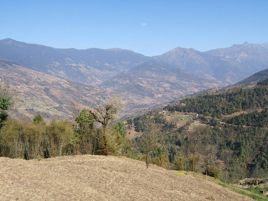
There are two possible routes up to the pass: the main trail mounts steadily along the mountain flank until it reaches the pass; a rarely used alternative first climbs steeply to a ridge and then stays on the ridge until about 100m higher than the pass; it then veers right and drops down to the actual pass. We have loads of time and take the alternative route, not least because there are beautiful sights towards the mountain chains north of us along the way. There are even a few snow giants already on show. Another interesting feature are the small villages surrounded by fields. Some plants look very similar to the tea bushes we saw in Ilam (that's near the border with India) — perhaps tea is the next cash crop?
We arrive in Deorali (almost empty, just a few bored lodge owners) for an extended lunch break. From the pass, there are extensive views down the valley, including parts of the bit we came up yesterday and also to the other side, towards Bhandar. Deep below us, we can already spot the two stupas we will visit later that day. They are white-washed and glint in the sun.
The descent to Bhandar, about 500 vertical metres, is quite steep but not really wearying; we have walking sticks anyway. The one thing that annoys us is that we repeatedly have to cross a dusty dirt track — it is amazing how these tentacles of “civilisation” extend and expand their reach in Nepal these days. This track seems almost unused but even if a lorry trundles along a few times per week only, it means more choice and cheaper products in Bhandar. Yeah, it's progress all right but we still look forward to the next day when all roads and dirt tracks will be finished.
We arrive in Bhandar at 3pm and quickly find a rather basic, but cheap lodge with a friendly owner and broken windows in the guest room. The lady has a headache and a noisy toddler bent on destroying a small plastic car by throwing it against the walls of the kitchen. However, she still agrees to take us on. Both of us have a wash in her kitchen during which she looks on very interested, then we stroll through the village and visit the gompa and the twin stupas. Bhandar is a pretty big place and, as the stupas already reveal, mostly inhabited by lowland Sherpas.
Once we return, our landlady starts preparing diner while we small-talk with her older daughter and a friend, both of whom have acquired passable English in the local secondary school. Finally, the dal bhat arrives, steaming rice and lentil soup with green veggies. It is tasty (then again, we're so hungry we would wolf down anything) and quite filling: the rule here is that you can have as much rice and lentils as you can eat. We decide that we will try to stay with the lady again, in a few weeks' time on the way back.
| The Khimti Khola, some terraces and a few farm houses, slightly north of Shivalaya. This shot was taken almost immediately after we started. | 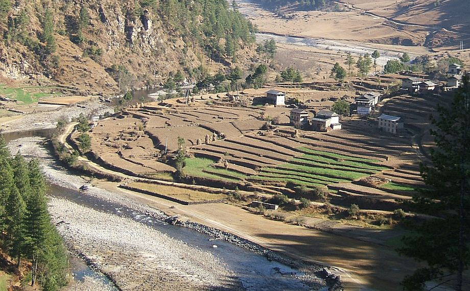 |
 |
About an hour into the walk, we're now up the ridge and enjoy the views northwards. This ridge extends for many kilometres and gives tremendous views. |
| A little later, even a great snow mountain makes an appearance. We don't know its name but we think it must be roundabout 6000m high. | 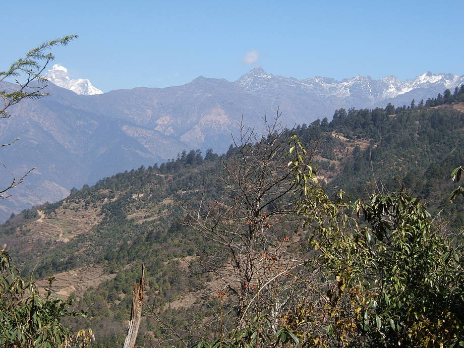 |
 |
One of the twin stupas of Bhandar (they are just a few metres apart). The weather had been perfect all day and the colourful prayer flags contrast beautifully with the dark-blue sky. |
05 March: Bhandar to Sete via Kenja
As mentioned, some of the window panes in our lodge were broken or altogether missing… which made it easy for the local cat population to pay us a nightly visit. Vero saw and heard them, Thomas was more concerned with his beauty sleep. Morning, as usual, greets us with a clear blue sky. Today will be harder than yesterday: the hill after Kenja is a real killer, steep and hot in the burning midday sun. But we already know it, so we can prepare ourselves mentally.
We have a quick breakfast where we tell our landlady that we will be back in six or seven weeks' time, something she doesn't seem to believe. We also buy a few packs of instant noodle soup and some biscuits and set off towards the Likhu Khola, one of the bigger rivers to cross on our way to Namche. There are two trail options: one trail drops fast to the river (from ~2200m to ~1600m) and crosses it, while the other keeps high, at around 2000m, and provides utterly amazing balcony views, steeply down to the river and also to the other side. This is of course the preferred route for trekkers and we follow it (we had done the river route, which is also not bad, a few years before).
The upper trail is one of our favourite walks in all of Nepal: everything is perfect and the views, in all directions, are beyond description. After three relatively easy hours we arrive in Kenja (~1600m), a village with many, many lodges. There's also a police checkpost there and after signing the register, we pause at the lodge where we always rest for lunch. In 2003 there had been a group of Maoists in that lodge, asking all trekkers present for “donations”. For unfathomable reasons, they overlooked our table and we went scot free.
The owner won't make a great deal of money, though, as our “lunch” consists simply of two packs of noodle soup (we eat the precooked noodles like a snack, a trick we've learned from Nepalese porters) and, as dessert, a bag of very expensive chocolate (a present for Vero from her colleagues, hauled by Thomas from Britain all the way up to Kenja!).
After a long rest in the glaring sun, we finally decide to tackle that awful but inevitable hill. Three hours later — and almost 1000 vertical metres higher — we arrive in Sete (2575m), hot and sweaty and somewhat tired (we also know that the third day is always the hardest and that tomorrow, though we have another 1000 vertical metres waiting for us, will be a lot easier). And in the end, the hill wasn't too bad: it definitely helps if you know what's in store. Once again, the views are sensational, they widen immensely the higher we climb. The huge ridge leading up to the twin summits of Pike Peak (4070m) and the summits themselves are amazing from this side.
Sete is a collection of lodges, some rather basic, a couple slightly more fancy. We know where to go; the owner even seems to remembers us (though you can never be sure) and after some bantering and haggling we get a nice room and an even better dal bhat. Alas, we learn that his two lively young daughters are nowadays in a boarding school in Kathmandu: during our last visit, the girls were funny and curious and rather keen to practice their English. It is amazing how kids in Nepal go to school in the strangest locations. In this case, the girls had walk a total of five hours to and from the local school, every single day. Kathmandu will be a lot easier on their legs, we suppose.
Since our last visit the lodge owner has installed solar power panels (sadly, that means no more hissing kerosene lamps but as compensation we admire the intriguing cabling between panels and batteries). He also has a mobile phone now but coverage seems patchy: he's always going to the window (with a beautiful view down the valley towards Kenja) if he attempts to make a call. During the evening he does indeed get a few phone calls (always taking them near the window) which nevertheless seem to finish rather quicker than they should, judging by his clumsy and futile attempts to revive the connection.
Like yesterday, we're the only guests. We've not seen other trekkers going up to Namche for two days running now: hard to believe but true. The only other people we've seen walking up are a group of Junbesi Sherpas back from a short holiday in Darjeeling, India. Meeting holidaying Nepalese on the trails would have been unthinkable even a few years ago.
| A typical lowland farmhouse. This one sits on a terrace above the Likhu Khola. Normally, one half of the house is reserved for cooking and eating (here it's the left part, note the smoke coming out from under the roof), with the other half for sleeping. In the lowlands the animals tend to have their own simple stables or at least some sort of shelter. | 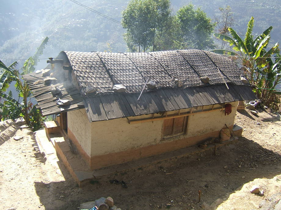 |
 |
Shortly before we arrive in Kenja. The snow mountains in the background form the head of the Likhu valley. |
| Sete is only a small settlement, nowadays mostly consisting of lodges, but it has an old gompa with beautiful paintings. We had been in Sete many times before and the gompa had always been closed — this time we were lucky. | 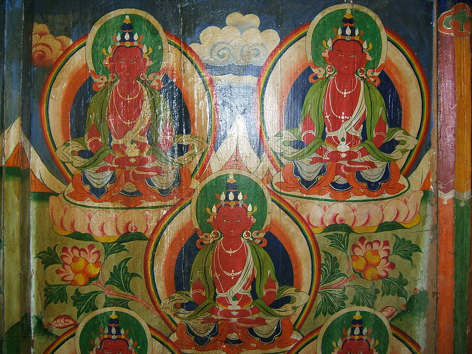 |
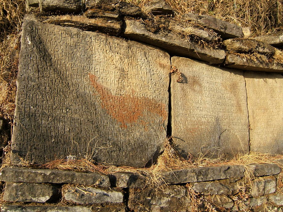 |
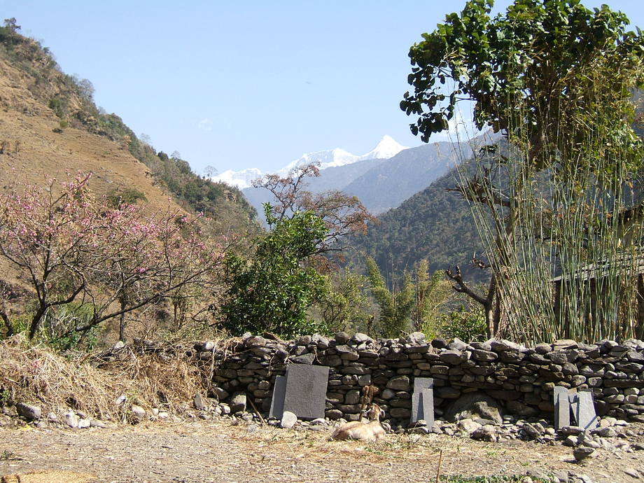
One of the weathered stone plates forming the mani wall at the entrance of the village. These walls are typically a Sherpa feature; some are hundreds of metres long. |
06 March: Sete to Junbesi via Lamjura La
Today should be a great day: the Lamjura La, the first significant pass on the walk-in, is on the cards. It's located at 3530m and this means climbing another 1000 vertical metres. Some people feel dizzy or experience other mild AMS symptoms at this altitude, but we should be fine.
The trail mostly follows the ridge, with extensive views towards the north and the great chain of the Himalayas (Everest is not yet visible, though). Southwards, there's the huge ridge leading up to the twin peaks of Pike; with those two summits looking ever more attractive, we're starting to think that we should try to climb Pike Peak on the way back. Main problem is the lack of lodges on the way; we will have to investigate this.
The rhododendron bushes (some more resemble trees) we have seen since yesterday afternoon are still with us, but the higher we climb, the colder it gets and fewer and fewer are already in bloom. Still, this is a fascinating spectacle. It must be amazing in a few weeks' time, when the whole ridge is in bloom. We should see some of that on our way back.
We arrive at the pass after about three hours of steady walking. Again, we're the only tourists walking up though shortly before the pass we meet a few other trekkers on their way back to Jiri. Strange: normally there should be at least ten or a dozen others walking up. Of course, we take lunch once at the Lamjura La (again instant noodles, but sadly no chocolate), it's hazily sunny but rather cold. Almost unbelievable how the sweat dripped yesterday afternoon on the way up to Sete.
Nowadays, there's a basic lodge at the pass (they even have a real TV set up there and we stare at that apparition as if we were imbeciles). The pass used to be a desolate stone wilderness and we're not quite sure whether we appreciate the building of a lodge at that place. Well, that's a sign of the times and certainly everyone making it up here will rest for a while: probably a sound business plan. The lodge also may turn out to be a good thing if someone runs into trouble.
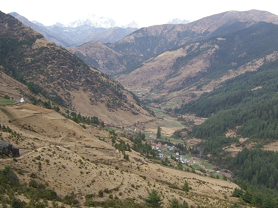
After a long rest during which we observe how the landlady does some haggling and business with a couple of travelling salesmen, we start the long descent towards Junbesi. This is an easy walk, first steeply down through a dense forest; afterwards almost level along beautiful meadows and through a few small villages. After more than two hours we spot the yellow-painted roof of the Junbesi gompa down in the valley before us. There's a Buddhist monastery (called Serlo) about 20 minutes before Junbesi itself, we rest there for a while and watch the young monks (and nuns, it seems? Strange…) play round after round of table tennis.
Finally, we grab our bags and hurry down to Junbesi, a big and pretty village with another old gompa, a secondary school and even a small museum. This must be our fifth or sixth visit and the village has changed quite a bit over the years. Many of the bigger lodges have closed nowadays, but most houses look at least as prosperous as they did sixteen years ago when we first came here. Many Sherpas will for the season walk up to Lukla or Namche Bazaaar and work as porters, guides or cooks. So if the tourists don't come to Junbesi, Junbesi will go after the tourists. We also meet the group of Nepalese back from Darjeeling; they started a bit earlier in Sete but we caught up with them because their rests are longer. Anyway, in such a landscape nobody's in any hurry.
We stay at the same lodge where we'd been in 2008 (actually in the same room); we're alone this time and that's a good thing because in 2008 there were two relatively old Czech couples with us and the two men were great snoring machines. With the paper-thin wood partitions between rooms, it wasn't exactly the best night we ever had in Junbesi…
We visit the gompa, of course, and the stupa at the village entrance. There's also a micro hydropower scheme down at the river (Junbesi was one of the first villages to get electricity) and since there's otherwise not a lot to do we stroll down there as well. It hasn't changed in these years, but sometime in the future they will have to enlarge this, as more and more power is needed: all villages nowadays want electricity — and if only for the ever more ubiquitous TV sets.
| The mountains slowly grow bigger! This is the view from the ridge up to the Lamjura La northwards. The white snow mountains at the far right are certainly higher than 6500m. | 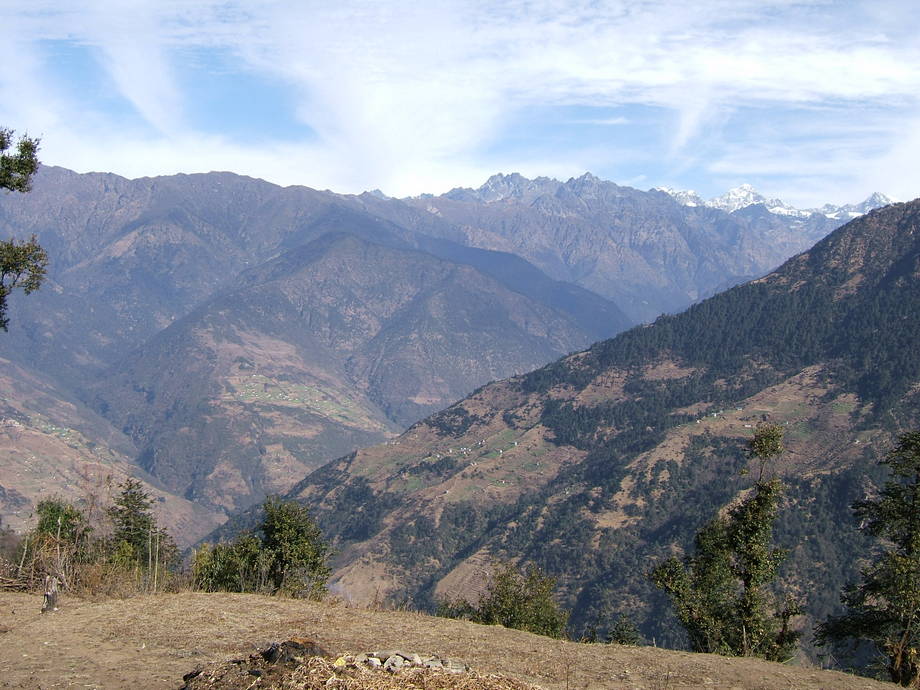 |
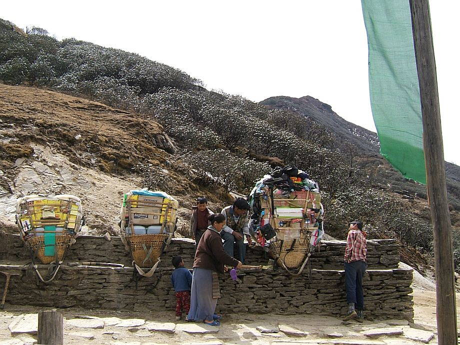 |
The landlady goes shopping. She haggled with the salesman for a very long time but in the end they could agree on a price, for shoes and flip-flops. The two loads to the left are actually carried up to Namche Bazaar by porters: the yellow boxes are instant noodle soup packs, while the grey jerrycans contain kerosene (this has to be carried in as transporting in a plane is too dangerous). Such a load will weigh between 70 and 80kg. Note the rhododendron bushes further up the slope. |
| This is the actual Lamjura La (3530m), only a few paces higher than the lodge we were resting at. Like all frequently visited high passes, it sports a huge cairn and long lines of prayer flags. | 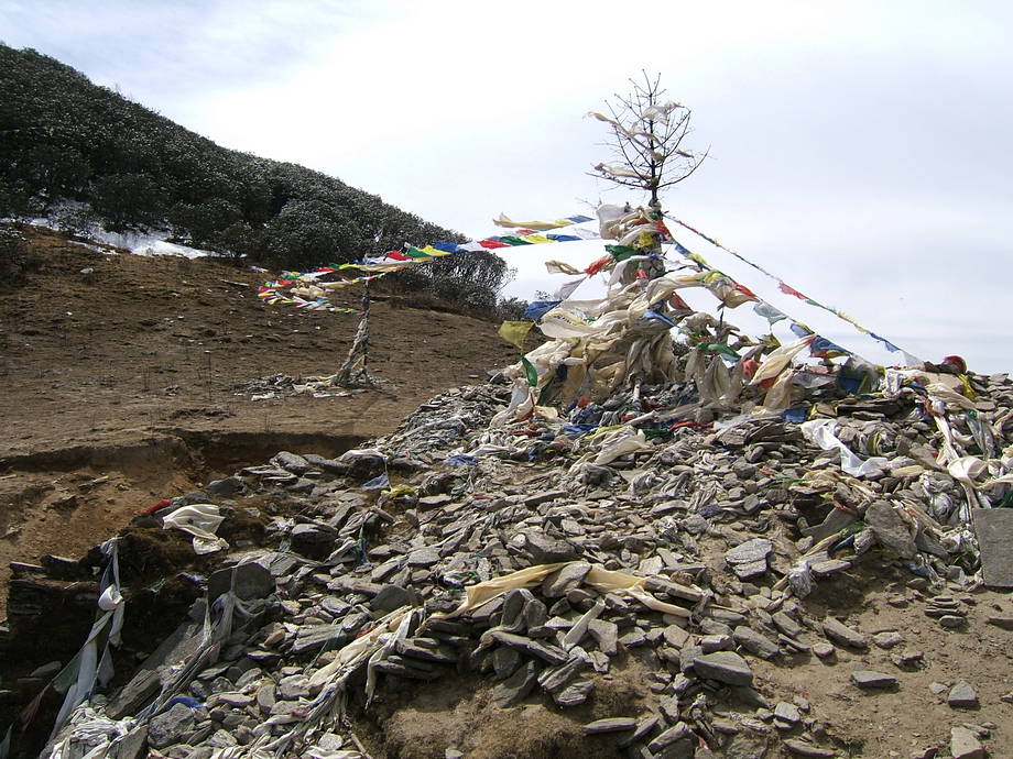 |
 |
On the way down to Junbesi. The forest is long behind us and the first houses of Junbesi have appeared. Note the whitewashed stupa on the left and the mountains in the background. |
| A view down from the gompa of Junbesi. Note the great stupa at the village entrance. In the middle of the picture is the school. During our 2003 visit the empty space was filled with hordes of young Maoist “cadres”, guns in hand, who were going through a fearsome and noisy drill. Nowadays it's back to silence or peacefully playing schoolchidren. | 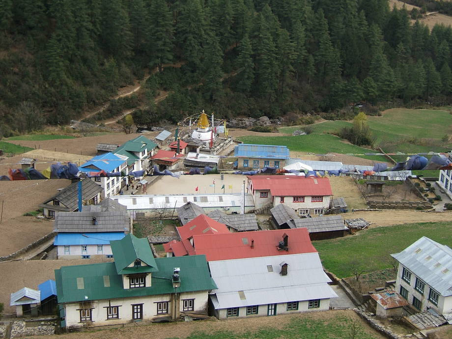 |
Go back to Everest Trek or forward to From Junbesi to Namche Bazaar.
$ updated from: Everest Trek.htxt Sun 24 May 2026 15:57:32 trvl2 — Copyright © 2026 Vero and Thomas Lauer unless otherwise stated | All rights reserved $