


The Gokyo Valley
(thomas;2010-Jul-15)
The Gokyo Valley (7 days, 21 Mar 2010 to 27 Mar 2010)
23 March: Daytrip around Gokyo: Fourth Lake, Frostbitten Fingers
24 March: Daytrip around Gokyo: Gokyo Ri
25 March: Gokyo to Lungden via Renjo La
27 March: Daytrip around Thame: Mingbo, Tarnga
See also:
- the panorama shots for the Gokyo Valley
- and the topographic map (based on Google Maps) for the Gokyo Valley
- or the next page: Kunde, Khumjung and ABC
21 March: Phortse to Na
From Phortse to Na: that's a long walk up the right (eastern) side of the Gokyo valley with panoramic views to the other side and glimpses of Cho Oyu and Gyachung Kang up valley. There are a few tiny settlements along the way, but this side of the Gokyo valley is not often travelled by tourists and locals alike. The main trail, from and to Namche, lies on the western side of the valley and almost during the whole day we can see it stretching far below us: the trekkers and their porters, as they slowly crawl up the slopes, look like colourful ants. However, the two sides of the valley are, as usual, separated by an extremely deep and steep rift: after leaving Phortse it's impossible to cross from one side to the other. Only shortly after Na, our destination for today, the terrain flattens out and there's a possibility to cross the river.
Our trail is a typical Nepalese affair: after the initial climb of around 600 vertical metres, we don't gain a lot of altitude but we're constantly going up or down. The distance between Phortse and Na, as the crow flies, isn't that great: a little more than eight kilometres. But there are a few landslides to negotiate and so many side valleys, some of them deeply-cut, that we will easily walk almost triple that distance. Still, the sun is shining, the sky's blue and we know we will have a great day of trekking ahead of us.
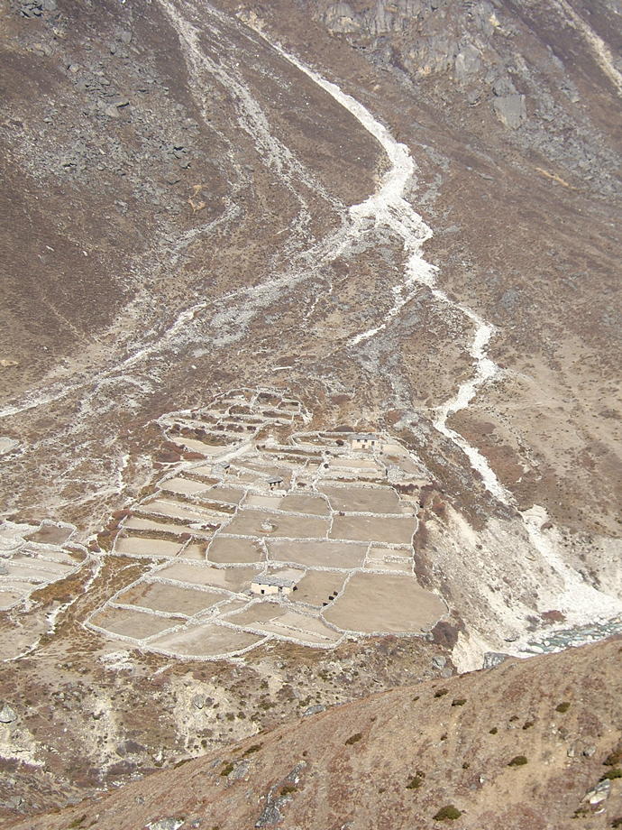
Na is a small village (really only a handful of dilapidated houses) below the huge end moraine of the Ngozumpa glacier. There's only one real lodge which, as we arrive, is still closed. No problem though: we stay with a young yakherd whom we already know from an earlier visit to Na. He has an extremely basic “lodge”: it's more a hut with a couple of old mattresses on the earthen floor to sleep on and his rather smoky kitchen to grab some food. But we don't complain: it's dry and relatively warm and his potato pancakes with loads of fresh homemade yakbutter (no other food is available, not even the otherwise ubiquitous rice and lentils) are steaming hot, thick and delicious.
Late in the afternoon, the landlord of the “real” lodge and his wife arrive: they are accompanied by a train of three hairy yaks, packed with tons of food stuffs, clinking pots and pans, stacks of rolled-up mattresses and thick Chinese blankets. We stroll over for some small talk and watch them unloading their animals. They seem to view us as their first customers of the season but we're quite happy to be with our rustic yakherd and his cosy, if smoky kitchen.
| A view back towards the houses of Phortse. | 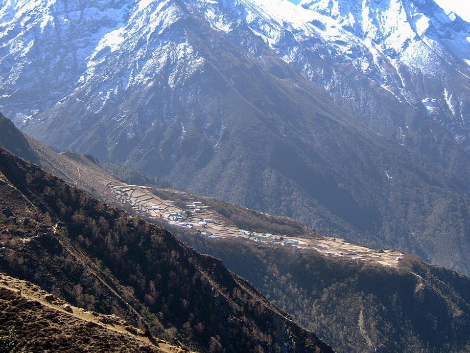 |
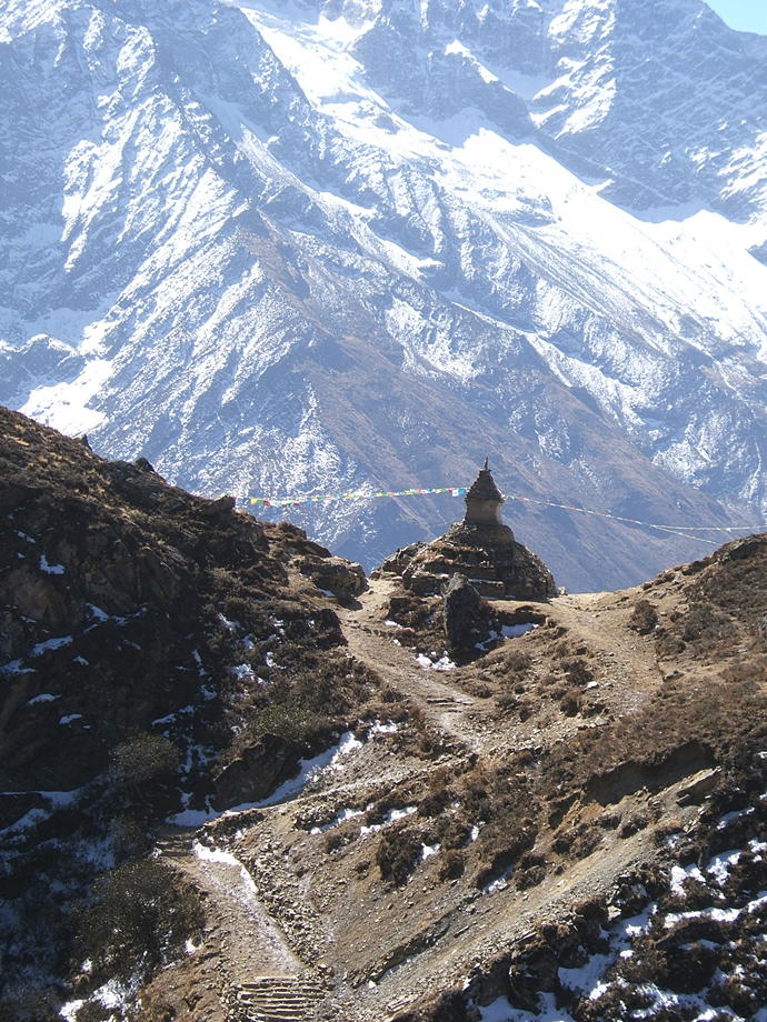 |
One of a few prominent stupas along the way. |
| The left (western) side of the Gokyo valley. The path coming up from Namche and leading to Gokyo is clearly visible. The houses are the lodges of Dole (at an altitude of around 4000m). | 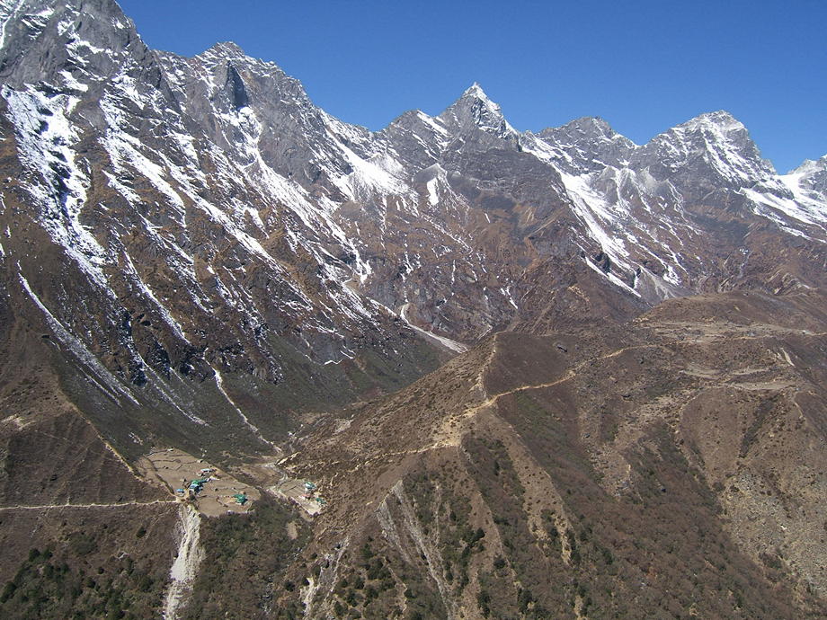 |
 |
The vista up valley. The big mountain towards the right edge is Cho Oyu. The path on the left side of the valley is also visible, as a thin line, near the left edge. |
| The inside of our “lodge” in Na. The shiny black stuff on the walls and ceiling is a solid layer of soot. | 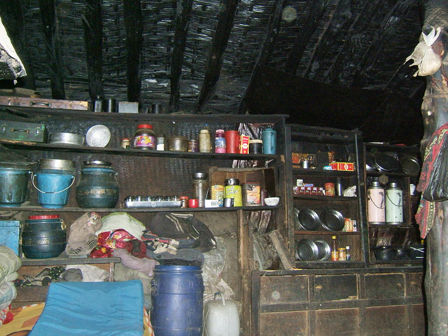 |
22 March: Na to Gokyo
A short day today: from Na (at around 4400m) up to Gokyo, around two hours solid walking or three leisurely. We first cross the river over a rather shaky bridge, scramble up to the main ridge and then follow the steady stream of yaks, trekkers and porters. In comparison to yesterday, this side of the valley resembles a motorway: the paths are broad and well-trodden. We steadily win height and, as we already have been above 5000m for a few days, we don't have any problems with the altitude. Many others, coming up from Namche, though do and we commiserate with a group of people who think they just can't go on. As ever, a few minutes of rest, and they feel a lot better.
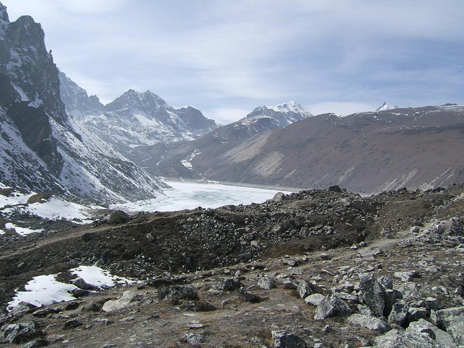
We pass the First and then the Second Lake, both on the left-hand (western) side of the trail. To the right the mighty side moraine of the Ngozumpa glacier rises and rises. It is a wild, desolate and yet profoundly beautiful landscape. The lodges of Gokyo are located near the Third Lake and there are another two big lakes further up the valley. The whole culminates in an area called Six Lakes: an otherworldly spot where a collection of small lakes and icy ridges nestles below the immense south wall of Cho Oyu whose summit towers another 3000m above the valley floor. We've already been up there twice: the Six Lakes area is one of the most remote bits of the upper Khumbu and we always wonder where all the people in the lodges go.
We arrive in Gokyo early enough to secure a half-decent room: Gokyo, together with Lobuche, is a bottleneck because it's the head of the valley and most people stay at least for two days. This situation is neither helped by the many groups which send a racing porter ahead to reserve dozens of rooms in one go, nor by the lodge owners who prefer to wait with giving away their available rooms as long as they possibly can.
Alas, shortly after noon the clouds which have threatened us the whole morning from down-valley start to roll in in earnest. Nevertheless, we start the sweaty trek up Gokyo Ri, a steep brown hill which rises about 700m above the lodges of Gokyo and offers, if not in the clouds, what we think is one of the most expansive panoramas the Khumbu has to offer. In one broad sweep of 180 degrees, you can take in five of the 15 highest mountains in the world: Mt Everest (1st), Lhotse (4th), Makalu (5th), Cho Oyu (6th) and Gyachung Kang (15th).
As we arrive, the top of Gokyo Ri, with its strings of prayer flags, is completely devoid of people. Fortunately, up here the clouds have thinned considerably and although we never get all the five great mountains together in a single view, there are enough breaks and gaps in the drifting, shifting clouds that sooner or later, we get them all. Funnily enough, behind us, towards the west, the sky is clear and cold and of a deep-blue colour. We stay for about an hour up there but slowly the cold gets us and we decide to return to the lodges and some warmth.
| On top of Gokyo Ri… and the clouds have arrived as well: view southwards. | 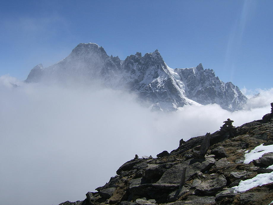 |
 |
Same spot, view to the north: not much better. |
| And yet… a little patience goes a long way: a sudden hole in the clouds shows that Everest is still somewhere out there. We really gotta return up here when the weather is better;-). | 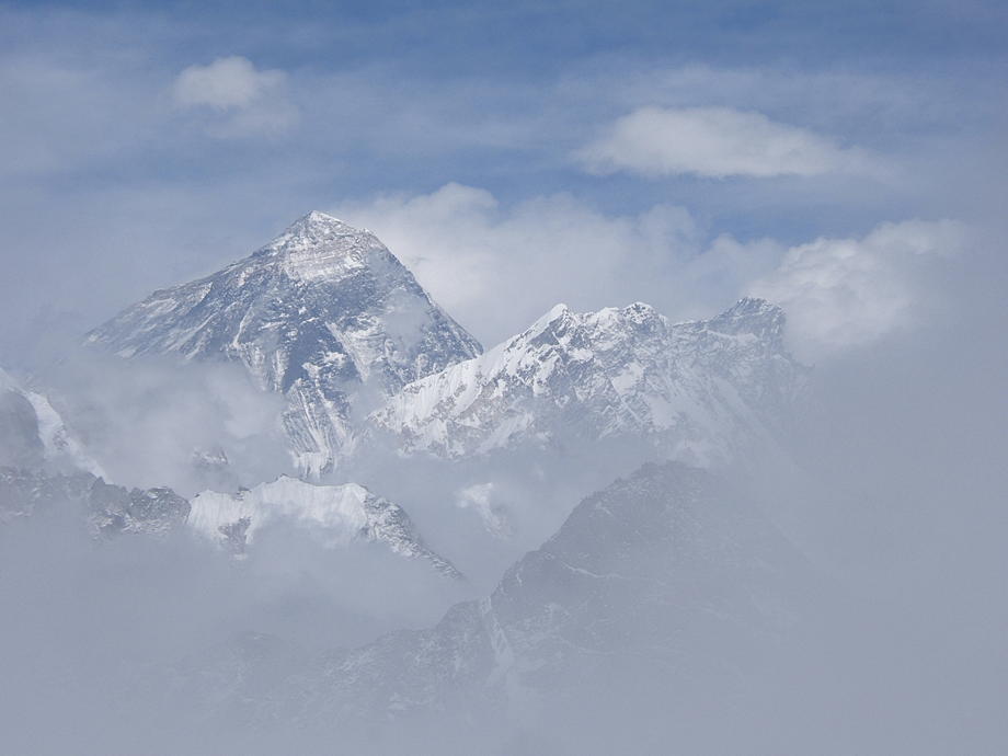 |
23 March: Daytrip around Gokyo: Fourth Lake, Frostbitten Fingers
Gokyo is one of the best places in the Khumbu to explore high places. There are at least three or four possible destinations for long and satisfying day trips: the most well-known is perhaps the Six Lakes area, where we had been already twice in previous years. Another is the Renjo La, a high pass with fabulous view towards Everest and down the Thame valley on the other side: however, this will be our escape route in two days' time.
A third possibility is a modest outcrop to the north, slightly further than the Fourth Lake, crowned by a couple of dark-brown rocky columns. This is called Frostbitten Fingers (ominous name if there ever was one). Its highest point is at 5800m but normally people only scramble up to about 5600m, because the fingers themselves are real climbing territory. Even getting to 5600m is no picnic: the last hundred vertical metres or so require climbing over huge boulders and there's always a possibility of slipping or falling into the void between two rocks.
We start early because the walking can be hard up there and the afternoons cold. There's some snow on the ground early on; further up it will be even worse. The first bit of trail-finding is easy: left is a high ridge and right is the steep side moraine of the Ngozumpa glacier. But after a while the terrain gets more difficult, up and down, and more up and down, very much like crossing a glacier. There's no discernible trail anymore; anyway, with the snow at places almost knee-deep now, we couldn't follow a trail in the first place.
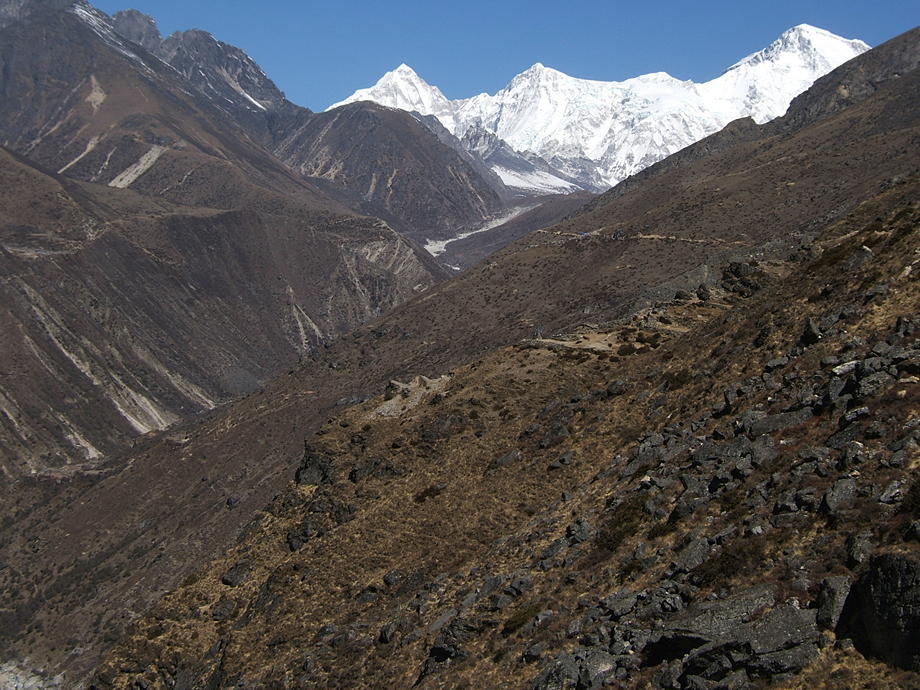
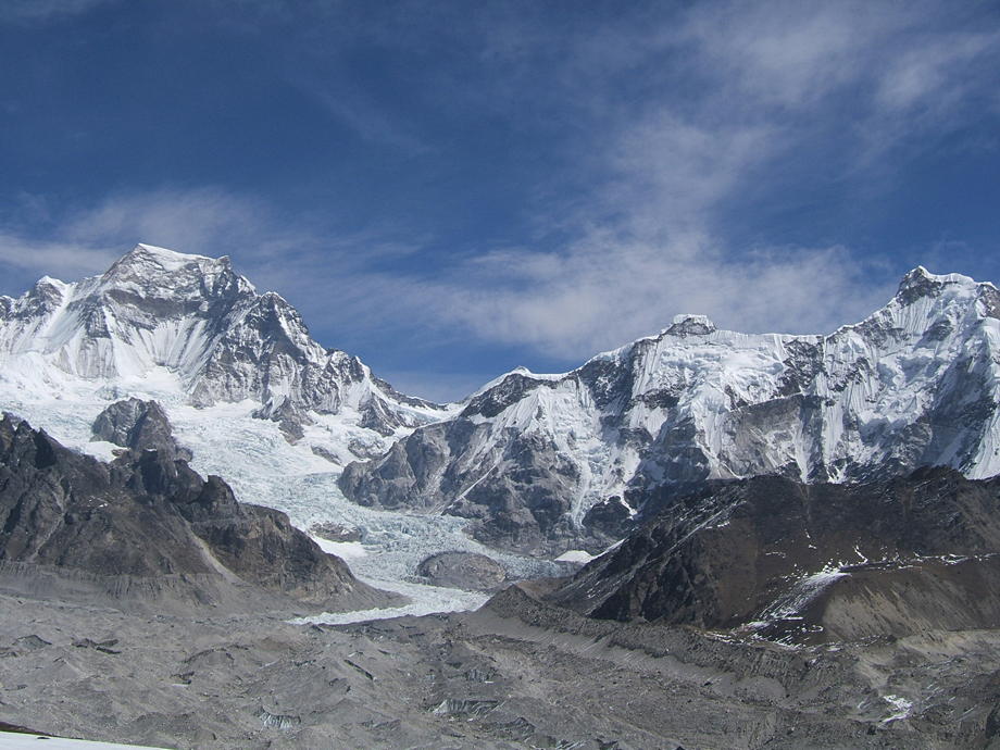
We traverse that rough patch as good as we can (and with many a curse muttered under our breath) and finally arrive at the shores of the Fourth Lake. The lake is partly frozen and there are some duck-like birds walking proudly on the ice sheet. Here, we turn left and start walking up the hill in a broad, sweeping curve. After a while we turn right and see the fingers slowly rising above us while the lake and the valley floor fall back. Everest and then Lhotse come into view and though it's rather cold we huff and puff our way to the line where the field of great boulders starts. Another push upwards and we finally get to a point where it gets too steep for comfort. The views from here are out of this world: the north wall of Everest is plainly visible and the wall between Cho Oyu and Gyachung Kang, with its hanging glaciers and the great flows of ice which all contribute to the giant Ngozumpa glacier (the largest glacier in Nepal, some even say in the whole Himalayas).
We take a long rest before slowly trundling downwards and back to the Fourth Lake. The weather, as often hereabouts, deteriorates after 3pm: it gets cloudy and windy and very cold and we're glad to arrive at the warm lodges of Gokyo.
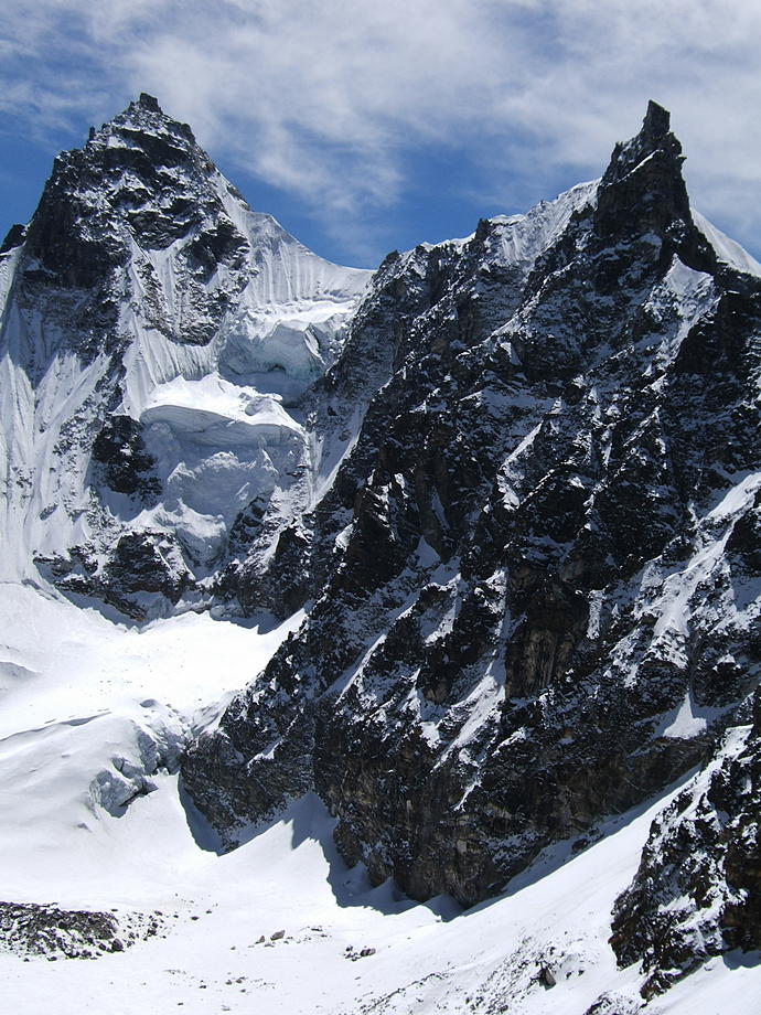
| At the shore of the Fourth Lake, the head of the Gokyo valley in front. Left is Cho Oyu, right Gyachung Kang, both are connected by a wall of rock and ice that is barely lower than 8000m. | 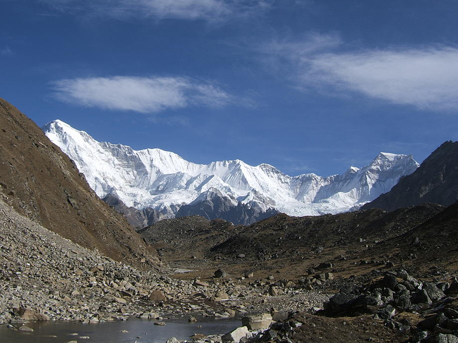 |
 |
Sitting on Frostbitten Fingers, a view towards Gyachung Kang and the glaciers flowing down from its southern wall. |
| Mt Everest. This is perhaps the best view of the northern flank to be had from inside Nepal. | 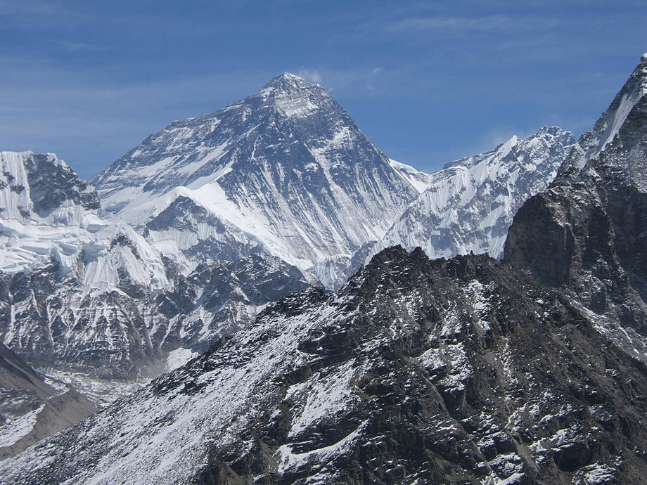 |
 |
View down- and southwards to the Fourth Lake. |
24 March: Daytrip around Gokyo: Gokyo Ri
Our third day in Gokyo and with it another chance to do a daytrip: over breakfast we discuss whether to go up-valley to the Six Lakes area (a full day and a strenuous trip to boot but with unbelievable views) or up Gokyo Ri (not very hard, also very nice views). Today promises to be a perfect day for a viewpoint: blue sky, not a single cloud in sight. So we decide to be lazy gits and to climb Gokyo Ri, with the idea to stay there for as long as the weather remains so warm and sunny.
We very leisurely walk up the steep hill, pausing often so as not to get into a sweat and admiring the ever-changing views. When we arrive on top it's not very crowded, but still we move as far north as we can. The summit of Gokyo Ri forms a long plateau with many boulders and smaller rocks, all connected with dozens, if not hundreds, of prayer flags. Some of those must be close to ten years old: the colours are almost faded and the fabric is thin and is easily ripped.
Today we can thoroughly survey and savour the views from Cho Oyu in the north to Everest and Lhotse in the east and all the way down to Thamserku in the south. We spend almost the whole day up there in the sun and admire the scenery: incredible views and perhaps the best day in the Khumbu so far.
At about 3pm, still in glorious sunshine, we finally start to walk back, very slowly. After 15 minutes, Thomas sees a nice slab of rock protruding from the flank of the hill: flat and empty and crying to have a cairn on it. Thomas very much likes building cairns, so he grabs a couple of flat, heavy stones and staggers aboard the slab with them. Vero, his ever-faithful assistant, assembles further loads of building material and so the two uf us build a comely cairn, up there in the void.
Back in the lodge at around 5pm, perfect for a hot lemon tea.
| A close-up of Mt Everest from the top of Gokyo Ri. The flat area and small summit to the right of the main summit is the South Summit, almost exactly 100m below the top. The lighter-coloured band below is the famous Yellow Band. | 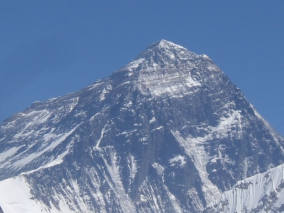 |
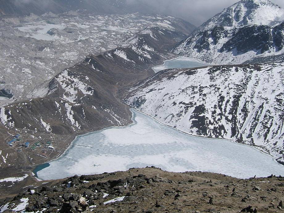 |
The Third and Second Lakes and the lodges of Gokyo nestling below Ngozumpa glacier. |
| Thomas erects a cairn on a promontory. This shot gives the false impression that he is dangerously balancing above the abyss: in reality, the scene was much less dramatic. | 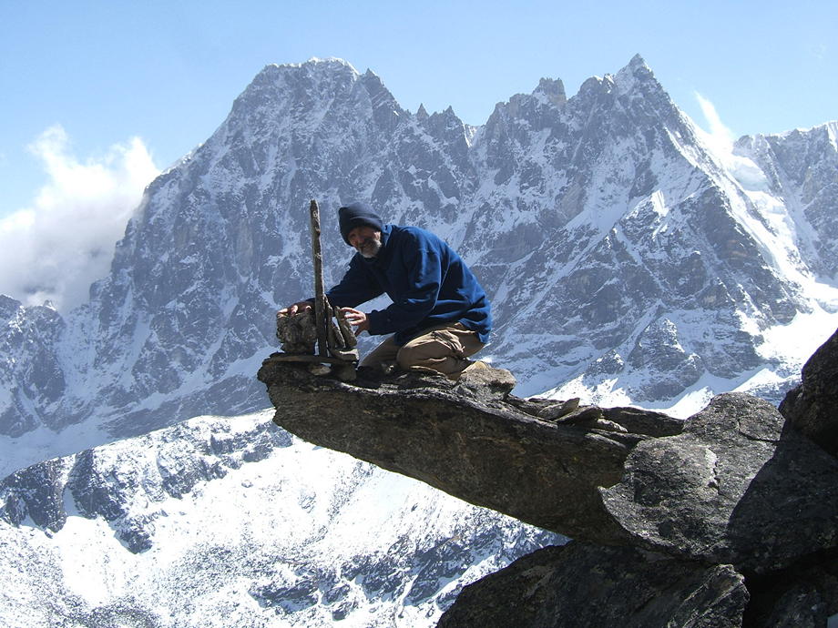 |
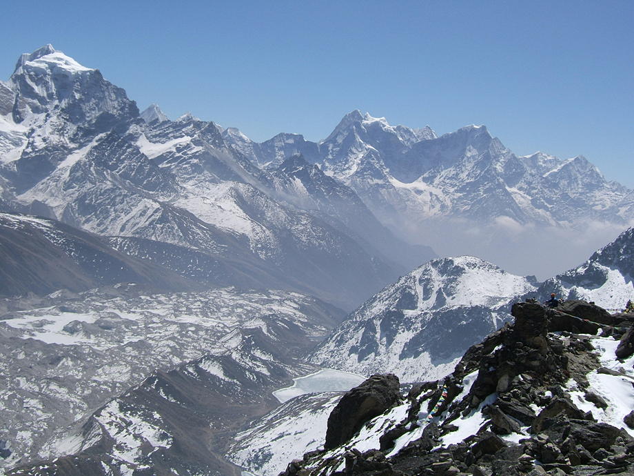 |
The view to the south. The bulk to the left, across the glacier, is Taboche; further to the right, Kang Tega (the Horse Saddle) and Thamserku are also clearly visible. |
25 March: Gokyo to Lungden via Renjo La
Bye-bye to the Gokyo valley: the plan for today is to cross over the Renjo La, a high pass of 5417m, into the next great valley to the west. This valley leads up to the Nangpa La, a pass to the north that in turn crosses into Tibet. This was much used in the past by Tibetan refugees fleeing to Nepal. These days, it's still mostly Tibetans who cross, but nowadays they (or rather their yaks) carry huge Chinese-produced flatscreen TVs to Namche Bazaar (every lodge in and around Namche has one of these, even if the owners sometimes don't know how to use it).
We start early as we know from earlier crossings that it's a good three hours' hard work to lug ourselves and the backpacks up to the pass. There's quite some snow and even ice on the trails; shortly below the pass the trail disappears completely in the knee-deep snow and we have to rely on the little we remember from our earlier trips. But we finally make it up in one piece, hot and sweaty and out of breath. We're alone on the top which feels a bit strange as normally there are some other parties, even big groups, doing the crossing, in both directions.
Mt Everest and the other usual suspects are of course there in all their glory: as we are now even farther away from the great mountain and about the same height as on Gokyo Ri the views are perhaps even more expansive.
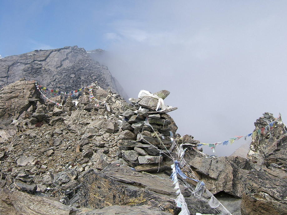
We rest for a good while as the hardest part for today is now behind (and below) us: the walk down to Lungden, a tiny herders' village, is long but easy. After a while, we hear someone wheezing up on the Thame side of the pass: it's an old man, a local of tiny build, who gravely nods at us but doesn't say a word. Instead he slowly climbs further up into the rocks above the pass. We wonder what he'll do up there; it turns out that he checks and, if necessary, reties the strings which attach the multitude of prayer flags to the rocks.
When he's back we ask him why he did that and he smiles and says in broken English that he's sort of an inspector for prayer flags. He comes up every couple of weeks from his village to perform this sacred duty (a full day for the return trip). We ask about his village and he tells us it's a small place called Mingbo. That's funny because we are thinking of doing a day trip, a loop from Thame into the Langmoche valley and to Mingbo, later that week.
Twenty minutes later the old man says his good-byes and starts the long journey back. We also prepare our packs and slowly follow him.
The Thame side of the pass is a rather steep rock wall often covered with sheets of hard ice, making it not altogether easy to negotiate. Fortunately, this time the ground is mostly clear. Strange, as the other side was completely snowed under. The views are amazing all round and the weather seems to hold, so it looks as if there's a rather pleasant afternoon walk in store for us. We have crossed this pass already twice and in both cases, the afternoon turned foggy and cold. First time round, we were actually quite lucky to locate the village of Lungden, as we had no very clear idea where we (or it) were!
Today, by contrast, route finding is a doddle and we are in Lungden quite early. We stay at the first lodge we encounter as we know that all lodges here are basic and rough. Well, as long as the dal bhat is filling and tasty… who cares!
A very perfunctory wash with a bowl of ice-cold water, a stroll around the village (no more than half a dozen scattered houses, a few hairy yaks grazing here and there and many partly dug-up fields, as the potato planting now gets underway) and another satisfying day is gone.
| A final look back from Renjo La to Mt Everest, Lhotse and Makalu. | 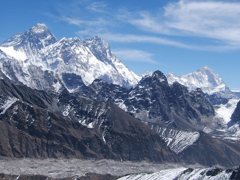 |
 |
Isn't that a nice picnic spot, below those hanging glaciers…? |
| The twin mountains of Cholatse (left) and Taboche (right). These are not giants like Everest or Cho Oyu but we like them nevertheless. | 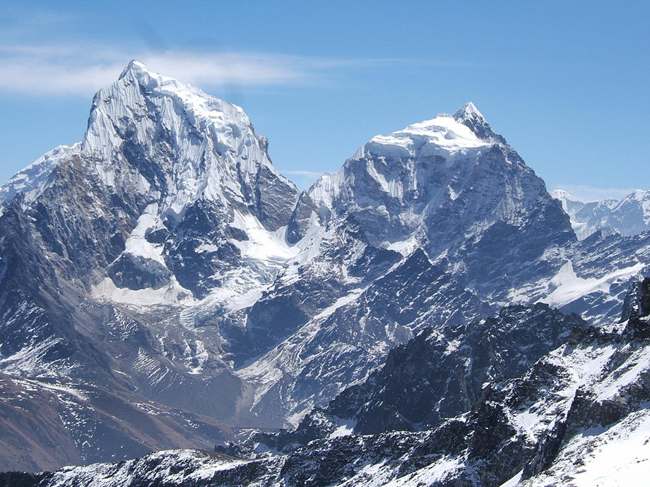 |
 |
The Third Lake and the lodges of Gokyo. |
26 March: Lungden to Thame
An easy day ahead: we will be strolling down from Lungden to the substantial village of Thame, the main centre in this, the western-most, valley in the Khumbu region.It is clear and freezing cold when we start but we can already see the first wisps of clouds making their appearance far down-valley.
The path is broad and easy to follow: many yaks with their Tibetan drivers have already trodden here. Actually, there's a decent chance that we might run into Tibetans as the trade between eastern Nepal and China has significantly picked up during the last decade. These Tibetans are a bunch of wild-looking guys, with their long jet-black hair wound around the head, jauntily intertwined with a bright red scarf. But they are of a rough, almost childlike friendliness.
En route, we pass a few small villages where the potato planting has already started, with groups of men and women working the fields: one, with a couple of quick movements, hacks a shallow hole into the ground, the other throws in a tiny potato. Then they move a metre down the line and repeat… all day long. Potatoes have long been a mainstay of the Khumbu diet as not many vegetables are hardy enough to survive at this altitude.
We arrive in Thame in the early afternoon and, after locating a lodge, walk up to the local gompa which is quite famous in the Khumbu. This gompa, together with the lower fields of Phortse, is one of the best places in the Khumbu to spot Danphe, the Nepalese national bird. There are always a few around somewhere in the terraced fields below the gompa although it's not easy to spot the colourful male bird. We have a lot of time at our hands, so we just sit there on the terrace of the gompa, watch the young monks scurrying around, and keep surveying the fields below. Sooner or later, one of the birds will make its appearance.
Later, a few tourist groups, probably on an acclimatisation trip from Namche, arrive, slightly disturbing the quiet of the gompa with their noisy chatter and their incessant photographing. Occasionally, we have a strong impression that these people will only really examine and cherish what they have seen once they are back home: then they will be able to savour these things with a tranquility they apparently can't afford now.
We stroll back to the village and Vero, after many days of self-denial, takes the opportunity to wash her hair in the warm afternoon sunshine (further up it's simply too cold for that).
| Early morning view of the Thame valley below Lungden. | 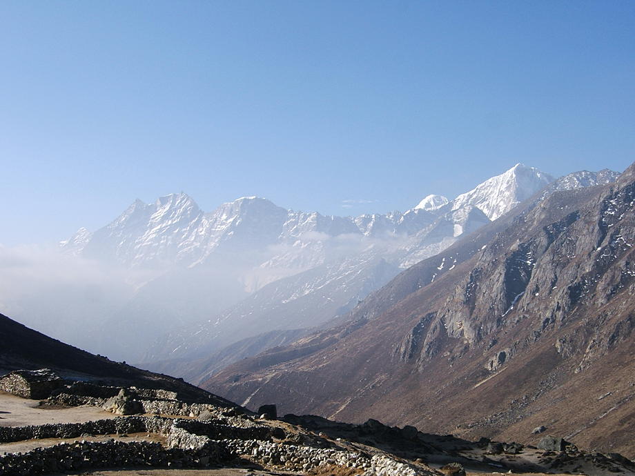 |
 |
A yersa. Yersas are summer meadows where the yaks and other animals are brought up for the season. |
| The gompa of Thame. | 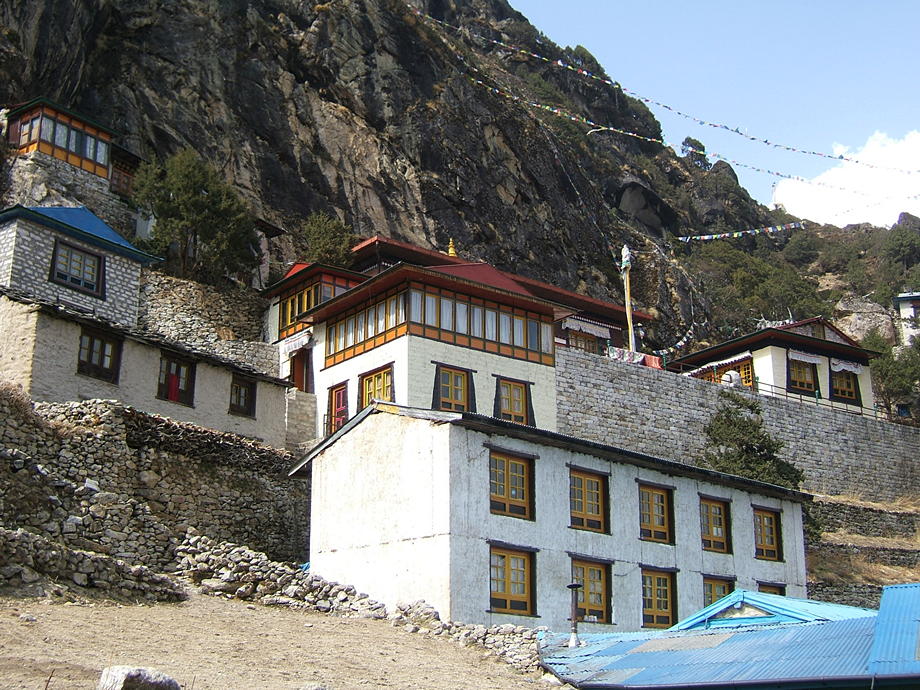 |
 |
View from the gompa towards the fields (mostly potato) of Thame. |
27 March: Daytrip around Thame: Mingbo, Tarnga
Fine weather, as usual, and in store is a leisurely daytrip around Thame. We could either “go west”, towards the difficult high pass of Trashi Laptsa which leads over to the Rolwaling area, or we could visit the Langmoche area, next side valley up from Thame. We already have done the Trashi Laptsa route twice in the past, so we decide to do a big loop: first across the ridges into the Langmoche valley, then crossing the Nanggpo river (the main river in the Thame valley which later, with the Imja Khola coming from Mt Everest, forms the Dudh Kosi) and then back again on the left side on the valley (the main trekking trail is on the right side).
Route-finding is not obvious as we (try to) cross the intervening ridges more or less as the crow flies, but fortunately this is all grazing territory and there are many tiny yaks trails cut into the steep hillsides (without the yaks, of course!). It also helps that we have a first-rate topographic map of the Khumbu region. We slowly huff and puff our way up to about 4200m. There's nothing here save the yak trails in the hardy grass and the occasional perennial bush clinging to the hard, dry soil. At long last we reach a sort of pass and there's even a small hut, probably used by local yak herders. A thin trail makes its appearance as well and now the walking gets significantly easier.
After a while the landscape widens and almost the whole of the Langmoche valley appears in front of us. The other (northern) side of the valley, with the small village of Mingbo just visible, is deeply scarred by huge landslides: these are the results of a glacial lake, further up the valley, which burst and flooded the lower part of the Langmoche valley and everything below that. These GLOFs (“glacial lake outburst flood”) are a constant threat in the high Himalayas; the walls of water and debris can destroy whole villages and huge swathes of arable land.
This devastating GLOF happened in August 1985 when the Dig Tsho burst and produced a sort of tsunami-in-the-mountains: the huge wave ripped big chunks off the valley walls and even swept away some houses in Mingbo. Today, the remaining houses balance precariously close to the abyss.
We continue up-valley and presently, we can see very similar scars appearing on our side: sudden holes and steep, almost cliff-like falls. There are a few more tiny villages further up the valley and at one, we rest for a while in the sun. Then we climb down to the river, cross the river bed, full of pebbles, and laboriously scramble up the other side. The houses of Mingbo, perhaps a dozen, are almost all empty: most people are gone for good and the few remaining ones are working their fields. At the other end of the village we find a house with a few people in and around and further down, in a field close to the landslide, we spot the old man whom we had met on top of Renjo La: the inspector of prayer flags. We walk down for a chat and he instantly recognises us. He talks a little about the devastating flood of '85 and its consequences but sadly, his English and our Nepalese are just not good enough for that type of discussion.
Later we continue across another ridge and walk a bit further north, to the substantial village of Tarnga. There are wide, fertile plains here and quite a few people are in the fields, planting potatoes. We make our way to the river and once or twice get to talk to the farmers. They show us how, during the previous autumn, they have dug deep holes into the ground (more than 2m deep), filled them with sackloads of seed potatoes for the next season and then closed them for the winter. Now these holes are all open again (gaping wide, some) and the locals ferry the loads all over the place, for planting. Many potatoes grown here finally land on the plates of Everest hopefuls in their high camps!
We finally cross the big river and slowly amble down towards Thame, always in the shadow of some high cliff or hanging boulder: a harsh, profoundly beautiful land but also one full of extraordinary dangers.
| A farm house in Mingbo, as they used to be built in the old days before the arrival of corrugated iron and cement. | 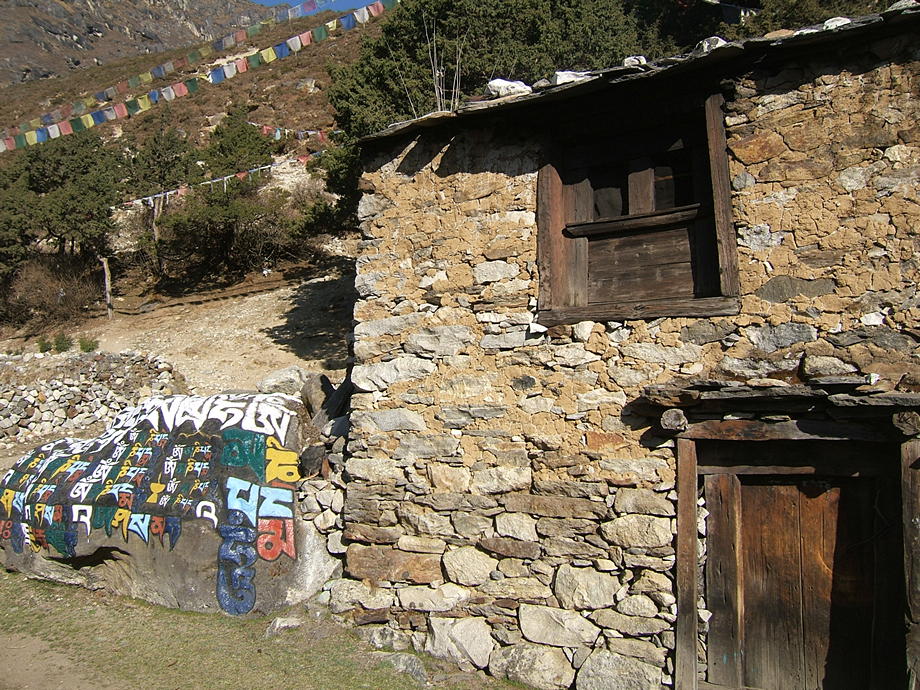 |
 |
Too much hard work or too much liquor? Who knows… |
| Tarnga: a typical high-altitude village in the upper Thame valley. These villages are a million miles from Namche. | 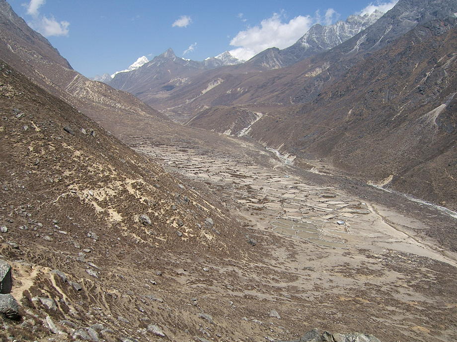 |
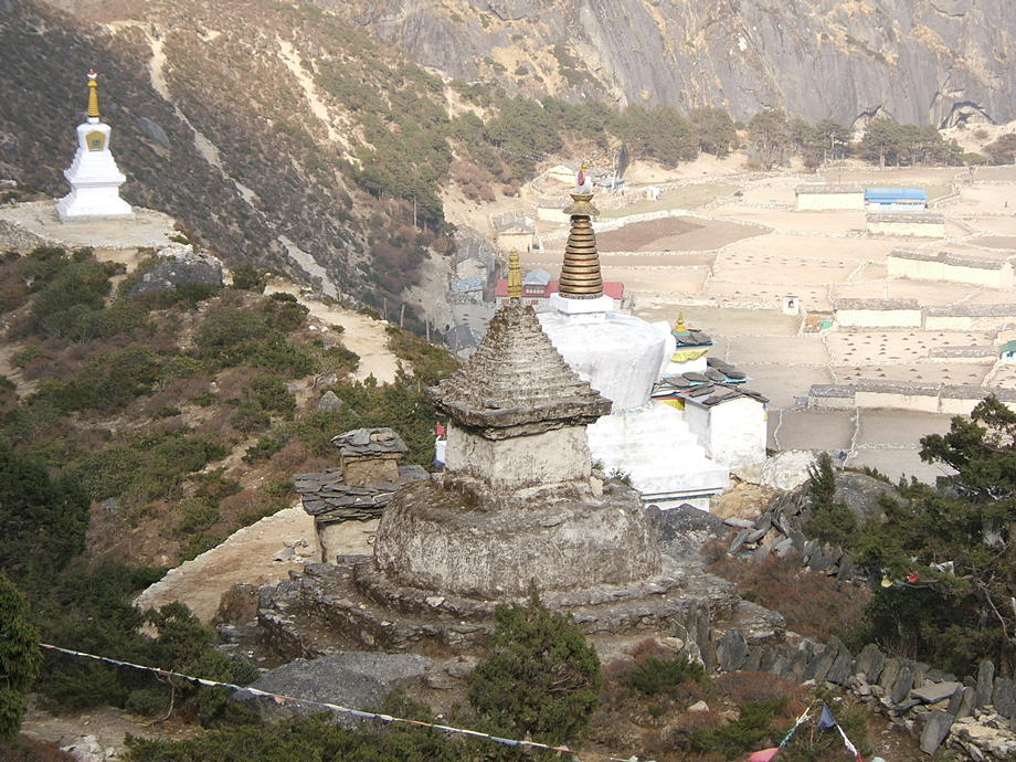
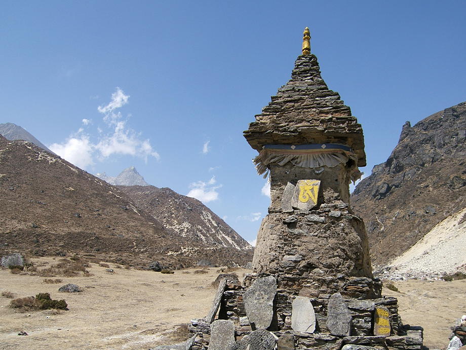 |
The whole show: stupa, mani wall and prayer tablets. |
Go back to The Lobuche Valley or forward to Kunde, Khumjung and ABC.
$ updated from: Everest Trek.htxt Sun 24 May 2026 15:57:32 trvl2 — Copyright © 2026 Vero and Thomas Lauer unless otherwise stated | All rights reserved $