


Panoramas 2010 Lobuche Valley
(thomas;2010-Jul-13)
The Lobuche Valley: Dingboche and Kala Pattar (8 panoramas)
(Clicking on a panorama will open a larger version in a separate tab.)
This page shows our slow progress from Namche towards the Lobuche valley and Kata Pattar (this is one of two hills with famous views, the other being Gokyo Ri: see next page). Our progress was slow because we had still to acclimatise; the village of Dingboche is at 4400m and Kala Pattar is about 5600m high.
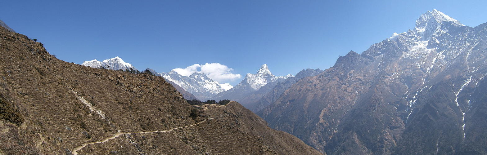
| This shows a famous view above Namche, towards Mt Everest (8848m) and the Lhotse south wall. The path in the foreground leads to the Everest View Hotel, an eye-wateringly expensive Japanese-built hotel where the rooms sport amazing views and oxygen bottles. Everest is the small dark triangle with the clouds streaming off (below the red dot); Lhotse (8516m) is partly hidden in these clouds. The impressive mountain further to the right, below the blue dot, is Ama Dablam (6812m). |
 |
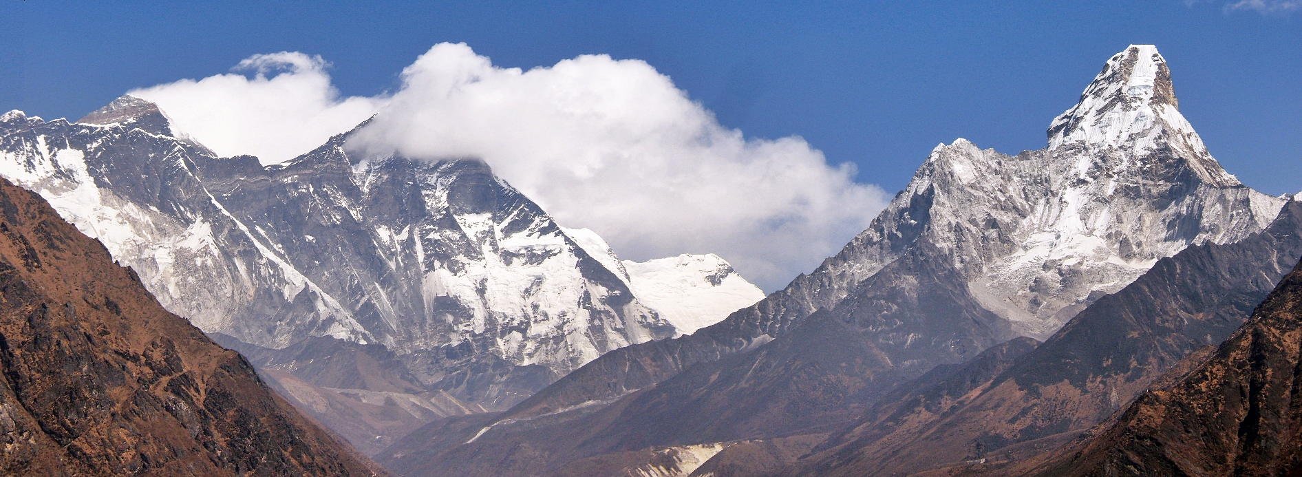
| Very similar scene, but nearer to the action. The summit of Everest is now clearly visible as it peeks over the connecting wall between Nuptse and Lhotse. The latter is in the clouds, as always at this time of day. Ama Dablam is her usual perfect self. Note the brown-grey valleys in the lower third of the picture: this is where we are heading. These valleys, just to give you an idea about the scale of things, are about 4000 to 5000 metres above sea level. From their top level, the Lhotse wall rises another 3.5km in about 2.3 horizontal km: the steepest mountain wall of this size in the world. |
 |
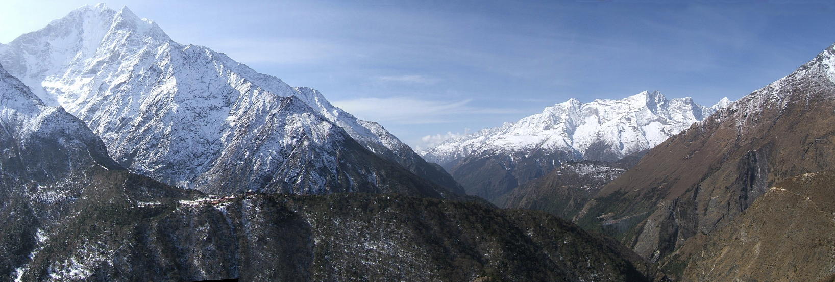
| This is a view back from the high trail between Phortse and Pangboche. The big white mountain to the left is called Thamserku (6608m); the impressive chain to the right in the background is Kongde Ri. Tengboche monastery is just about visible on the spur in the foreground (below the red dot). Namche Bazaar is down valley but not visible from here. |
 |
| This amazing panorama was shot from a peak above the village of Dingboche. Dingboche (4400m) is an important acclimatisation stop; we normally stay there for two nights. The second day is always spent with some acclimatisation trip. This time we went up Nangkartshang, a small peak of 5100m above the village. Everest is not visible from there but many other mountains are: Kang Tega (6782m, red dot), Thamserku (blue), Kongde Ri (red), Taboche, the “hausberg” of Pangboche (6542m, blue) and finally Cholatse (6440m, again red). |
 |
| This shot was taken on the way up to Lobuche, somewhere above Dingboche. It shows the upper valley of the Imja Khola, the rivulet coming from the Khumbu glacier (that's the huge glacier originating in the Western Cwm, the high valley below Everest and Lhotse). Taboche is the bulky mountain to the left and Cholatse is the next to the right. The snowed-over lake in front of Cholatse is the Chola Tsho (4533m), on the way up to the Chola pass which links the Lobuche and Gokyo valleys. |
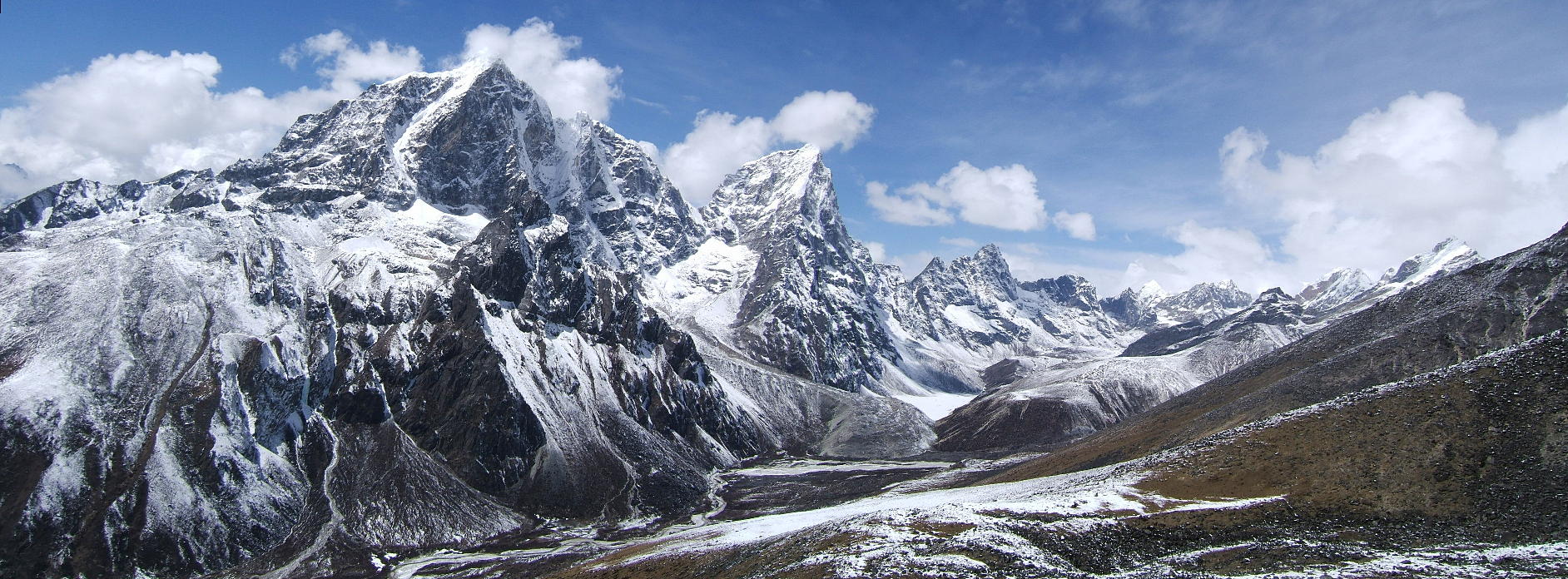 |
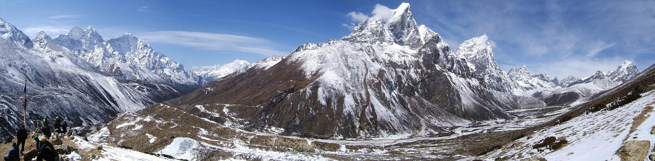
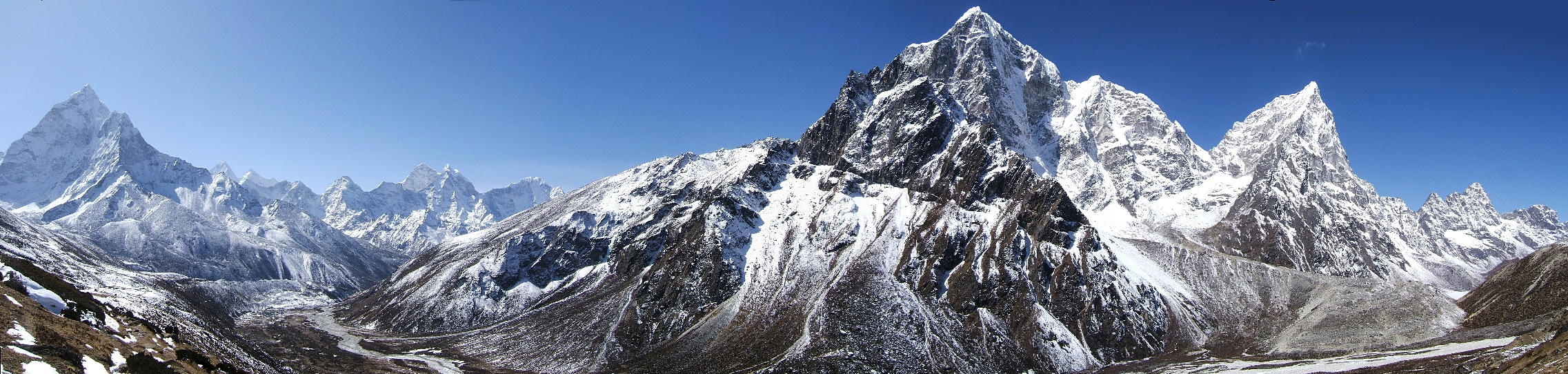
| Same day, but a couple hours later. We are now nearing Dughla, a small collection of lodges. The usual suspects, Taboche and Cholatse, are dominating the foreground. To the far left, however, there's a quite unusual view of Ama Dablam. And squeezed in between Ama Dablam and Taboche are Kang Tega and Thamserku. |
 |
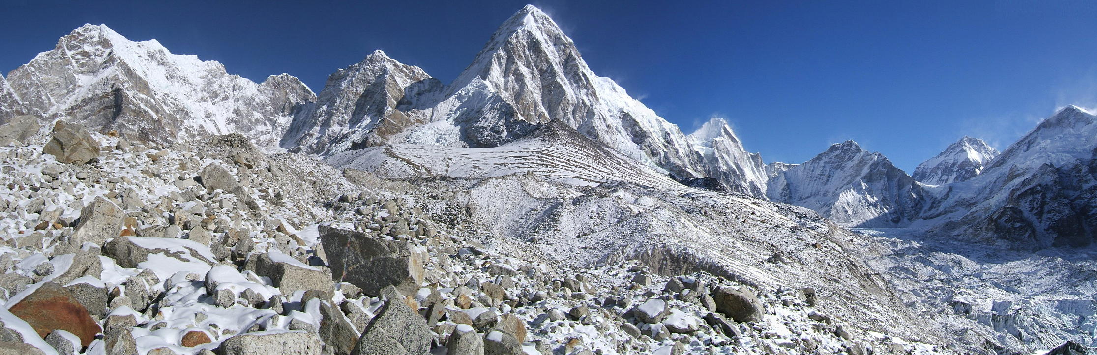
| Next day and we have just struggled to almost the top of Kala Pattar (about 5600m), accompanied by a punishing head wind. In fact, it was so cold and windy that we didn't bother with taking too many photographs (and Everest was partly in the clouds anyway). This shot shows Pumo Ri (7145m), the mountain rising behind Kala Pattar (indeed, Kala Pattar is a mere small bump on the south ridge of Pumo Ri). This whole chain of mountains forms the boundary between Nepal and Tibet. The peak below the red dot actually lies in Tibet: this is the Changtse (7550m), the northern neighbour of Everest. In front of this mountain is the Lho La (6006m), the pass from which Mallory, in 1921, first saw what he later would call the Western Cwm. And in front of the Lho La stretches the Khumbu glacier, flowing down from that very same Western Cwm. Everest Base Camp (about 5400m), though not visible here, is not far away from the Lho La. No photo — or set of photos — can ever do justice to this out-of-the-world scenery. |
 |
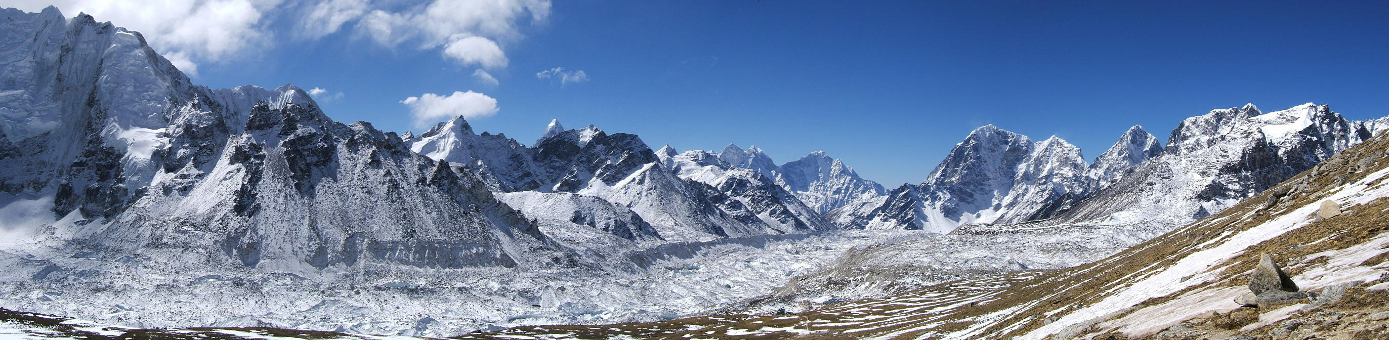
| Same spot, just a few seconds later and a few degrees colder: this is a shot towards the south, ie where we had come from. Beside the mountains, the dominating feature here is the majestic stream of the Khumbu glacier as it flows down with its usual glacial speed. It was so cold up there that we hurried down as fast as we could: the identification of the mountains is left as an exercise for the reader. |
 |
Go to Panoramas 2010 Gokyo Valley or up to Panoramas 2010.
$ updated from: Panoramas 2010.htxt Sun 24 May 2026 15:57:32 trvl2 — Copyright © 2026 Vero and Thomas Lauer unless otherwise stated | All rights reserved $