


From Junbesi to Namche Bazaar
(thomas;2010-Jul-15)
From Junbesi to Namche Bazaar (6 days, 07 Mar 2010 to 12 Mar 2010)
07 March: Junbesi to Trakshindo La
08 March: Trakshindo La to Kharikhola via Nuntala
09 March: Kharikhola to Puiyan via Bupsa
10 March: Puiyan to Chaunrikharka via Surke
11 March: Chaunrikharka to Jorsalle via Phakding and Rimijung
12 March: Jorsalle to Namche Bazaar
See also:
- the panorama shots for the walk-in
- and the topographic map (based on Google Maps) for the second part of the walk-in
- or the next page: The Lobuche Valley
07 March: Junbesi to Trakshindo La
The day-long walk from Junbesi to the Trakshindo La (the last high pass before reaching the Khumbu region) is another great Himalayan classic. For the first part, the trail contours a hill, offering amazing sights to the mountains in the north, the west (direction Lamjura La, which we've crossed yesterday, and Pike Peak) and down the valley to the south. Most of the time, the trail stays a few hundred metres above the valley floor, so it's another of those incredible balcony walks.
After about two hours of leisurely walking the path slowly veers to the left, into a more easterly direction. We are now rounding the ridge and soon there comes a collection of two lodges into view. One of those is the aptly named Everest View Lodge where we always drop the backpacks and have a prolonged rest.
The lodge is aptly named because this is indeed the first spot on the trek from where the summit of Mt Everest is visible. Or rather, should be visible: often clouds above the lower Khumbu valley are already obscuring the line of sight. We have now been at that spot five or six times, in the spring and autumn season, and normally the views, even at 9am are already limited. Today, we're lucky: the sky is pure deep-blue with not a single cloud in sight. In fact, we have never before seen Everest so clearly from this spot.
After a long rest we continue towards the village of Ringmo. This is a famous apple-growing community: they sell them up and down the country and they also produce cider and a strong schnapps. (Many trekkers who tuck into an apple pie in or even above Namche Bazaar have no idea that the apples are carried in from Ringmo, just a few days down-valley).
Ringmo means another stop and we have some lunch, noodle soup and biscuits, while we admire the mountains to the north. So far the walk has been easy: first we contoured for about three hours, then we lost some two-hundred metres which we had to regain upon climbing up to the houses of Ringmo. The remaining part is a steep ascent of around four-hundred metres to the Trakshindo La, at 3071m the second-highest pass between Jiri and Namche Bazaar.
Like the whole route from/to Jiri we've done this stretch already a few times, so we know that it's a bit longwinded but not too strenuous. The pass is announced by a huge, newly whitewashed stupa and the ubiquitous prayer flags. Normally we continue for a few minutes down the other side, until we reach Trakshindo Gompa with its big monastery buildings and a small collection of lodges, but today the weather is so amazingly good and the views are so clear that we decide to stay at the pass itself. The lodge is very basic; the owner, an old and wizened woman, barely understands a word of English, but luckily Thomas has picked up some basic Nepalese, so we can get a room and arrange some food for later (dal bhat, that was easy).
After some half-hearted attempts at washing ourselves (always a tribulation at this height), we stroll down to the monastery and gompa, pay our respects to the local Buddha statue and watch an electrician laying cables and installing switches all around the temple. The electrification of rural Nepal proceeds with alacrity, though most power is produced locally, either via a micro hydropower scheme or with the help of solar panels and car batteries. In 1994 , electricity was the exception (only Junbesi and Namche had a reliable hydropower scheme) but these days it's so commonplace that the few places which do not yet have it look decidedly old-fashioned.
Our landlady produces a hearty and filling dal bhat, and once again is amazed at the mountains of rice Thomas manages to make disappear. The Nepalese, young and old, can eat incredible amounts of rice but seeing tourists do the same is quite rare. During dinner it turns out that the landlady, though she looks like 80, is in fact only 50, a mere four years older than Vero!
| About an hour from Junbesi a view towards the west, whence we came the day before. The central valley leads up to the Lamjura La; this is the lowest point in the ridge line. | 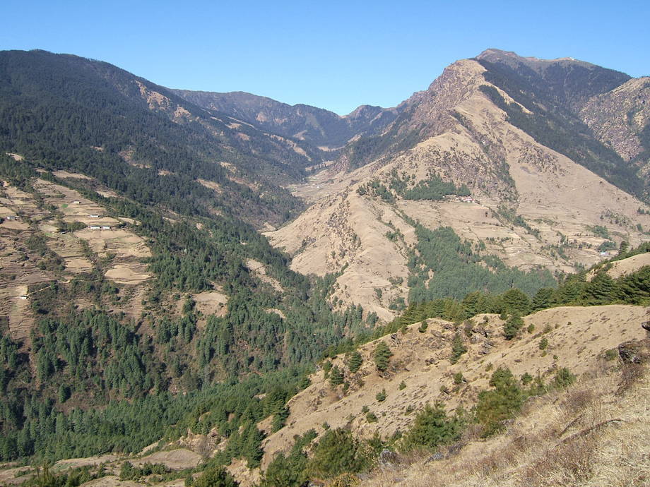 |
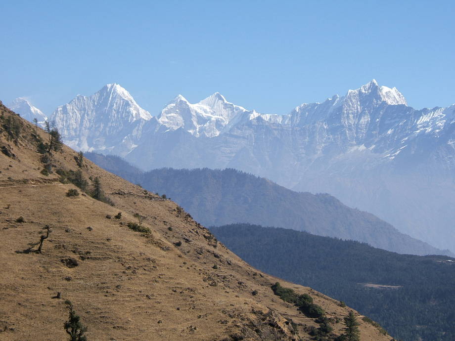 |
The vista northwards from the Everest View Lodge. Mt Everest is the mountain in the far left, the one with the thin snow cloud. The mountain chain right of Everest is forming the backdrop of the Dudh Kosi valley: this valley leads up to Namche Bazaar. The bright spot in the foreground ridge line (at the far right edge of the picture) is the Trakshindo La, today's destination. |
| A view towards the idyllic village of Ringmo. The Trakshindo La is on the ridge just above the village. | 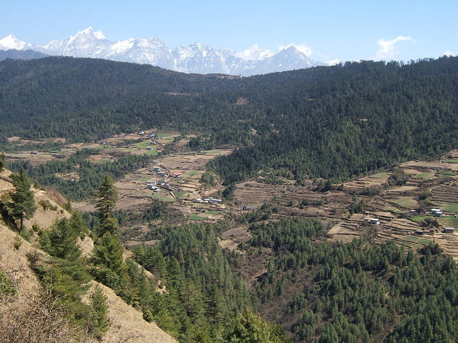 |
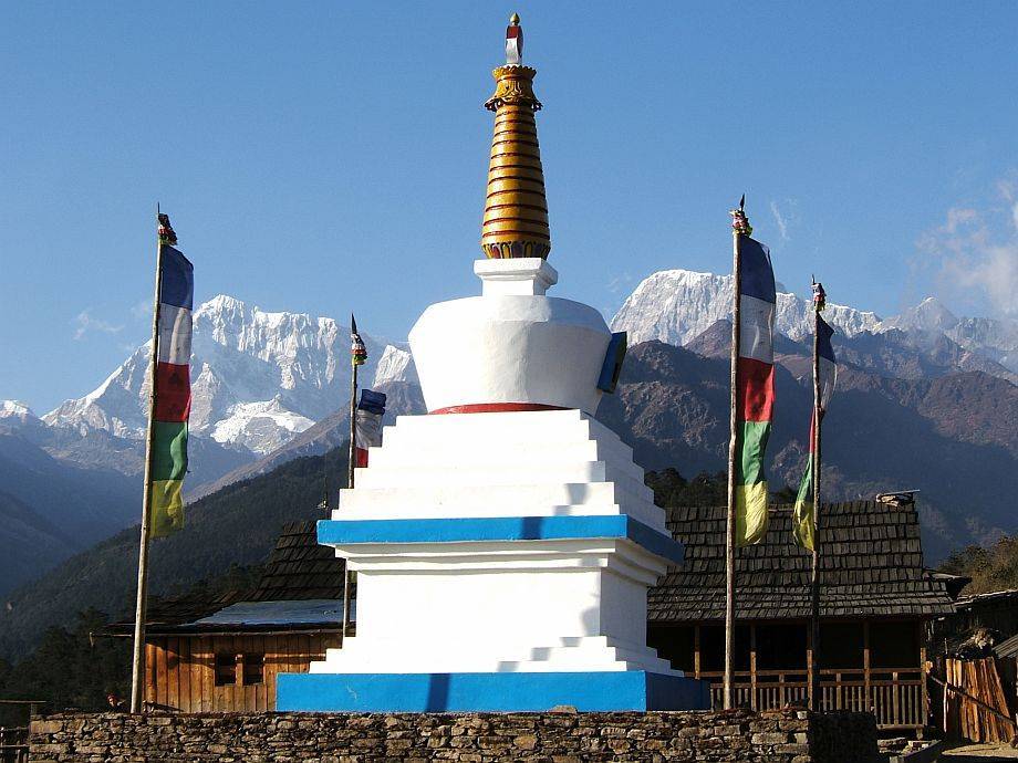 |
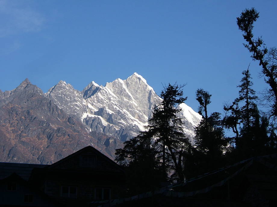
The Trakshindo La (3071m) with its distinctive stupa. The two mountains in the background are the Numbur (left, 6958m) and the Karyolung (right, 6530m) |
| This gate, at the far side of the Trakshindo La, forms the entrance into the Khumbu region. Trakshindo gompa and monastery are a few minutes below. | 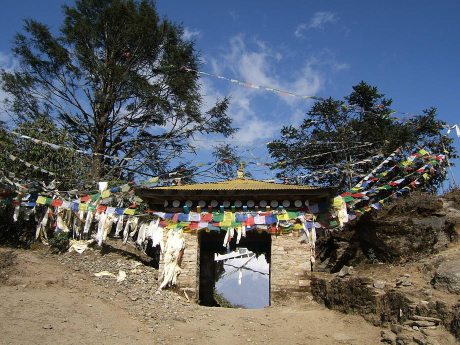 |
08 March: Trakshindo La to Kharikhola via Nuntala
A short but sweaty day before us: upon leaving the Trakshindo La, we stroll down towards Nuntala, a big but rather non-descript village at a height of around 2200m. We always take a long rest there (and always in the shade of the same tree) because the lower we get the warmer it is. And with the heavy backpacks we always arrive in Nuntala dripping wet with sweat: the halt is more to dry ourselves and less to reload the batteries.
This day, there will be a big festival (it's International Women's Day, which is also observed in rural Nepal) and predictably, many women flutter around: some are concerned with preparing and arranging food and drink, others with memorising the speeches they are going to give later on. It's an excited, lively atmosphere.
After one hour, we reluctantly grab the packs and start the long walk down to the Dudh Kosi river. Dudh Kosi means “Milk River” and the waters, coming from the glaciers of the Everest region, are indeed of a milky white-grey colour. We have to cross the river at a big suspension bridge (the first of those bridges was built by the Swiss, for an Everest expedition in the 1950s). To get there, we lose another 700m, so we drop down to 1500m. At this altitude it is very warm and all sorts of plants grow, including citrus fruit and bananas.
We know that after we've crossed that bridge, it'll be almost relentlessly up, up and up… until we arrive in Namche Bazaar (where no banana trees grow). But today's destination is “only” another 600m further up: Kharikhola, a village that stretches along the valley of the Khari Khola.
We know the route well and we also know that we will be horrible sweaty at the end. So we take another long rest at the last houses of Jubing, about 200m above the bridge. There is a Himalayan Tailor with her shop and sewing machine there but the only thing that almost constantly buzzes is the phone. We sit in the shadow and try to cool ourselves before the short but steep climb to Kharikhola.
Finally, we start and do what has to be done. About an hour later, and nearing dissolution, we arrive at the pass slightly above Kharikhola. The long stretched-out village and the hillside up to Bupsa is clearly visible. But this is tomorrow's walk and we now walk down into town and start looking for a lodge.
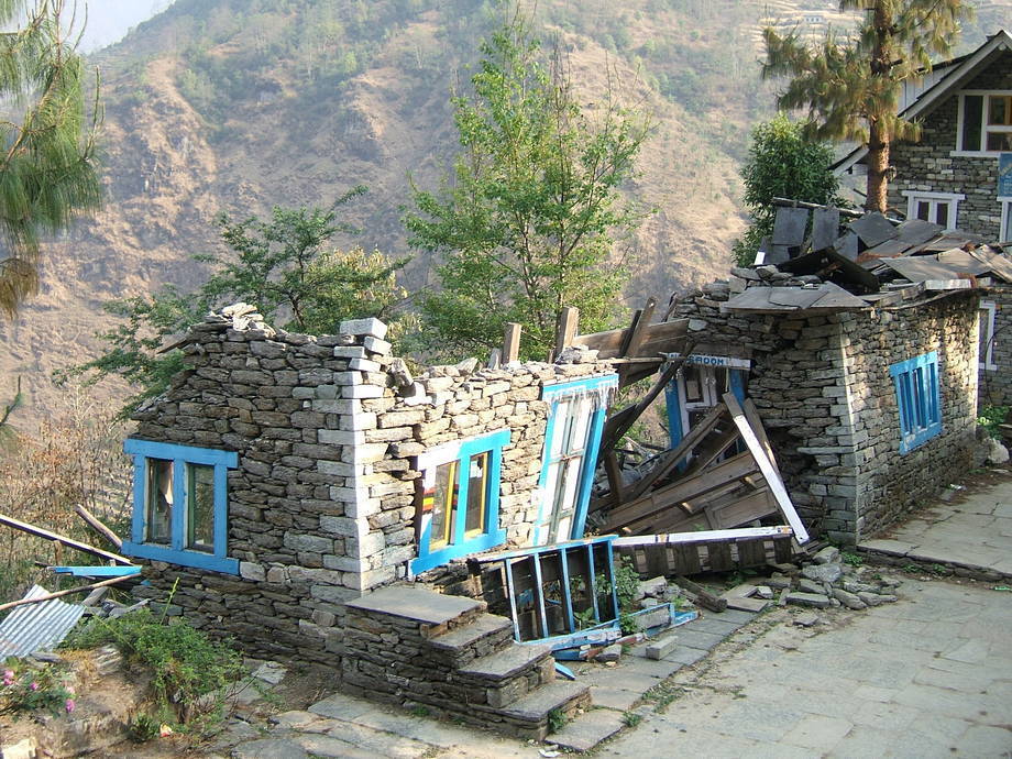
Unfortunately, the (admittedly already rather shaky) lodge we've been with two years ago has broken down, with bits and pieces literally tumbling down the hillside, towards the river. The remains of what once was a quite large two-storey house look rather impressive and we're glad that the building hadn't collapsed a little earlier, with us sleeping peacefully in the rooms.
We easily locate another lodge, a nice and steady-looking one tended by a young and beautiful Sherpa woman with a newborn baby. Her husband, she tells us, is guiding tourists (interestingly, there are many more guides than porters around these days; either because a guide can charge more money or because the women want to give the impression that their husbands are not “slaving away” as lowly porters). Like many wives, she stays at the family home, deals with the kids and works the lodge (and more often than not also the fields… this is not at all an easy life).
| A look up-valley, towards the Trakshindo La. |  |
 |
View from Nuntala, towards the north and the lower Dudh Kosi valley. |
| Women's Day? Not for her. A farmer and his wife are tending their small terraced fields, about half an hour below Nuntala. | 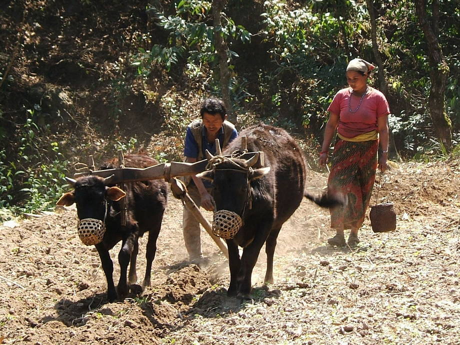 |
 |
The sad remains of a lodge… |
09 March: Kharikhola to Puiyan via Bupsa
Today the climb up the valley of the Dudh Kosi towards Namche Bazaar begins in earnest. The trails are pretty good round here because they are also used by laden porters. But unfortunately, we first have to gain almost 1000m, today, before we drop, tomorrow, down again some 700m. The Dudh Kosi has cut itself a very steep and impressive bed through the rocks and so the path dances sometimes high above the river, only to drop almost to river level a couple of hours later… and then back up again!
The first episode for today is to climb the terraced hillside towards Bupsa. The village, surrounded on all sides by many beautifully terraced fields, sits on top of a long ridge and the houses and the rather conspicuous village gompa, 350m higher up, are already visible from Khari Khola. This is one factor why this climb is somewhat dreary; the other is the fact that the sun already bathes the hillside we have to climb up with its rays. Walking up to Bupsa is always a sweaty business, however early one starts. It is also a pretty dusty walk these days, mainly because of the mule trains ferrying supplies up to Namche Bazaar. (These trains are a relatively new phenomenon; in the old days the Everest region was dominated by porters further down and yaks further up. Our theory is that many of these mule trains swapped the Annapurna region for the Everest area, mostly because the Annapurna Circuit has lost much of its appeal due to the constant road-building there.)
We rest in Bupsa for a good while, to dry the sweat and let some mule trains pass (these animals can be pretty awful: they just follow the path without really looking who or what might be in front of them). We will have to gain another 500m, before the route sharply turns right and follows a deep side valley of a small river tumbling down to the Dudh Kosi.
Almost two hours later, after much huffing and puffing, we arrive at that spot; it is sunny but quite cool and windy. The place is called Khari La and there are a few weather-beaten and rather basic lodges here; as ever we take our lunch break here. The village of Puiyan, our destination for the day, is already visible to the north, across the deeply cut valley, not more than perhaps ten minutes as the crow flies. Alas, we're no crows, so it takes us another 90 minutes to get there, mostly on a level path that first contours away from the Dudh Kosi and then turns sharply left.
We already know where we will stay in Puiyan: with Pemba Sherpa, a funny, middle-aged landlady, in a place called Apple Pie Lodge. This is a family-run lodge (always better than the shiny, big rented lodges), and it's one of the more basic lodges in Puiyan. However, we know the dal bhat is good and filling; the rooms are cheap and cheerful. Last but not least Pemba always produces a roaring fire of yak shit in the stove — which at this height, in the deep valley of the Dudh Kosi (ie where not too much sun reaches Puiyan during the day) is very welcome indeed.
| View from Bupsa, back towards the stretched-out village of Khari Khola. Note the huge gompa on its promontory above the village. The big flat building to the left is the school. | 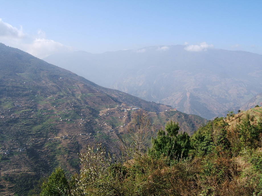 |
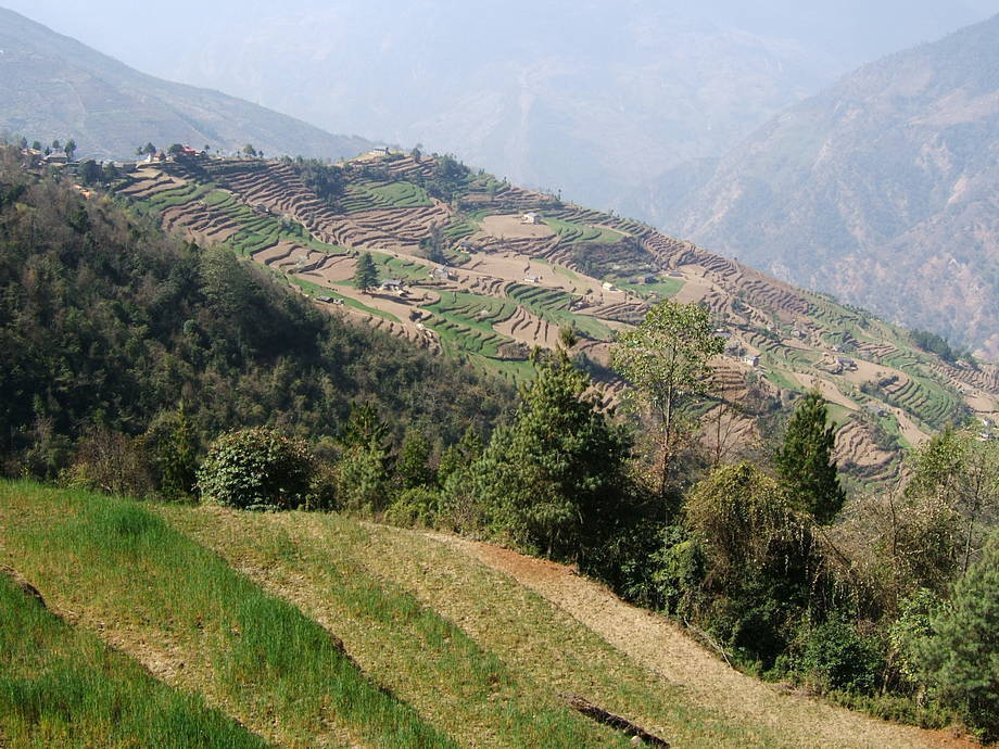 |
The terraces of Bupsa, a little above the village. |
| A gnarled old rhododendron tree in full bloom. Note the electrical cables in the lower right corner: these lead down to Puiyan's brand-new hydropower scheme. | 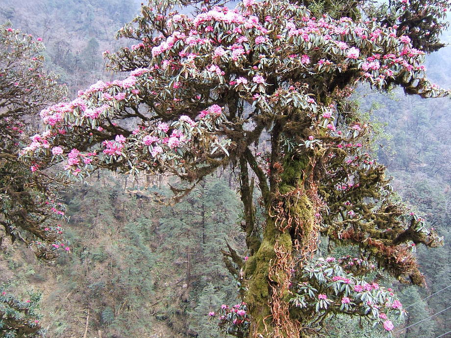 |
 |
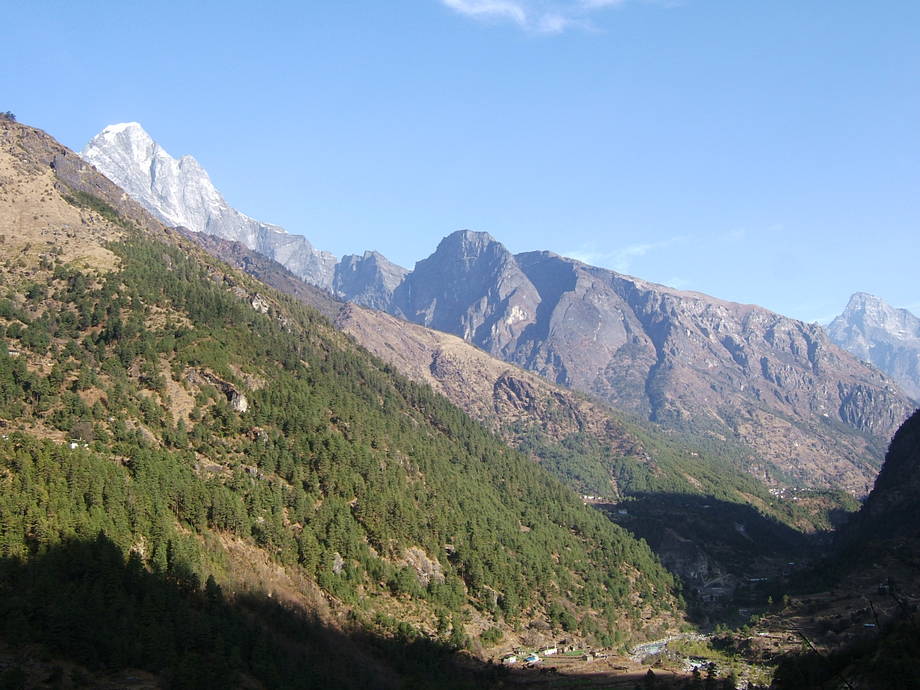
This is Karyolung, the same mountain we had already admired at the Trakshindo La. |
10 March: Puiyan to Chaunrikharka via Surke
From Puiyan, altitude a little above 2800m, we first climb a bit, to almost 3000m, then we drop down sharply to the tidy village of Surke at 2300m. Today will be a rather short day, mainly because after Surke, we just climb back to about 2600m, to a place called Chaunrikharka where we will stop for good. There are two reasons why we stay there, instead of continuing another one or two hours further on: first we know a nice lodge and also the owner, a very friendly, funny and good-looking Sherpani. Her husband is normally guiding Hauser groups from Germany through the Khumbu region and as Thomas is German as well, the lady has taken a liking of us during previous visits. The second reason why we stay in Chaunrikharka is that this is the last village before the trail from Lukla joins our route: from that point on the paths will be swamped with tourists, porters and yaks. And everything — tea, Coke, food — within a few hundred metres of passing that juntion at least doubles in price: tourists flying into Lukla tend to pay whatever is asked, no questions asked.
Surke is a beautiful Sherpa village which always looks so tidy and idyllic in its setting down the hillside. There used to be a lake down there; what remains these days is a big flat plain with the village and its fields. We rest there for a quite long while, mainly because sitting in the warm sun feels so good. There's always a lot of people watching going on in Surke, since the village is so concentrated around its bridge. The locals have all sorts of things to do: cleaning their houses, cook, reason with the children, argue…
And anyway, the climb up to Chaunrikharka will only take another two and very leisurely hours. The first bit is steep but afterwards the trail just ambles along. Chaunrikharka is a long-drawn-out, pretty village with many impressive mani walls: some are more than hundred metres long. Although the inhabitants do make a lot of money with tourism (everybody is either a guide or porter or cook or has some other work in the industry), luckily their village doesn't see many tourists, so it remains a haven a tranquility, beauty and authenticity: almost all villages further up are nowadays just big, artificial collections of lodges without much character; the whole area above Lukla towards Namche and above more resembles a Himalayan Disneyland than rural Nepal.
Surprise: in the Buddha Lodge, our destination, both Pasang Ramu, the landlady, and her husband, Ang Kaji Sherpa, are home. Pasang recognises us immediately and we have our room within a minute. The husband has just returned from a two-week trek with a small group and is already slightly tipsy (Sherpa households always have some vats filled with home-brewed rakshi (strong) or chang (weak). They produce the alcohol either from rice or from coarsely ground maize.).
Because of Ang Kaji's return, Pasang has already started to produce a big chicken dal bhat (meat is a rarity in these regions, at least for locals) and invites us to share the spoils with them. Any suggestion that we should pay for it is roundly refused. Instead we get two cups with warm chang.
Later on, after we had our customary wash and a stroll through Chaunrikharka, a couple of neighbours appear, to share in the drinking (they concentrate on the rakshi) and eating. We have a feeling that the evening will turn out to be a quite lively affair… as they often do when a bunch of Sherpas get together.
| Early in the morning, a few minutes before we leave: Pemba Sherpa, our landlady in Puiyan, from the Apple Pie Lodge. Note the earrings: pure gold. Most Nepalese women carry their personal wealth around in the form of golden rings, bracelets or pendants. | 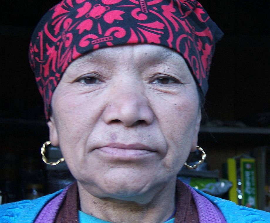 |
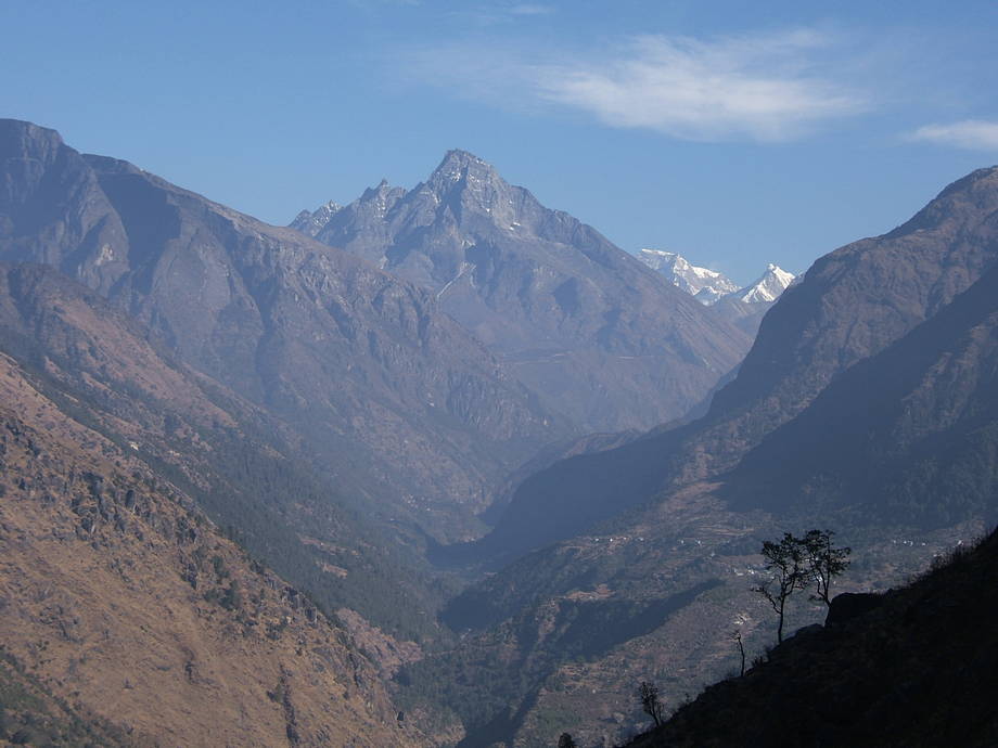 |
View northwards, up the Dudh Kosi valley towards Namche Bazaar. Namche itself is not visible from here without binoculars, but the huge dark bulk of Khumbu Yul Lha, the holy mountain of the Sherpas, soaring above Namche, dominates the middle part of the photo. The big snowy mountain immediately to the right, almost hidden by the dark ridge, is the Gyachung Kang (7952m; 15th highest mountain in the world). Guides often tell their groups that this is Cho Oyu (8201m), one the 14 eight-thousanders — although Cho Oyu is completely hidden behind the Khumbu Yul Lha. |
| View up a western side valley of the Dudh Kosi, towards the summit of Karyolung. |  |
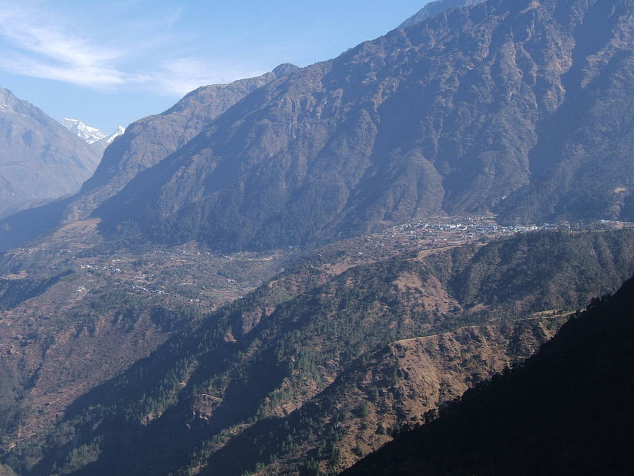 |
Lukla and Chaunrikharka. The slighty lower village in the left half is Chaunrikharka (2600m), today's destination. Lukla (around 2800m) is to the right, a little higher on its prominent plateau. The runway and airport are not visible here, but with good glasses they can be seen. |
| The bridge and village of Surke. | 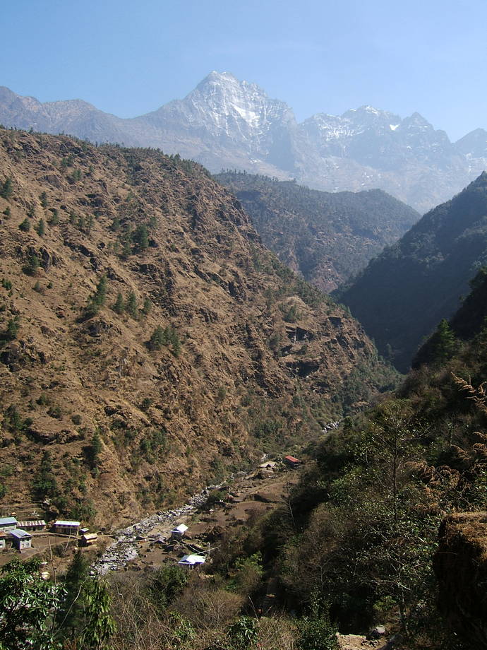 |
11 March: Chaunrikharka to Jorsalle via Phakding and Rimijung
We are woken shortly before 6am by the soothing sounds of “Om mane padme hum” (a Nepalese CD, found all over the place, with a 26-minute rendition of this famous mantra). There is also a smell of burning juniper wafting through the lodge: the Sherpas burn small branches of this as sacrificial offerings in their homes and before stupas. These are the moments when you turn in your sleeping bag and know that the world is fundamentally a good place.
Anyway, we leave Pasang and Ang Kaji, our friendly (and fighting-fit) hosts, after breakfast, about an hour later: they want to go shopping to the weekly Lukla market and we want to continue towards Namche Bazaar. But we tell them that we will be back in four of five weeks' time.
The trails today are all broad and easy but alas full of other people and obnoxious yak trains (yaks are even worse than mules: real tanks). Given that so far we had almost no other tourists around (normally, on the walk-in from Jiri we meet at least a dozen other people, but this time we've been alone most of the time), this sudden rush seems somewhat indecorous. Well, we are here, so they have every right to be here as well.
The walk mainly contours along the Dudh Kosi, first on the right-hand bank, and later, after the “lodge city” of Phakding, on the left side. Phakding, though it's only a couple of hours up-stream, is the first overnight stop for most groups flying into Lukla, so this ex-village has seen a dramatic development during the last decade. It is really a perfect showpiece for the positive as well as the negative sides of tourism.
We're clearly getting ever closer to the really high mountains now: almost every side valley is crowned by some huge grey-white pyramid of rock and snow and there are always interesting vistas up and down the valley. Shortly after Phakding we leave the main path and crawl up to a place called Rimijung. This small village, about half an hour above the beaten track, remains almost unchanged, something that is hard to believe if we take the enormous number of people into account that walk by day after day, literally only a few hundred metres below us.
Rimijung still has a traditional gompa and quite a few active farmers, so it would in theory make a perfect detour and lunch spot for groups. However, most tourists are short of breath already and probably not overly keen to climb up here. Which is fine, because this way we have the place for us.
After a long rest (and frugal lunch) in the glaring sun we continue northwards, along a few rocks inscribed with Buddhist mantras, until we regain the main route. The bit that follows is one our least-favourite spots of walking in Nepal: the trail basically contours by always going up 30 or 50 metres and then down again… what we call “Nepali Flat”. Pretty tiring and the scenery is also not that great as the valley is very narrow here. Nevertheless, we soon cross the Dudh Kosi again and reach the village of Monjo, after a couple of sweaty hours. This place has also grown quite a bit though not as dramatic as Phakding.
A few minutes further on is the Sagarmatha National Park Entrance (“Sagarmatha” is the rather artificial Nepalese name for Mt Everest; the local Sherpas have always called the mountain “Chomolungma”). We normally try to enter the Park in the afternoon because in the morning there can be awfully long queues at the counter. And anyway, a few minutes behind the Park Entrance, there's another village called Jorsalle, ignored by most tourists, where we customarily stay for the night. It would be possible to continue to Namche the same day (there's just one big hill left, with around 600m to climb, but nothing more), but we prefer to stay down and to savour next day's walk in the cool of the morning.
In Jorsalle we meet an interesting Sherpa, Lhakpa Tenzing, and his family. This is one of the nice things of trekking in Nepal: you always meet other people, either tourists or locals, and there's always enough time for a chat. It turns out that Lhakpa stays in the same lodge as we do (probably no accident) and so we have another lively and not entirely dry evening to look forward to (though we tend not to drink a lot at these occasions: first, it doesn't at all help with acclimatisation and second, we just don't like drinking while we're on the road. Strange but true.).
Lhakpa even invites us to his place in Namche, because he wants us to show his lodge (still closed: he now returning to clean and open it) and also to try his home-made tsampa (a Tibetan and Sherpa staple food: roasted barley flour, often eaten mixed with Tibetan salt tea). Allegedly, his tsampa is the “best in all of Namche”. We will certainly check that.
| Just before leaving Chaunrikharka, we take a shot of Pasang, our friendly Sherpani hostess, and her rakshi-loving husband. | 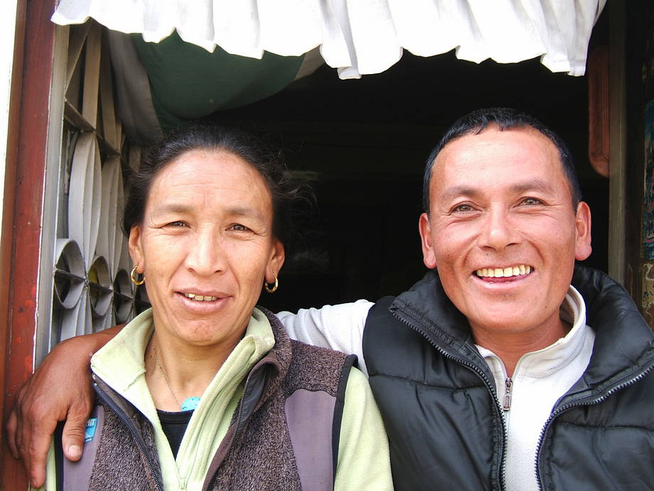 |
 |
The lower Dudh Kosi valley: view to the north. |
| One of the giant rocks lying around everywhere since the last ice age. In most Sherpa regions, big rocks (or even rock faces) are sculpted and painted with mantras (the script is traditionally Tibetan). Om mane padme hum… | 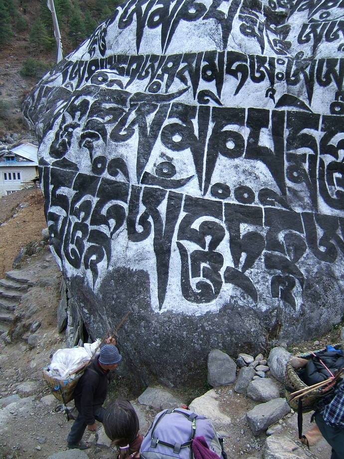 |
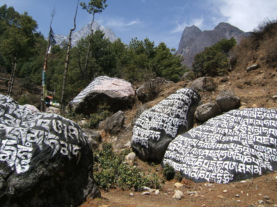 |
More mantra-fied rocks on the way from Rimijung back to the main trail. |
12 March: Jorsalle to Namche Bazaar
Next morning, crisp and cool and sunny, we start early for the last hike before reaching Namche Bazaar. The trail first wends its way along the Dudh Kosi, which we cross once, and further through a great field of rocksbeforeitclimbs steeply towards the last bridge before Namche: like most, this is a strong suspension bridge. That one is special in that it is hanging about 100 metres above the waters of the river: crossing is perfectly safe, but some people are a tad nervous. Another perennial problem with specifically that bridge are the yak trains: the bridge is quite narrow and a bit shaky, plus there's not a lot of space at either end, so if a yak train wants to cross, you can just as well have a rest. (If two yak trains meet there, it's like the M25 during the rush hour: nothing goes.)
After the bridge, the final hill awaits us. It is 600m up, up and up. First time round, 16 years ago, we did this in the afternoon and it was a pretty horrible climb: hot, dusty and not helped by the fact that the air is getting thinner with every step. Nowadays, we're older and wiser (or lazier) and tackle it in the morning. The trail zigzags up a huge mountain flank, with the river slowly falling away, until we reach the remains of a tea house. At this point, we always rest for a while, not least because there's a nice view of Mt Everest (the mountain is not visible from Namche itself, because the village sits in a bowl which opens towards the southwest).
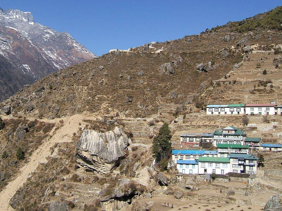
A final push and at around 11am we're arriving at the police check post in Namche Bazaar. After the formalities (quick as we're the first tourists today), we slowly wander up the lively “High Street” which is full with all sorts of shops and stalls: after having seen no real shop for more than a week now, we are probably a little like kids in a candy store. The village has grown even more since last time we've been here, 18 months before: there is a shiny new pharmacy and a massage parlour (for real bone-crunching massages, not the other sort) . However, Namche has always been the traditional centre of the Khumbu region, so its growth is not nearly as conspicuous as that of Phakding, for instance.
We know already two lodges in Namche quite well, so we first check with good old Sun Site Lodge… unfortunately, there's nobody home. (We later learn that the lady doing the lodge (she's more than 80 years old but still fit as a fiddle) has been in the fields, planting potatoes.) So we trundle up the hillside, huff and puff to the Sagarmatha lodge (which is just a few metres below the Namche gompa) where we find indeed a good room and, more importantly, a menu that's not too expensive (prices in Namche can be outrageously high: 400 rupees for a dal bhat is not unusual. In Jorsalle, a couple of hours down, dal bhat can be had in the simple eateries for just a quarter of that price.). One nice thing about the traditional Namche lodges (as opposed to some of the more modern, big places) is that most sport a beautiful view from their large dining rooms… which is dominated by a big iron stove: our best friend for the next days and weeks.
| First glimpses of Mt Everest, on the trail up to Namche Bazaar. | 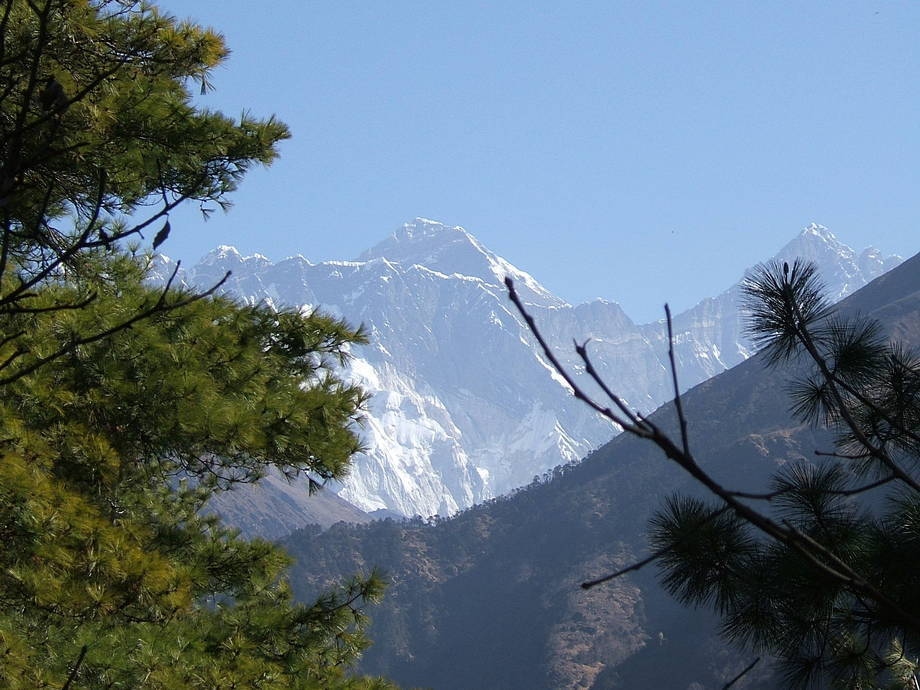 |
 |
Entering Namche: the first houses glued to the hill side, and some fields down in the central bowl. |
| Kongde Ri, the nearest 6000+m mountain, sits just across the river from Namche. | 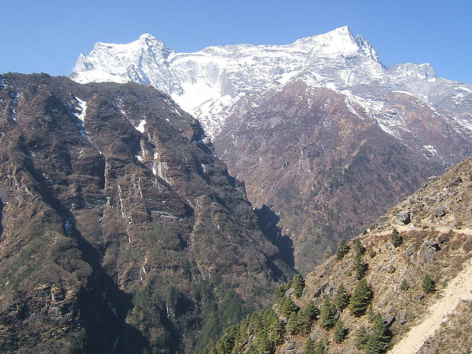 |
Go back to From Jiri to Junbesi or forward to The Lobuche Valley.
$ updated from: Everest Trek.htxt Sun 24 May 2026 15:57:32 trvl2 — Copyright © 2026 Vero and Thomas Lauer unless otherwise stated | All rights reserved $