


Panoramas of the Brecon Beacons
(vero;2020-May-31)
The Brecon Beacons are a three hours drive from Basingstoke and are our destination of choice when we want to go on a bit of serious walking without having to drive too far. The area is particularly pleasant and enjoyable during the lambing season.
The area around Pen y Fan
The area around Pen y Fan can be considered as the “Brecon Beacons range” and comprises four main peaks. Those are from west to east: Corn Du (873m), Pen y Fan (the highest peak at 886m), Cribyn (795m) and Fan y Big (719m). These summits are linked by a ridge system which forms a horseshoe shape around the head of the river Taf Fechan, which flows away from the foot of Pen y Fan to the southeast and feeds the Upper Neuadd Reservoir. To the north of the ridge separated by long parallel spurs are four cwms (cirques) descending to the plain. Those are from west to east: Cwm Sere, Cwm Cynwyn, Cwm Oergwm and Cwm Cwareli.
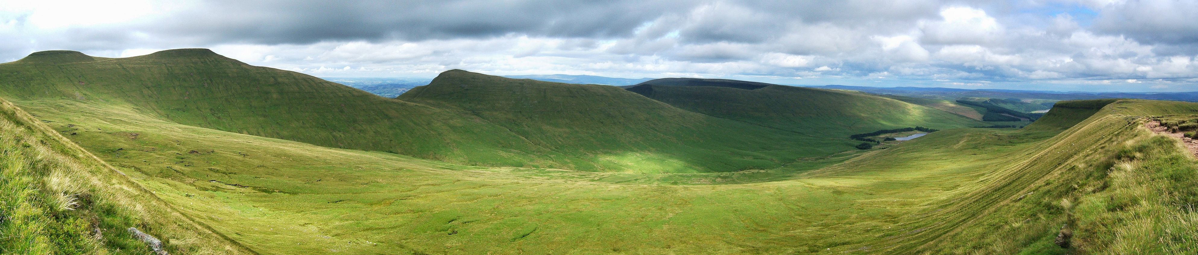
| View to the north on the way down from Fan y Big. Click on the panorama to open a larger version in a separate tab, click again to activate scrolling in the full picture. |
 |
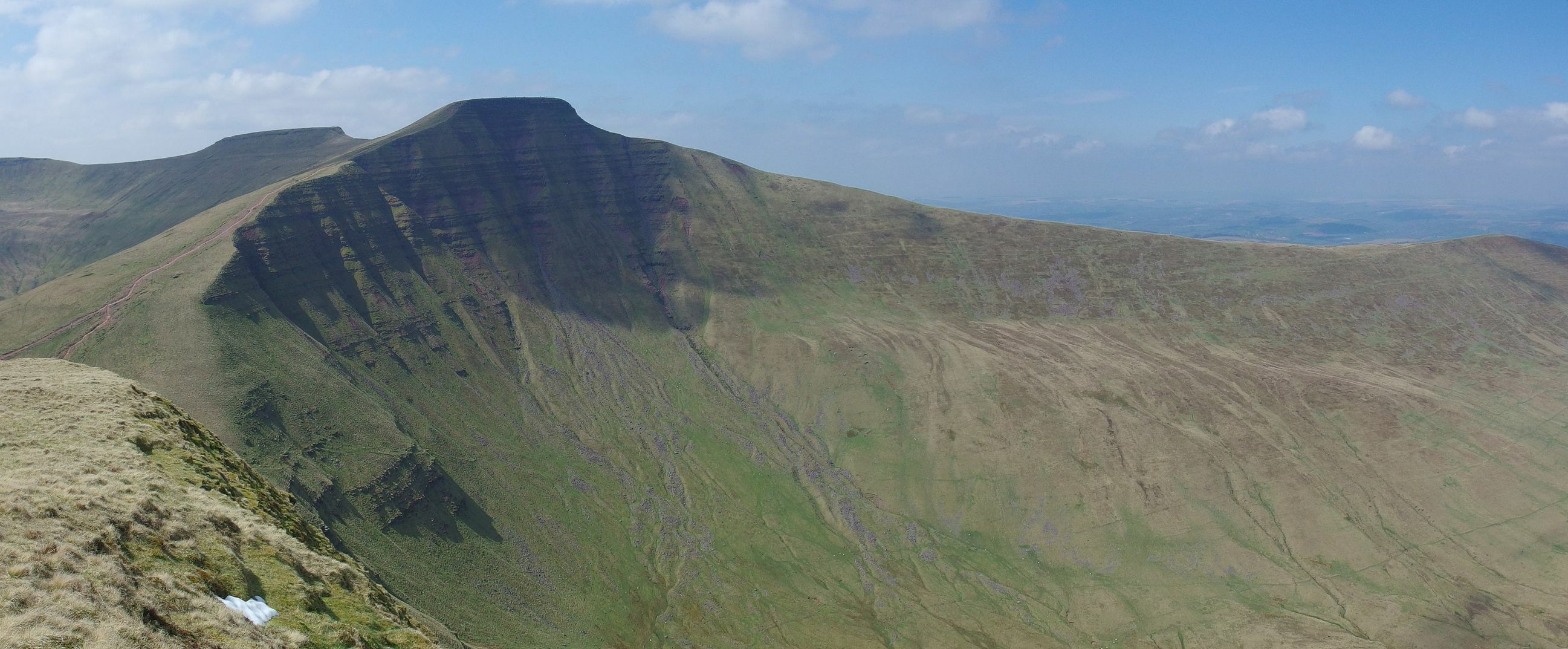
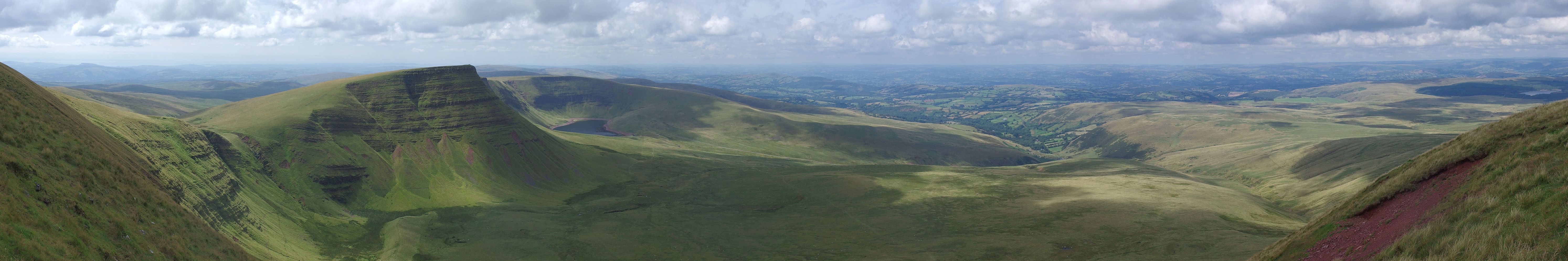
| View from the western ridge leading to Corn Ddu (873m) towards Pen y Fan 886m (red dot), Cribyn 795m (blue dot) and Fan y Big 719m (pink dot). Upper Neuadd Reservoir can be seen in the valley. Click on the panorama to open a larger version in a separate tab, click again to activate scrolling in the full picture. |
 |
| Northeastern face of Cribyn (795m) on the left and Pen y Fan (886m) on the right seen from Llanfrynach. Click on the panorama to open a larger version in a separate tab, click again to activate scrolling in the full picture. |
 |
| The summits of Pen y Fan (886 m) and Corn Ddu (873 m in the background), seen from Cribyn (795 m). Click on the panorama to open a larger version in a separate tab, click again to activate scrolling in the full picture. |
 |
The Black Mountains (with a s!)
The Black Mountains are part of the Brecon Beacons National Park and are straddling the border between Wales and England on their eastern fringes. We often go there on our last day in the Brecon Beacons, as we drive southward from Haye on Wye through the very scenic Vale of Ewyas taking in the romantic ruins of the Llanthony priory on our way back home. There are great walks to be had in this area too, with Lord Hereford's Knob (or Twmpa - 690m) and Hay Bluff (or Penybegwn - 677m) easily accessible from the road.
The Black Mountains should not be mistaken with the Black Mountain (without s!) which is a mountain range on the western side of the Brecon Beacons National Park.
| View from Lord Hereford Knob. Click on the panorama to open a larger version in a separate tab, click again to activate scrolling in the full picture. |
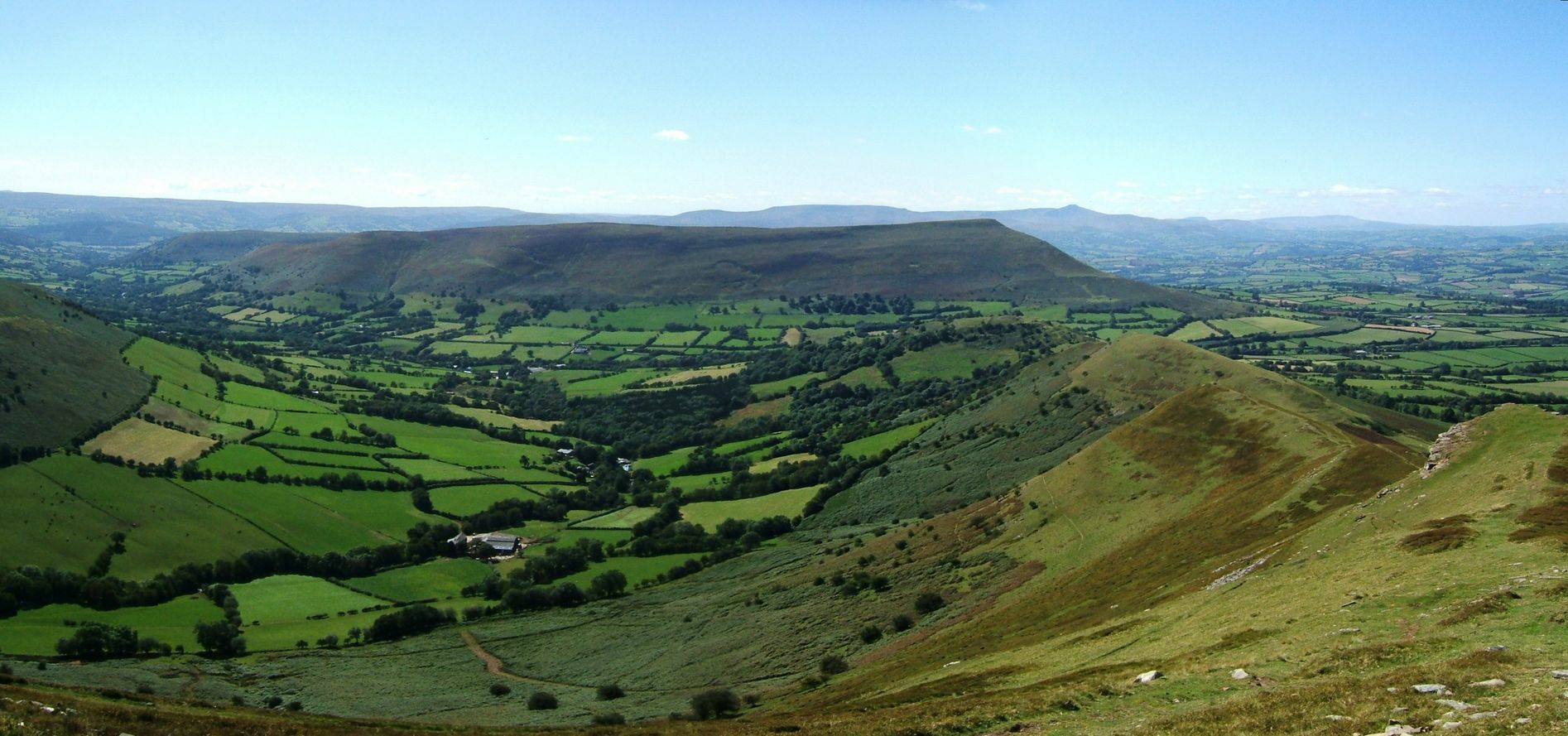 |
The Black Mountain
Those four panoramas were taken on walks in the Black Mountain starting south of the small village of Llanddeusant. The area is quite isolated and only accessible via single lane country roads but worthwhile the effort to get there. The scenery is quite impressive, the main draw being the two natural lakes of Llyn y Fan Fach and Llyn u Fan Fawr which can both be combined on a single walk.
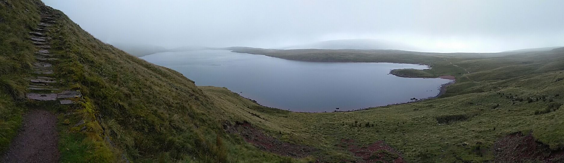
| Llyn y Fan Fach. The lake is an easy walk from the spot where cars have to park, the trail leading to it clearly visible on the picture. It is overlooked by steep mountains on its southern side. This picture of the lake was taken on the way to the summit of Picws Du along the ridge of Waun Lefrith (677m). Click on the panorama to open a larger version in a separate tab, click again to activate scrolling in the full picture. |
 |
| A bit further up, picture taken from Picws Du (or Bannau Sir Gaer - 749m) with Waun Lefrith (677m) and Llyn y Fan Fach in the distance. Click on the panorama to open a larger version in a separate tab, click again to activate scrolling in the full picture. |
 |
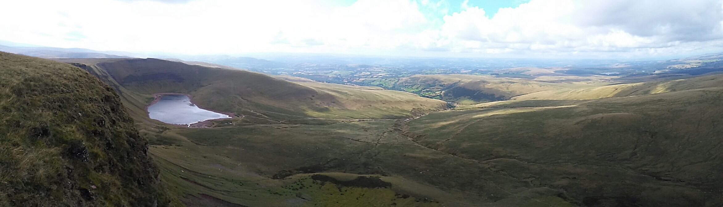
| This is Llyn y Fan Fawr, the second natural lake in the area. Much of the land around it is peaty and can be wet underfoot, specially in a weather like the one we had on that day. The path left of the picture is leading to the summit of Fan Brycheiniog (802m). Click on the panorama to open a larger version in a separate tab, click again to activate scrolling in the full picture. |
 |
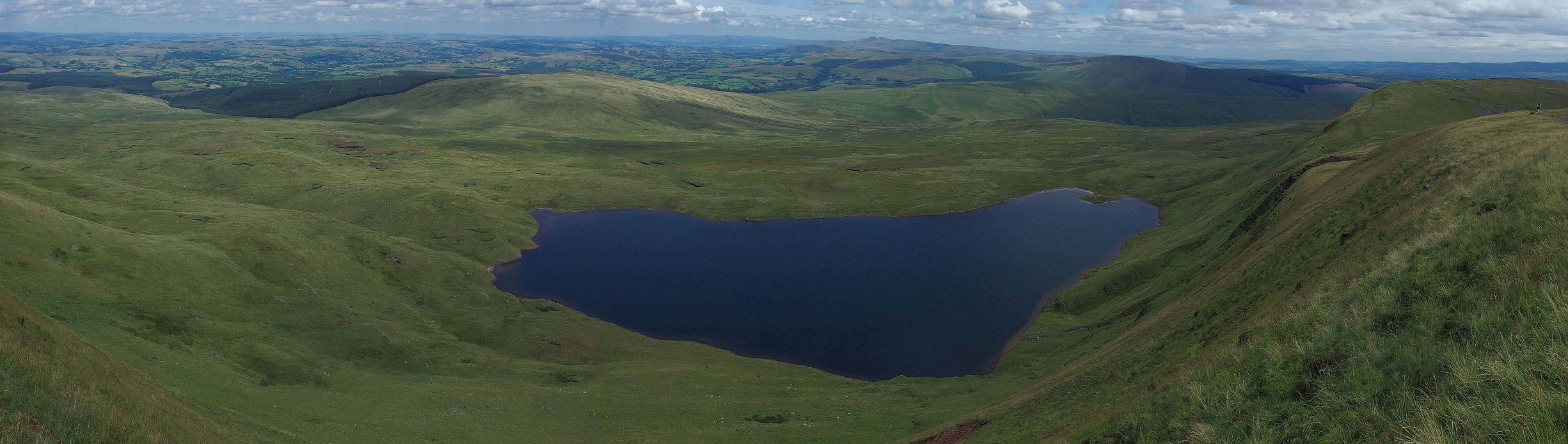
| Llyn y Fan Fawr seen from Fan Brycheiniog (802m). We had good weather on that day and enjoyed great views of the moorland and open country to the northeast. Click on the panorama to open a larger version in a separate tab, click again to activate scrolling in the full picture. |
 |
Go back to Brecon Beacons or go on to Snowdonia or go up to Welsh Mountains
$ updated from: Welsh Mountains.htxt Sun 24 May 2026 15:57:33 trvl2 — Copyright © 2026 Vero and Thomas Lauer unless otherwise stated | All rights reserved $