


Panoramas of Snowdonia
(vero;2020-May-31)
The Snowdonia National Park is home to Snowdon, the highest mountain of England and Wales culminating at 1085m and counts many attractive summits. The mountains are a magnet for walkers and Snowdon itself sees a lot of visitors thanks to the Snowdon Mountain Railway which brings tourists from the town of Llanberis right up to the summit. There are a multitude of trails and breathtaking sceneries to be had. Hiking in Snowdonia can be a bit strenuous and the weather not always auspicious which makes the area a demanding territory which should not be taken lightly; the 1953 Everest expedition for example trained there before going off to the Himalayas for the real thing.
| Pick your area: | Snowdon | Glyderau | Carneddau | Moel Hebog | South Snowdonia |
Snowdon
Snowdon is the part of the National Park which sees the most of tourists. For walkers the massif can be reached via diverse trails which provide a multitude of approaches and loops.
| View from under the summit of Snowdon to Llyn Llydaw with Miner's track leaving from the lake's northwest shore and Pyg track skirting the flank of Crib Goch (923m). Both tracks eventually rejoin north of Glaslyn. Click on the panorama to open a larger version in a separate tab, click again to activate scrolling in the full picture. |
 |
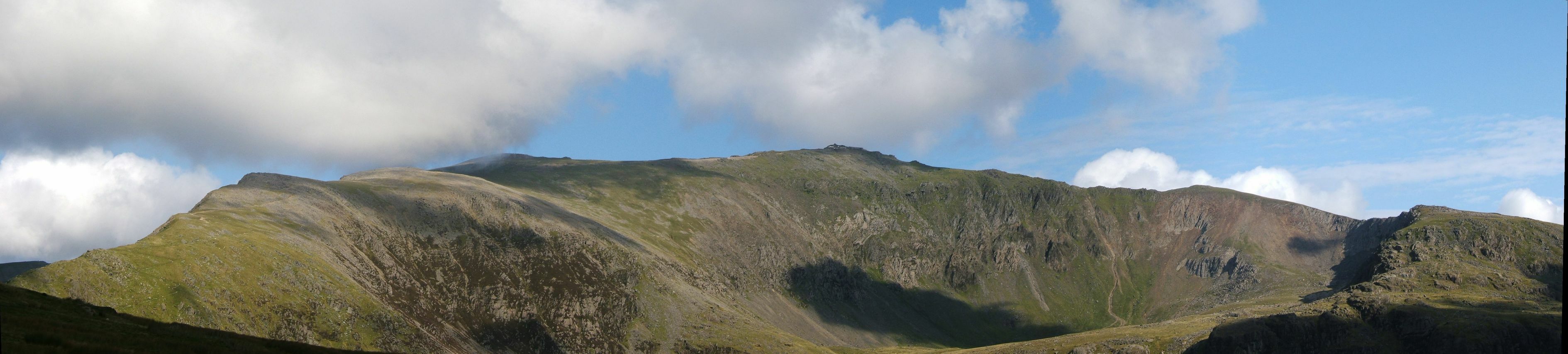
| Snowdown (1085m) seen from the Ranger path approach. The path meets the train tracks before reaching the summit and you can spot the train station on the top. Click on the panorama to open a larger version in a separate tab, click again to activate scrolling in the full picture. |
 |
| View on Llyn Cwellyn (left of the picture) and Llyn Coch from the Rhyd-Ddu path. Click on the panorama to open a larger version in a separate tab, click again to activate scrolling in the full picture. |
 |
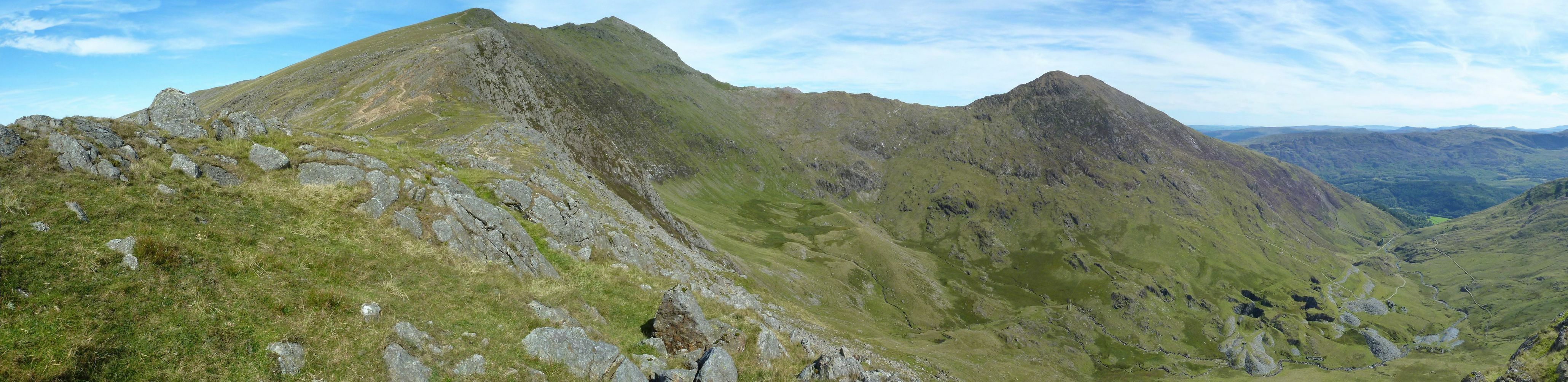
| The Snowdon South ridge. Click on the panorama to open a larger version in a separate tab, click again to activate scrolling in the full picture. |
 |
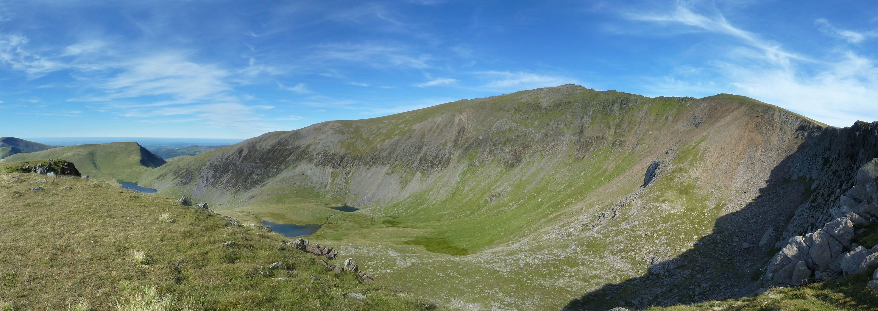
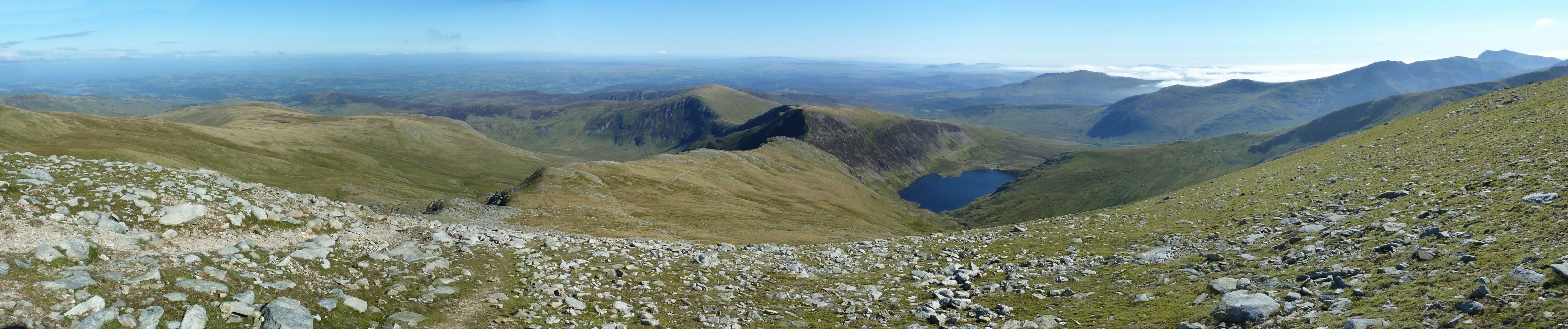
| View from Snowdon (1085m) down to Llyn Llydaw. The junction of Miner's and Pyg track is clearly visible. Click on the panorama to open a larger version in a separate tab, click again to activate scrolling in the full picture. |
 |
| Snowdon seen from the Rhyd-Ddu path. The lakes from left to right are Llyn Ffynnon-y-gwas, Llyn Nadroedd and the smallest one Llyn Coch. Click on the panorama to open a larger version in a separate tab, click again to activate scrolling in the full picture. |
 |
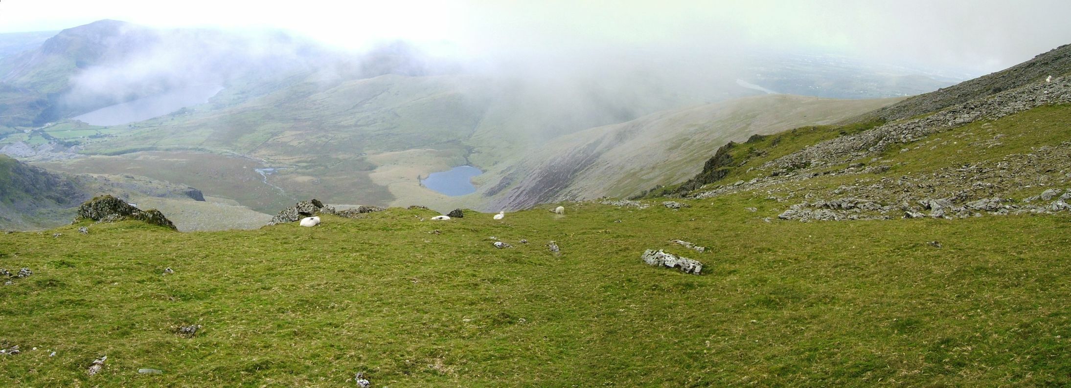
| Llyn Cwellyn seen from Snowdon on an autumn overcast day. The sea is visible in the distance. Click on the panorama to open a larger version in a separate tab, click again to activate scrolling in the full picture. |
 |
Glyderau
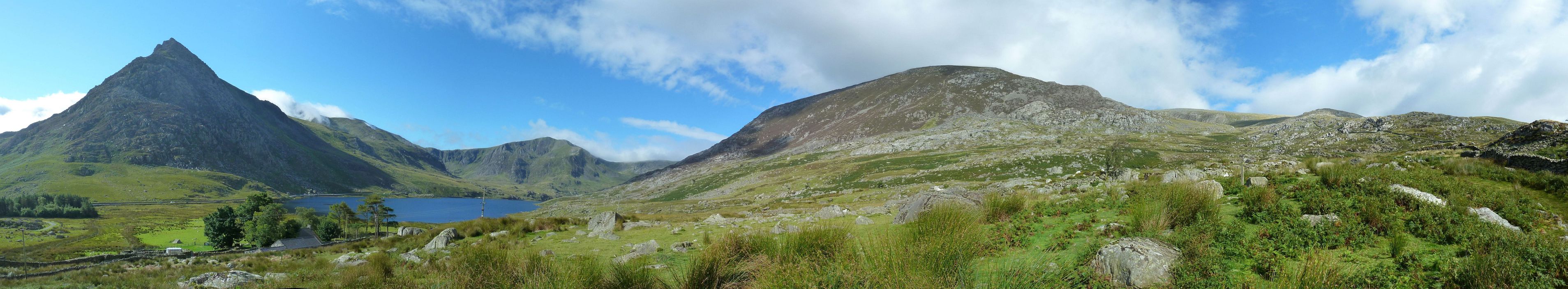
The Glyderau stretch along the southern side of the road linking Llyn Ogwen and Capel Curig. Summits in the area include Tryfan, Y Garn, Glyder Fawr and Glyder Fach.
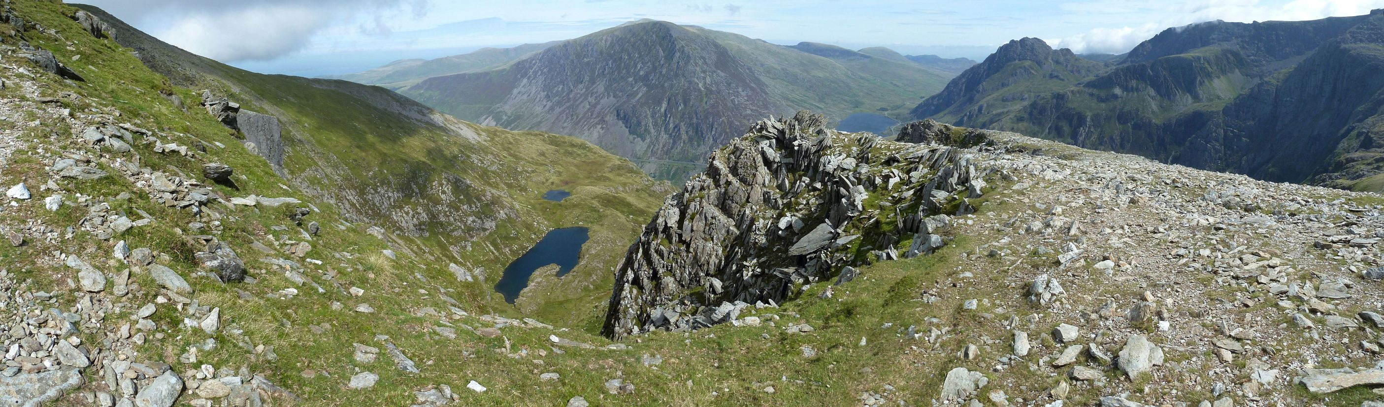
| View on Llyn Clyd from the summit of Y Garn (947m). The lake in the distance is Ffynnon Lloer in the Carneddau. Click on the panorama to open a larger version in a separate tab, click again to activate scrolling in the full picture. |
 |
| Coming down from Carnedd Dafydd (Carneddau), view on the north face of Tryfan on the left, Y Garn rises from the far side of the lake Llyn Ogwen. Click on the panorama to open a larger version in a separate tab, click again to activate scrolling in the full picture. |
 |
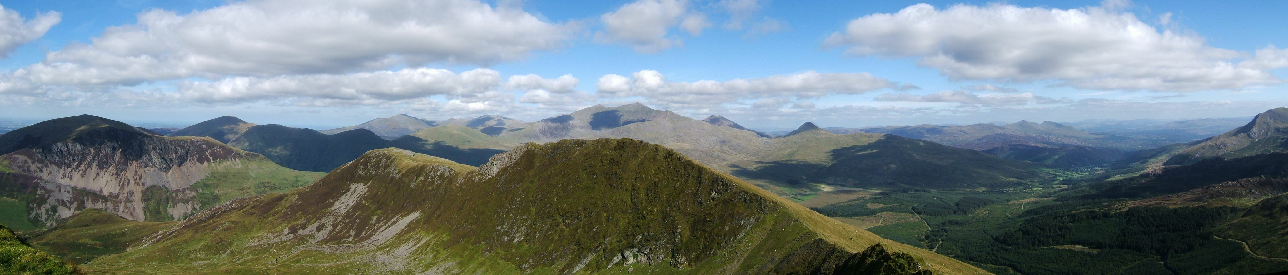
| The Glyders East. Click on the panorama to open a larger version in a separate tab, click again to activate scrolling in the full picture. |
 |
Carneddau
The Carneddau stretch along the northern side of the road linking Llyn Ogwen and Capel Curig which separates it from the range of Glyderau to the south. Summits in the area include Carnedd Dafydd (1044m) and Carnedd Llewelyn (1064m).
| The reservoir of Ffynnon Llugwy seen from the summit of Carnedd Llewelyn (1064m). Click on the panorama to open a larger version in a separate tab, click again to activate scrolling in the full picture. |
 |
Moel Hebog
Moel Hebog is a mountain which dominates the view west from the village of Beddgelert. It gives its name to a whole range of peaks in the north-western corner of Snowdonia, including Garnedd Goch (700m), the Nantlle Ridge and Mynydd Mawr (698m).
| View from the summit of Garnedd Goch (700m) to the northwest.Click on the panorama to open a larger version in a separate tab, click again to activate scrolling in the full picture. |
 |
| The Nantlle Ridge. Click on the panorama to open a larger version in a separate tab, click again to activate scrolling in the full picture. |
 |
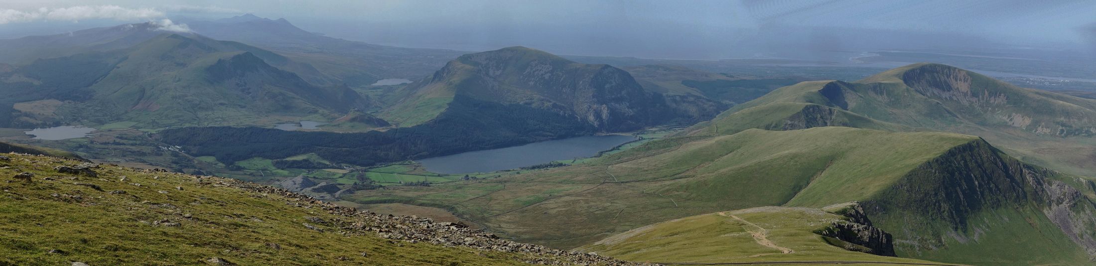
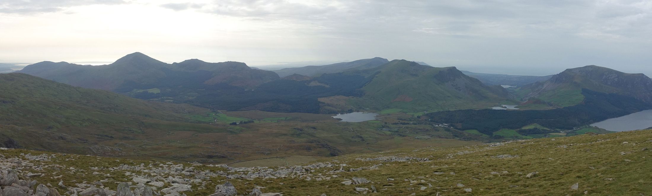
| The Nantlle Ridge and Llyn Cwellyn on the right seen from the RhydDdu Path. Click on the panorama to open a larger version in a separate tab, click again to activate scrolling in the full picture. |
 |
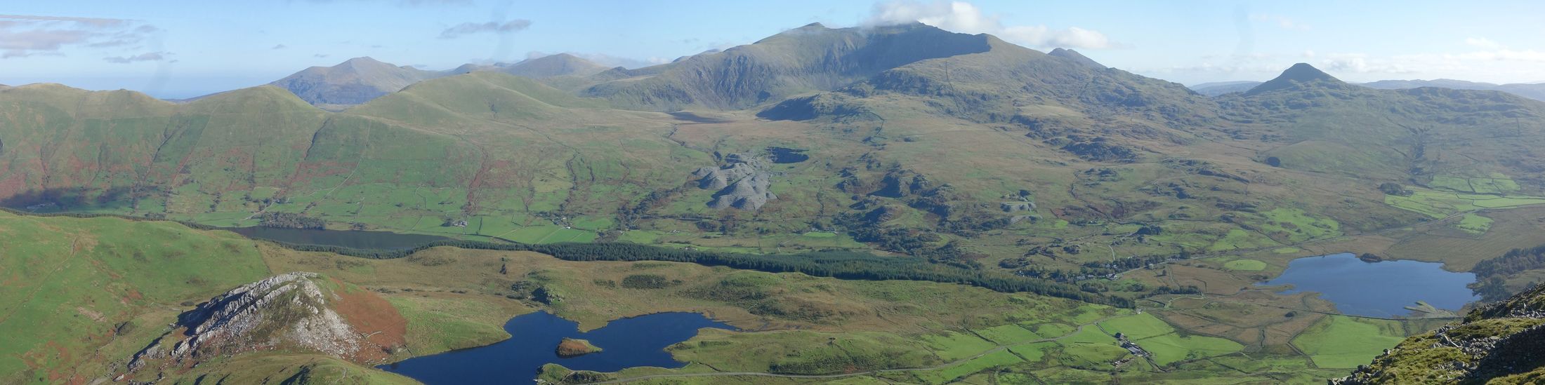
| Snowdon seen from Y Garn. Click on the panorama to open a larger version in a separate tab, click again to activate scrolling in the full picture. |
 |
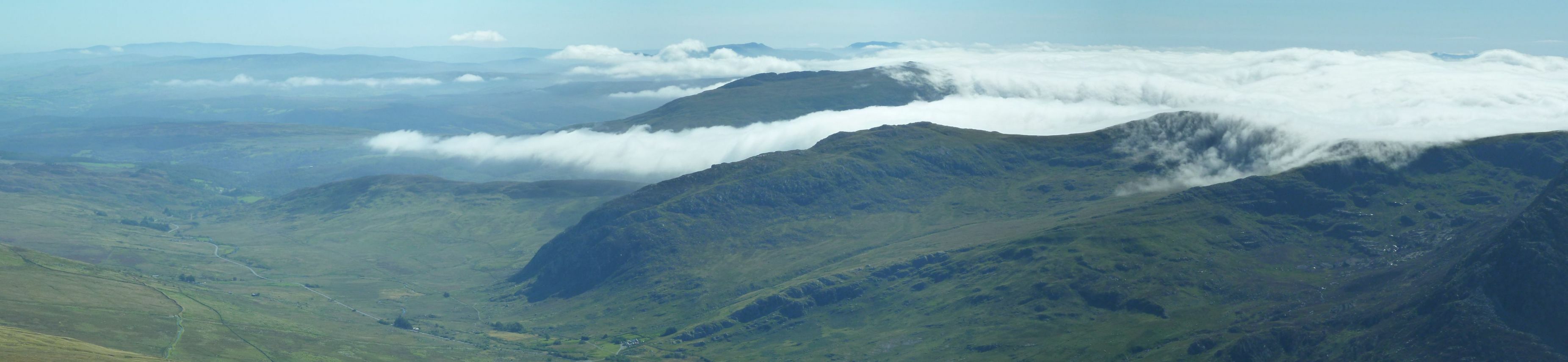
South Snowdonia
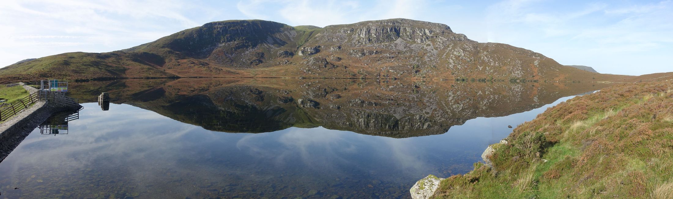
| South Snowdonia: Llyn Arewig Fawr. Click on the panorama to open a larger version in a separate tab, click again to activate scrolling in the full picture. |
 |
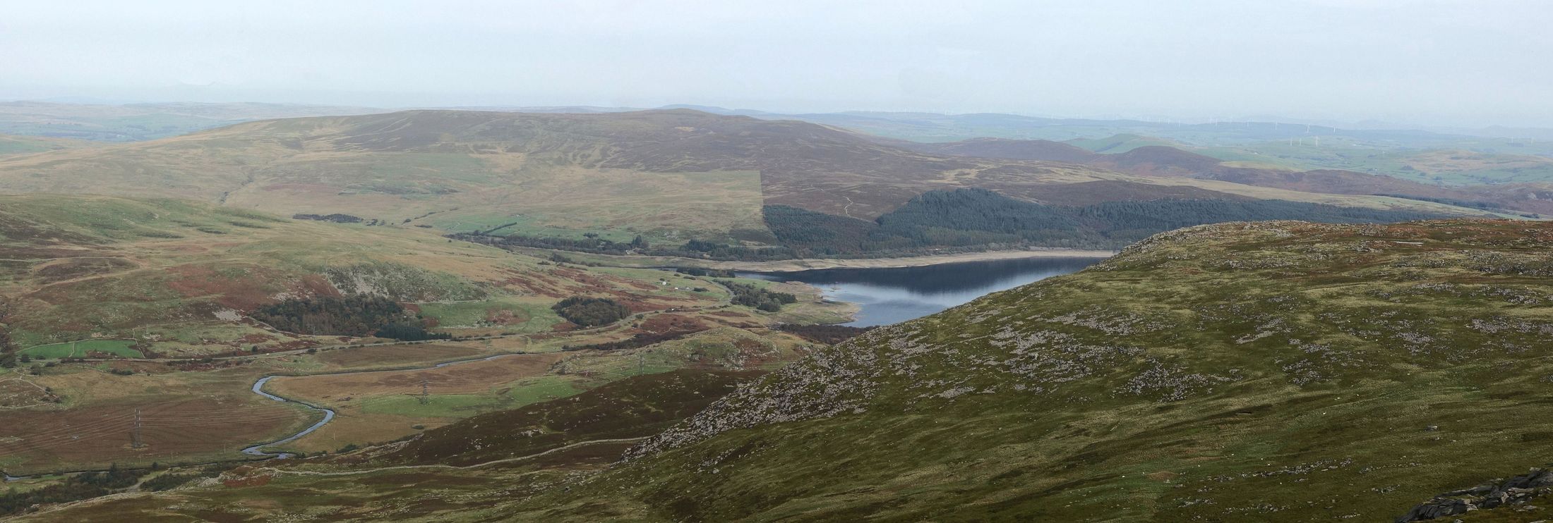
| South Snowdonia: Llyn Celyn seen from the top of Arewig Fawr. Click on the panorama to open a larger version in a separate tab, click again to activate scrolling in the full picture. |
 |
Go back to Snowdonia or go up to Welsh Mountains
$ updated from: Welsh Mountains.htxt Sun 24 May 2026 15:57:33 trvl2 — Copyright © 2026 Vero and Thomas Lauer unless otherwise stated | All rights reserved $